Login
Register


2VG2
Upperville Airport
Official FAA Data Effective 2023-03-23 0901Z
VFR Chart of 2VG2
Sectional Charts at SkyVector.com
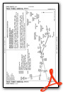
IFR Chart of 2VG2
Enroute Charts at SkyVector.com
Location Information for 2VG2
Coordinates: N38°58.30' / W77°52.19'Located 02 miles SE of Upperville, Virginia. View all Airports in Virginia.
Estimated Elevation is 557 feet MSL.
Operations Data
|
|
Airport Communications
| UNICOM: | 122.725 |
|---|---|
| AWOS-3 at JYO (15.9 NE): | 125.225 703-777-3781 |
| AWOS-3 at OKV (16.4 NW): | 124.85 540-662-6970 |
| AWOS-3 at FRR (18.0 W): | 121.85 540-635-5377 |
Nearby Navigation Aids
|
| ||||||||||||||||||||||||||||||||||||||||||||||||||||||||||||


Runway 13/31
| Dimensions: | 5100 x 100 feet / 1554 x 30 meters | |
|---|---|---|
| Surface: | Asphalt | |
| Edge Lighting: | Medium Intensity | |
| Runway 13 | Runway 31 | |
| Coordinates: | N38°58.51' / W77°52.66' | N38°58.09' / W77°51.73' |
| Elevation: | 557.7 | 519.9 |
| Traffic Pattern: | Left | Left |
| Runway Heading: | 120° True | 300° True |
Services Available
| Fuel: | NONE |
|---|---|
| Transient Storage: | NONE |
| Airframe Repair: | NONE |
| Engine Repair: | NONE |
| Bottled Oxygen: | NOT AVAILABLE |
| Bulk Oxygen: | NOT AVAILABLE |
Ownership Information
| Ownership: | Privately Owned | |
|---|---|---|
| Owner: | OAK SPRING GARDEN FDN | |
| 1776 LOUGHBOROUGH LANE | ||
| UPPERVILLE, VA 20184 | ||
| (540) 592-3240 | ||
| Manager: | OAK SPRING GARDEN FDN | |
| 1776 LOUGHBOROUGH LANE, 8540 MILL REEF RD | ||
| UPPERVILLE, VA 20184 | ||
| (540) 592-3240 | ||
Other Remarks
- FOR CD CTC POTOMAC APCH AT 866-709-4993.
- FOR RWY LGTS CALL 540-592-3465.
Standard Terminal Arrival (STAR) Charts
Nearby Airports with Instrument Procedures
| ID | Name | Heading / Distance | ||
|---|---|---|---|---|
 |
KJYO | Leesburg Exec Airport | 066° | 15.9 |
|
KOKV | Winchester Regional Airport | 308° | 16.5 |
|
KFRR | Front Royal-Warren County Airport | 259° | 18.2 |
|
KIAD | Washington Dulles International Airport | 094° | 19.2 |
|
KHEF | Manassas Regional/Harry P Davis Field Airport | 131° | 22.4 |
|
KHWY | Warrenton/Fauquier Airport | 162° | 24.3 |
|
KMRB | Eastern Wv Regional/Shepherd Field Airport | 348° | 26.4 |
|
KCJR | Culpeper Regional Airport | 178° | 26.7 |
|
KLUA | Luray Caverns Airport | 238° | 34.8 |
|
KGAI | Montgomery County Airpark Airport | 070° | 34.9 |
|
KFDK | Frederick Municipal Airport | 040° | 35.3 |
|
KDAA | Davison AAF Airport | 115° | 35.8 |
 Looking West")
")


