Login
Register


FRR
Front Royal-Warren County Airport
Official FAA Data Effective 2026-01-22 0901Z
Chart Supplement

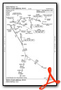
VFR Chart of KFRR
Sectional Charts at SkyVector.com
IFR Chart of KFRR
Enroute Charts at SkyVector.com
Location Information for KFRR
Coordinates: N38°55.05' / W78°15.20'Located 03 miles W of Front Royal, Virginia on 90 acres of land. View all Airports in Virginia.
Surveyed Elevation is 703 feet MSL.
Operations Data
|
|
Airport Communications
| AWOS-3: | 121.85 Tel. 540-635-5377 |
|---|---|
| POTOMAC APPROACH: | 120.45 |
| POTOMAC DEPARTURE: | 120.45 |
| TRSTN STAR: | 126.75 307.2 |
| CTAF: | 123.000 |
| UNICOM: | 123.000 |
| HYPER STAR: | 133.0 288.35 |
| AWOS-3 at OKV (14.5 N): | 124.85 540-662-6970 |
| AWOS-3 at LUA (19.0 SW): | 118.275 540-743-1148 |
| AWOS-3 at 8W2 (26.5 SW): | 118.175 540-740-3801 |
Nearby Navigation Aids
|
| ||||||||||||||||||||||||||||||||||||||||||||||||||||||||||||


Runway 10/28
| Dimensions: | 3008 x 75 feet / 917 x 23 meters | |
|---|---|---|
| Surface: | Asphalt in Good Condition | |
| Weight Limits: | S-12 | |
| Edge Lighting: | Medium Intensity | |
| Runway 10 | Runway 28 | |
| Coordinates: | N38°55.04' / W78°15.52' | N38°55.06' / W78°14.89' |
| Elevation: | 693.0 | 703.5 |
| Traffic Pattern: | Left RY 10 RIGHT TFC FOR GYROCOPTERS, ULTRALIGHTS & GLIDERS. |
Left RY 28 RIGHT TFC FOR GYROCOPTERS, ULTRALIGHTS & GLIDERS. |
| Runway Heading: | 87° True | 267° True |
| Markings: | Basic in fair condition. | Non-Precision Instrument in fair condition. |
| Glide Slope Indicator | PNIR (3.00° Glide Path Angle) | PNIL (3.00° Glide Path Angle) |
| Obstacles: | 24 ft Road 350 ft from runway, 131 ft left of center | 42 ft Pole 1382 ft from runway, 63 ft right of center |
Services Available
| Fuel: | 100LL (blue) |
|---|---|
| Transient Storage: | Hangars,Tiedowns |
| Airframe Repair: | MINOR |
| Engine Repair: | MINOR |
| Bottled Oxygen: | NONE |
| Bulk Oxygen: | NONE |
| Other Services: | CHARTER SERVICE,GLIDER SERVICE,PILOT INSTRUCTION,PARACHUTE JUMP ACTIVITY,AIRCRAFT RENTAL,ANNUAL SURVEYING |
Ownership Information
| Ownership: | Publicly owned | |
|---|---|---|
| Owner: | COUNTY OF WARREN | |
| 220 NORTH COMMERCE AVENUE, STE 100 | ||
| FRONT ROYAL, VA 22630 | ||
| 540-636-4600 | ||
| Manager: | MIKE BERRY | |
| 229 STOKES AIRPORT RD | ||
| FRONT ROYAL, VA 22630 | ||
| 540-635-3570 | ||
Other Remarks
- GLIDER OPNS ON & INVOF ARPT.
- NOISE ABATEMENT PROCS IN EFCT, CTC ARPT MGR FOR DTLS AT 540-635-3570.
- DEER & GEESE ON & INVOF ARPT.
- FOR CD CTC POTOMAC APCH AT 866-709-4993.
- ACTVT MIRL RWY 10/28 - CTAF.
Weather Minimums

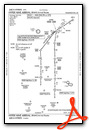
Standard Terminal Arrival (STAR) Charts
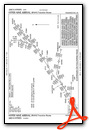
Instrument Approach Procedure (IAP) Charts

Nearby Airports with Instrument Procedures
| ID | Name | Heading / Distance | ||
|---|---|---|---|---|
 |
KOKV | Winchester Regional Airport | 020° | 14.5 |
|
KLUA | Luray Caverns Airport | 217° | 19.0 |
|
8W2 | New Market Airport | 233° | 26.5 |
|
KCJR | Culpeper Regional Airport | 141° | 29.9 |
|
KMRB | Eastern Wv Regional/Shepherd Field Airport | 023° | 31.7 |
|
KHWY | Warrenton/Fauquier Airport | 127° | 32.3 |
|
KJYO | Leesburg Exec Airport | 073° | 33.9 |
|
KHEF | Manassas Regional/Harry P Davis Field Airport | 108° | 36.6 |
|
KIAD | Washington Dulles International Airport | 086° | 37.2 |
|
KOMH | Orange County Airport | 166° | 41.3 |
|
W99 | Grant County Airport | 276° | 42.0 |
|
KGVE | Gordonsville Municipal Airport | 174° | 45.8 |
Airport Images
 looking East")
By: sbeste


