Login
Register


3T3
Boyceville Municipal Airport
Official FAA Data Effective 2026-02-19 0901Z
Chart Supplement

VFR Chart of 3T3
Sectional Charts at SkyVector.com
IFR Chart of 3T3
Enroute Charts at SkyVector.com
Location Information for 3T3
Coordinates: N45°2.64' / W92°1.28'Located 00 miles SE of Boyceville, Wisconsin on 148 acres of land. View all Airports in Wisconsin.
Surveyed Elevation is 967 feet MSL.
Operations Data
|
|
Airport Communications
| UNICOM: | 122.800 |
|---|---|
| CTAF: | 122.800 |
| AWOS-3PT at LUM (11.2 SE): | 118.025 |
| AWOS-3 at RNH (22.6 W): | 120.0 715-246-3202 |
| AWOS-3P at Y23 (22.8 NE): | 119.05 715-924-1836 |
- APCH/DEP SVC PRVDD BY MINNEAPOLIS ARTCC ON FREQS 125.3/335.6 (EAU CLAIRE RCAG).
Nearby Navigation Aids
|
| ||||||||||||||||||||||||||||||||||||||||||||||||||||||||||||


Runway 08/26
| Dimensions: | 3299 x 60 feet / 1006 x 18 meters | |
|---|---|---|
| Surface: | Asphalt in Excellent Condition | |
| Edge Lighting: | Medium Intensity | |
| Runway 08 | Runway 26 | |
| Coordinates: | N45°2.61' / W92°1.66' | N45°2.67' / W92°0.90' |
| Elevation: | 952.0 | 967.1 |
| Runway Heading: | 84° True | 264° True |
| Markings: | Non-Precision Instrument in good condition. | Non-Precision Instrument in good condition. |
| Glide Slope Indicator | P2L (4.00° Glide Path Angle) | P2L (3.00° Glide Path Angle) |
| REIL: | Yes | |
Services Available
| Fuel: | 100LL (blue) |
|---|---|
| Transient Storage: | Tiedowns |
| Airframe Repair: | MAJOR |
| Engine Repair: | MINOR |
| Bottled Oxygen: | NONE |
| Bulk Oxygen: | NONE |
| Other Services: | PILOT INSTRUCTION |
Ownership Information
| Ownership: | Publicly owned | |
|---|---|---|
| Owner: | VILLAGE OF BOYCEVILLE | |
| VILLAGE HALL, PO BOX 368 | ||
| BOYCEVILLE, WI 54725 | ||
| 715-643-2351 | ||
| Manager: | JOEL TIMBLIN | |
| 803 AIRPORT DRIVE | EMAIL ADDRESS: MEDIC145@YAHOO.COM. | |
| BOYCEVILLE, WI 54725 | ||
| (218) 393-5264 | ||
Other Remarks
- DEER ON & INVOF ARPT, PRIMARILY AFTER DUSK.
- FOR CD CTC MINNEAPOLIS ARTCC AT 651-463-5588.
- 0LL 24 HR SELF SVC FUEL AVBL WITH CREDIT CARD.
- MIRL RWY 08/26 PRESET TO LOW SS-SR; TO INCR INTST AND ACTVT REIL RWY 26; MIRL RWY 08/26 - CTAF.
Weather Minimums

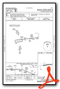
Instrument Approach Procedure (IAP) Charts

Nearby Airports with Instrument Procedures
| ID | Name | Heading / Distance | ||
|---|---|---|---|---|
 |
KLUM | Menomonie Municipal/Score Field Airport | 144° | 11.2 |
|
KAHH | Amery Municipal Airport | 313° | 20.7 |
|
Y23 | Chetek Municipal/Southworth Airport | 045° | 22.7 |
|
KRNH | New Richmond Regional Airport | 285° | 22.9 |
|
KRPD | Rice Lake Regional/Carl's Field Airport | 024° | 24.9 |
|
KEAU | Chippewa Valley Regional Airport | 114° | 25.3 |
|
KUBE | Cumberland Municipal Airport | 003° | 27.8 |
|
KOEO | L O Simenstad Municipal Airport | 299° | 32.5 |
|
KRGK | Red Wing Regional Airport | 216° | 33.7 |
|
21D | Lake Elmo Airport | 265° | 35.5 |
|
KSSQ | Shell Lake Municipal Airport | 005° | 41.5 |
|
KSGS | South St Paul Municipal/Richard E Fleming Field Airport | 255° | 44.5 |
Airport Images
Do you have a recent image of this airport? Upload it here!


