Login
Register


RGK
Red Wing Regional Airport
Official FAA Data Effective 2026-02-19 0901Z
Chart Supplement

VFR Chart of KRGK
Sectional Charts at SkyVector.com
IFR Chart of KRGK
Enroute Charts at SkyVector.com
Location Information for KRGK
Coordinates: N44°35.36' / W92°29.10'Located 03 miles NE of Red Wing, Minnesota on 534 acres of land. View all Airports in Minnesota.
Surveyed Elevation is 778 feet MSL.
Operations Data
|
|
Airport Communications
| AWOS-3: | 119.25 Tel. 715-594-3763 |
|---|---|
| MINNEAPOLIS APPROACH: | 121.2 335.65 |
| MINNEAPOLIS DEPARTURE: | 121.2 335.65 |
| CTAF: | 123.050 |
| UNICOM: | 123.050 |
| AWOS-3 at SYN (23.7 W): | 119.35 507-664-3806 |
| AWOS-3 at SGS (28.4 NW): | 119.425 651-457-8120 |
| AWOS-3 at 21D (29.1 NW): | 120.075 651-779-5949 |
Nearby Navigation Aids
|
| ||||||||||||||||||||||||||||||||||||||||||||||||||||||||||||


Runway 09/27
| Dimensions: | 5010 x 100 feet / 1527 x 30 meters | |
|---|---|---|
| Surface: | Asphalt in Fair Condition | |
| Weight Limits: | S-30, D-75 | |
| Edge Lighting: | High Intensity | |
| Runway 09 | Runway 27 | |
| Coordinates: | N44°35.38' / W92°29.67' | N44°35.34' / W92°28.52' |
| Elevation: | 777.9 | 776.8 |
| Traffic Pattern: | Left | Left |
| Runway Heading: | 93° True | 273° True |
| Markings: | Precision Instrument in fair condition. | Precision Instrument in fair condition. |
| Glide Slope Indicator | P4L (3.00° Glide Path Angle) | P4L (3.70° Glide Path Angle) |
| Approach Lights: | MALSR 1,400 Foot Medium-intensity Approach Lighting System with runway alignment indicator lights. | ODALS Omnidirectional Approach Lighting System |
Services Available
| Fuel: | 100LL (blue), Jet-A |
|---|---|
| Transient Storage: | Hangars,Tiedowns |
| Airframe Repair: | MAJOR |
| Engine Repair: | MAJOR |
| Bottled Oxygen: | HIGH/LOW |
| Bulk Oxygen: | HIGH/LOW |
| Other Services: | AVIONICS,CHARTER SERVICE,PILOT INSTRUCTION,AIRCRAFT RENTAL,AIRCRAFT SALES |
Ownership Information
| Ownership: | Publicly owned | |
|---|---|---|
| Owner: | CITY OF RED WING, PUBLIC WORKS | |
| 229 TYLER RD NORTH | ||
| RED WING, MN 55066-1826 | ||
| 651-385-3674 | ||
| Manager: | SHAWN BLANEY | |
| 229 TYLER RD N | ARPT PHYS ADS: W7145 148TH AVE, BAY CITY, WI 54723-1100. | |
| RED WING, MN 55066-1826 | ||
| 651-385-3653 | ||
Other Remarks
- ADMIN BLDG 715-594-3701.
- ARPT PHYS LCTN IS IN WISCONSIN.
- DEER ON & INVOF ARPT.
- FOR CD CTC MINNEAPOLIS APCH AT 612-726-9086.
- 0LL FUEL AVBL H24 VIA CREDIT CARD.
- ACTVT OR INCR INTST MALSR RWY 09; ODALS RWY 27; PAPI RWY 09 & 27; HIRL RWY 09/27 - CTAF. HIRL RWY 09/27 PRESET LOW INTST.
Weather Minimums


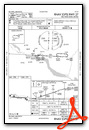
Instrument Approach Procedure (IAP) Charts


Nearby Airports with Instrument Procedures
| ID | Name | Heading / Distance | ||
|---|---|---|---|---|
 |
KSGS | South St Paul Municipal/Richard E Fleming Field Airport | 304° | 28.4 |
|
21D | Lake Elmo Airport | 327° | 29.1 |
|
KLVN | Airlake Airport | 274° | 31.9 |
|
KLUM | Menomonie Municipal/Score Field Airport | 055° | 32.0 |
|
KSTP | St Paul Downtown Holman Field Airport | 310° | 32.2 |
|
KRNH | New Richmond Regional Airport | 356° | 33.6 |
|
3T3 | Boyceville Municipal Airport | 035° | 33.7 |
|
KMSP | Minneapolis-St Paul International/Wold-Chamberlain Airport | 299° | 36.1 |
|
KTOB | Dodge Center Airport | 203° | 37.4 |
|
KFBL | Faribault Municipal-Liz Wall Strohfus Field Airport | 246° | 38.9 |
|
KRST | Rochester International Airport | 180° | 40.9 |
|
KAHH | Amery Municipal Airport | 006° | 41.8 |


