Login
Register


4K6
Bloomfield Municipal Airport
Official FAA Data Effective 2026-01-22 0901Z
Chart Supplement

VFR Chart of 4K6
Sectional Charts at SkyVector.com
IFR Chart of 4K6
Enroute Charts at SkyVector.com
Location Information for 4K6
Coordinates: N40°43.93' / W92°25.70'Located 02 miles SW of Bloomfield, Iowa on 43 acres of land. View all Airports in Iowa.
Surveyed Elevation is 888 feet MSL.
Operations Data
|
|
Airport Communications
| UNICOM: | 122.800 |
|---|---|
| CTAF: | 122.800 |
| AWOS-3 at TVK (21.6 W): | 123.775 641-437-1213 |
| ASOS at OTM (22.2 N): | 124.175 641-684-9164 |
| AWOS-3 at FFL (28.1 NE): | 132.025 641-472-4548 |
- APCH/DEP SVC PRVDD BY CHICAGO ARTCC ON FREQS 118.15/335.575 (OTTUMWA RCAG).
Nearby Navigation Aids
|
| ||||||||||||||||||||||||||||||||||||||||||||||||||||||


Runway 18/36
| Dimensions: | 3401 x 60 feet / 1037 x 18 meters | |
|---|---|---|
| Surface: | Concrete in Good Condition | |
| Weight Limits: | 6 /R/C/W/T, S-28, D-20 | |
| Edge Lighting: | Medium Intensity | |
| Runway 18 | Runway 36 | |
| Coordinates: | N40°44.21' / W92°25.70' | N40°43.65' / W92°25.69' |
| Elevation: | 883.0 | 888.0 |
| Traffic Pattern: | Left | Left |
| Runway Heading: | 179° True | 359° True |
| Markings: | Non-Precision Instrument in good condition. | Non-Precision Instrument in good condition. |
| Glide Slope Indicator | P2L (3.00° Glide Path Angle) | P2L (3.00° Glide Path Angle) |
| Obstacles: | 58 ft Tree 801 ft from runway, 182 ft right of center | 22 ft Trees 732 ft from runway, 114 ft right of center |
Services Available
| Fuel: | 100LL (blue) |
|---|---|
| Transient Storage: | Hangars,Tiedowns |
| Airframe Repair: | MAJOR |
| Engine Repair: | MAJOR |
| Bottled Oxygen: | NONE |
| Bulk Oxygen: | NONE |
| Other Services: | PILOT INSTRUCTION,AIRCRAFT RENTAL |
Ownership Information
| Ownership: | Publicly owned | |
|---|---|---|
| Owner: | CITY OF BLOOMFIELD | |
| 111 W FRANKLIN ST | ||
| BLOOMFIELD, IA 52537 | ||
| 641-664-2260 | ||
| Manager: | CHARLES A. SPARGUR | TONY |
| MUNI ARPT 20956 230TH ST | ||
| BLOOMFIELD, IA 52537 | ||
| 641-664-1255 | ||
Other Remarks
- THIS AIRPORT HAS BEEN SURVEYED BY THE NATIONAL GEODETIC SURVEY.
- FOR SVC AFTER HRS CALL 641-208-6709.
- FOR CD CTC CHICAGO ARTCC AT 630-906-8921.
- ACTVT MIRL RY 18/36 - CTAF.
Weather Minimums

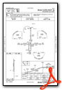
Instrument Approach Procedure (IAP) Charts
Nearby Airports with Instrument Procedures
| ID | Name | Heading / Distance | ||
|---|---|---|---|---|
 |
03D | Memphis Memorial Airport | 151° | 19.4 |
|
KTVK | Centerville Municipal Airport | 262° | 21.8 |
|
4C8 | Albia Municipal Airport | 315° | 22.1 |
|
KOTM | Ottumwa Regional Airport | 357° | 22.5 |
|
KFFL | Fairfield Municipal Airport | 046° | 28.1 |
|
KOOA | Oskaloosa Municipal Airport | 354° | 29.8 |
|
KIRK | Kirksville Regional Airport | 187° | 38.7 |
|
KMPZ | Mount Pleasant Municipal Airport | 072° | 43.7 |
|
KCNC | Chariton Municipal Airport | 292° | 45.8 |
|
KOXV | Knoxville Municipal Airport | 317° | 46.1 |
|
KPEA | Pella Municipal Airport | 329° | 46.5 |
|
KAWG | Washington Municipal Airport | 046° | 47.2 |
Airport Images
Do you have a recent image of this airport? Upload it here!


