Login
Register


OXV
Knoxville Municipal Airport
Official FAA Data Effective 2026-02-19 0901Z
Chart Supplement

VFR Chart of KOXV
Sectional Charts at SkyVector.com
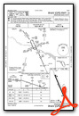
IFR Chart of KOXV
Enroute Charts at SkyVector.com
Location Information for KOXV
Coordinates: N41°17.95' / W93°6.82'Located 02 miles S of Knoxville, Iowa on 161 acres of land. View all Airports in Iowa.
Surveyed Elevation is 928 feet MSL.
Operations Data
|
|
Airport Communications
| AWOS-3: | 119.775 Tel. 641-828-8406 |
|---|---|
| DES MOINES APPROACH: | 123.9 307.15 |
| DES MOINES DEPARTURE: | 123.9 307.15 |
| UNICOM: | 122.800 |
| CTAF: | 122.800 |
| AWOS-3 at PEA (9.8 NE): | 118.875 641-628-3459 |
| AWOS-3 at CNC (20.1 SW): | 125.525 641-774-5645 |
| AWOS-3 at TNU (22.7 N): | 132.275 641-791-3302 |
Nearby Navigation Aids
|
| ||||||||||||||||||||||||||||||||||||||||||


Runway 15/33
| Dimensions: | 4000 x 75 feet / 1219 x 23 meters | |
|---|---|---|
| Surface: | Concrete in Good Condition | |
| Weight Limits: | 5 /R/C/W/U, S-28, D-48 | |
| Edge Lighting: | Medium Intensity | |
| Runway 15 | Runway 33 | |
| Coordinates: | N41°18.25' / W93°7.00' | N41°17.65' / W93°6.65' |
| Elevation: | 923.9 | 927.4 |
| Traffic Pattern: | Left | Left |
| Runway Heading: | 156° True | 336° True |
| Markings: | Non-Precision Instrument in good condition. | Non-Precision Instrument in good condition. |
| Glide Slope Indicator | P2L (3.00° Glide Path Angle) | P2L (3.00° Glide Path Angle) |
| REIL: | Yes | Yes |
| Obstacles: | 26 ft Pole 819 ft from runway, 325 ft left of center | 23 ft Tree 773 ft from runway, 99 ft right of center |
Services Available
| Fuel: | 100LL (blue), Jet-A |
|---|---|
| Transient Storage: | Hangars,Tiedowns |
| Airframe Repair: | MAJOR |
| Engine Repair: | MAJOR |
| Bottled Oxygen: | NONE |
| Bulk Oxygen: | NONE |
| Other Services: | CHARTER SERVICE,PILOT INSTRUCTION,AIRCRAFT RENTAL,AIRCRAFT SALES |
Ownership Information
| Ownership: | Publicly owned | |
|---|---|---|
| Owner: | CITY OF KNOXVILLE | |
| 305 SOUTH 3RD | ||
| KNOXVILLE, IA 50138 | ||
| 641-842-3147 | ||
| Manager: | KATHERINE SHAWVER | |
| 1770 S LINCOLN STREET | ||
| KNOXVILLE, IA 50138 | ||
| 702-466-9560 | ||
Other Remarks
- FOR CD CTC DES MOINES ATCT AT 515-974- 8016.
- ACTVT MIRL RY 15/33 AND PAPI RYS 15 & 33 AND REIL RYS 15 & 33 - CTAF.
Weather Minimums


Instrument Approach Procedure (IAP) Charts

Nearby Airports with Instrument Procedures
| ID | Name | Heading / Distance | ||
|---|---|---|---|---|
 |
KPEA | Pella Municipal Airport | 051° | 9.7 |
|
KCNC | Chariton Municipal Airport | 213° | 20.1 |
|
KTNU | Newton Municipal-Earl Johnson Field Airport | 010° | 22.9 |
|
4C8 | Albia Municipal Airport | 138° | 24.1 |
|
KOOA | Oskaloosa Municipal Airport | 098° | 28.4 |
|
KDSM | Des Moines International Airport | 299° | 28.5 |
|
I75 | Osceola Municipal Airport | 240° | 30.0 |
|
KGGI | Grinnell Regional Airport | 034° | 29.9 |
|
KIKV | Ankeny Regional Airport | 319° | 31.1 |
|
KOTM | Ottumwa Regional Airport | 110° | 32.3 |
|
KTVK | Centerville Municipal Airport | 165° | 38.1 |
|
3Y3 | Winterset Municipal Airport | 275° | 41.2 |
Airport Images
Do you have a recent image of this airport? Upload it here!


