Login
Register


OOA
Oskaloosa Municipal Airport
Official FAA Data Effective 2025-12-25 0901Z
Chart Supplement

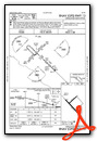
VFR Chart of KOOA
Sectional Charts at SkyVector.com
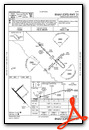
IFR Chart of KOOA
Enroute Charts at SkyVector.com
Location Information for KOOA
Coordinates: N41°13.57' / W92°29.63'Located 09 miles SE of Oskaloosa, Iowa on 620 acres of land. View all Airports in Iowa.
Surveyed Elevation is 840 feet MSL.
Operations Data
|
|
Airport Communications
| AWOS-3: | 118.625 Tel. 641-933-4312 |
|---|---|
| CTAF: | 122.800 |
| UNICOM: | 122.800 |
| ASOS at OTM (7.8 S): | 124.175 641-684-9164 |
| AWOS-3 at PEA (22.8 NW): | 118.875 641-628-3459 |
| AWOS-3 at FFL (25.5 SE): | 132.025 641-472-4548 |
- APCH/DEP SVC PRVDD BY CHICAGO ARTCC ON FREQS 118.15/335.575 (OTTUMWA RCAG).
Nearby Navigation Aids
|
| ||||||||||||||||||||||||||||||||||||||||||||||||


Runway 13/31
| Dimensions: | 4012 x 75 feet / 1223 x 23 meters | |
|---|---|---|
| Surface: | Concrete in Good Condition | |
| Weight Limits: | 8 /R/C/W/T, S-25 | |
| Edge Lighting: | Medium Intensity | |
| Runway 13 | Runway 31 | |
| Coordinates: | N41°13.72' / W92°29.94' | N41°13.26' / W92°29.32' |
| Elevation: | 837.3 | 835.7 |
| Traffic Pattern: | Left | Left |
| Runway Heading: | 135° True | 315° True |
| Markings: | Non-Precision Instrument in good condition. | Non-Precision Instrument in good condition. |
| Glide Slope Indicator | P2L (3.00° Glide Path Angle) | P2L (3.00° Glide Path Angle) |
| REIL: | Yes | Yes |
Runway 04/22
| Dimensions: | 1926 x 75 feet / 587 x 23 meters | |
|---|---|---|
| Surface: | Concrete in Fair Condition | |
| Weight Limits: | 6 /R/D/W/U, S-25 | |
| Runway 04 | Runway 22 | |
| Coordinates: | N41°13.61' / W92°29.78' | N41°13.84' / W92°29.48' |
| Elevation: | 837.5 | 839.8 |
| Traffic Pattern: | Left | Left |
| Runway Heading: | 45° True | 225° True |
| Markings: | Non-Precision Instrument in fair condition. | Non-Precision Instrument in fair condition. |
Services Available
| Fuel: | 100LL (blue), Jet-A |
|---|---|
| Transient Storage: | Hangars,Tiedowns |
| Airframe Repair: | MAJOR |
| Engine Repair: | MAJOR |
| Bottled Oxygen: | NONE |
| Bulk Oxygen: | NONE |
| Other Services: | PILOT INSTRUCTION,AIRCRAFT RENTAL,AIRCRAFT SALES |
Ownership Information
| Ownership: | Publicly owned | |
|---|---|---|
| Owner: | CITY OF OSKALOOSA | |
| 220 SOUTH MARKET | ||
| OSKALOOSA, IA 52577 | ||
| 641-673-9431 | ||
| Manager: | SHANE VANDE VOORT | |
| 2973 URBANA AVENUE | ||
| OSKALOOSA, IA 52577 | ||
| 641-933-4316 | ||
Other Remarks
- FOR CD CTC CHICAGO ARTCC AT 630-906-8921.
- ACTVT MIRL RWY 13/31; REIL RWY 13/31 - CTAF.
Weather Minimums
Instrument Approach Procedure (IAP) Charts
Nearby Airports with Instrument Procedures
| ID | Name | Heading / Distance | ||
|---|---|---|---|---|
 |
KOTM | Ottumwa Regional Airport | 163° | 7.4 |
|
4C8 | Albia Municipal Airport | 221° | 18.5 |
|
KPEA | Pella Municipal Airport | 297° | 23.0 |
|
KFFL | Fairfield Municipal Airport | 113° | 25.4 |
|
KOXV | Knoxville Municipal Airport | 279° | 28.4 |
|
4K6 | Bloomfield Municipal Airport | 174° | 29.8 |
|
KGGI | Grinnell Regional Airport | 339° | 31.0 |
|
KTNU | Newton Municipal-Earl Johnson Field Airport | 318° | 35.9 |
|
KAWG | Washington Municipal Airport | 085° | 37.1 |
|
KTVK | Centerville Municipal Airport | 209° | 37.4 |
|
KTZT | Belle Plaine Municipal Airport | 013° | 40.3 |
|
KCNC | Chariton Municipal Airport | 252° | 41.2 |
Airport Images
Do you have a recent image of this airport? Upload it here!


