Login
Register


CNC
Chariton Municipal Airport
Official FAA Data Effective 2026-01-22 0901Z
Chart Supplement

VFR Chart of KCNC
Sectional Charts at SkyVector.com
IFR Chart of KCNC
Enroute Charts at SkyVector.com
Location Information for KCNC
Coordinates: N41°1.18' / W93°21.58'Located 03 miles W of Chariton, Iowa on 120 acres of land. View all Airports in Iowa.
Surveyed Elevation is 1050 feet MSL.
Operations Data
|
|
Airport Communications
| AWOS-3: | 125.525 Tel. 641-774-5645 |
|---|---|
| DES MOINES APPROACH: | 123.9 360.7 |
| DES MOINES DEPARTURE: | 123.9 360.7 |
| CTAF: | 122.800 |
| UNICOM: | 122.800 |
| AWOS-3 at I75 (15.1 W): | 120.975 641-342-1422 |
| AWOS-3 at OXV (20.1 NE): | 119.775 641-828-8406 |
| AWOS-3 at TVK (29.1 SE): | 123.775 641-437-1213 |
Nearby Navigation Aids
|
| ||||||||||||||||||||||||||||||||||||


Runway 10/28
| Dimensions: | 4000 x 75 feet / 1219 x 23 meters | |
|---|---|---|
| Surface: | Concrete / Wire Combed in Good Condition | |
| Weight Limits: | S-12 | |
| Edge Lighting: | Medium Intensity | |
| Runway 10 | Runway 28 | |
| Coordinates: | N41°1.25' / W93°21.81' | N41°1.11' / W93°20.96' |
| Elevation: | 1045.6 | 1033.9 |
| Runway Heading: | 102° True | 282° True |
| Markings: | Non-Precision Instrument in fair condition. | Non-Precision Instrument in fair condition. |
| Glide Slope Indicator | V2L (3.00° Glide Path Angle) | P2L (3.00° Glide Path Angle) |
| REIL: | Yes | Yes |
| Obstacles: | +18' ROAD AT 650' GLIDESLOPE 25:1. |
21 ft Tree 948 ft from runway, 31 ft right of center |
Runway 17/35
| Dimensions: | 2800 x 75 feet / 853 x 23 meters | |
|---|---|---|
| Surface: | Concrete in Good Condition | |
| Weight Limits: | S-12 | |
| Edge Lighting: | Medium Intensity | |
| Runway 17 | Runway 35 | |
| Coordinates: | N41°1.41' / W93°21.86' | N41°0.94' / W93°21.86' |
| Elevation: | 1037.8 | 1049.8 |
| Traffic Pattern: | Left | |
| Runway Heading: | 180° True | 0 |
| Markings: | Non-Precision Instrument in fair condition. | Non-Precision Instrument in fair condition. |
| Glide Slope Indicator | P2L | P2L |
| REIL: | Yes | Yes |
| Obstacles: | 15 ft Road 500 ft from runway | |
Services Available
| Fuel: | 100LL (blue) |
|---|---|
| Transient Storage: | Hangars |
| Airframe Repair: | NONE |
| Engine Repair: | NONE |
| Bottled Oxygen: | NONE |
| Bulk Oxygen: | NONE |
Ownership Information
| Ownership: | Publicly owned | |
|---|---|---|
| Owner: | CITY OF CHARITON | |
| 115 SOUTH MAIN | ||
| CHARITON, IA 50049 | ||
| 641-774-5991 | ||
| Manager: | CHRISTY METZGER | |
| 115 SOUTH MAIN | ||
| CHARITON, IA 50049 | ||
| 641-774-5991 | ||
Other Remarks
- FOR CD CTC DES MOINES ATCT AT 515-974- 8016.
- MIRL RYS 17/35 & 10/28 PRESET ON LOW INTST; TO INCR INTST & ACTVT REIL RYS 17; 35; 10 & 28; PAPI RYS 17; 35 & 28 - CTAF.
Weather Minimums


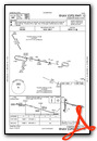
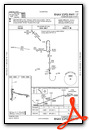
Instrument Approach Procedure (IAP) Charts
Nearby Airports with Instrument Procedures
| ID | Name | Heading / Distance | ||
|---|---|---|---|---|
 |
I75 | Osceola Municipal Airport | 277° | 15.1 |
|
KOXV | Knoxville Municipal Airport | 033° | 20.1 |
|
4C8 | Albia Municipal Airport | 092° | 27.0 |
|
KTVK | Centerville Municipal Airport | 133° | 29.0 |
|
KPEA | Pella Municipal Airport | 039° | 29.6 |
|
KDSM | Des Moines International Airport | 336° | 33.8 |
|
KLWD | Lamoni Municipal Airport | 226° | 33.9 |
|
3Y3 | Winterset Municipal Airport | 304° | 36.4 |
|
KOOA | Oskaloosa Municipal Airport | 072° | 41.2 |
|
KIKV | Ankeny Regional Airport | 347° | 41.4 |
|
KOTM | Ottumwa Regional Airport | 082° | 41.7 |
|
KTNU | Newton Municipal-Earl Johnson Field Airport | 021° | 42.1 |
Airport Images
Do you have a recent image of this airport? Upload it here!


