Login
Register


63C
Adams County Legion Field Airport
Official FAA Data Effective 2025-12-25 0901Z
Chart Supplement

VFR Chart of 63C
Sectional Charts at SkyVector.com
IFR Chart of 63C
Enroute Charts at SkyVector.com
Location Information for 63C
Coordinates: N43°57.64' / W89°47.32'Located 01 miles E of Friendship (Adams), Wisconsin on 380 acres of land. View all Airports in Wisconsin.
Surveyed Elevation is 979 feet MSL.
Operations Data
|
|
Airport Communications
| VOLK APPROACH: | 135.25 244.875 |
|---|---|
| VOLK DEPARTURE: | 135.25 244.875 |
| CTAF: | 122.900 |
| AWOS-3 at 82C (16.8 SW): | 123.925 608-562-6153 |
| ATIS at VOK (20.1 W): | 134.35 |
| AWOS-3PT at Y50 (21.4 E): | 119.475 920-787-0515 |
- APCH/DEP SVC PRVDD BY CHICAGO ARTCC (ZAU) ON FREQS 125.05/269.375 (CAMP DOUGLAS RCAG) WHEN VOLK APCH CTL CLSD.
Nearby Navigation Aids
|
| ||||||||||||||||||||||||||||||||||||||||||||||||||||||||||||


Runway 15/33
| Dimensions: | 3398 x 60 feet / 1036 x 18 meters | |
|---|---|---|
| Surface: | Asphalt in Good Condition | |
| Weight Limits: | S-12 | |
| Edge Lighting: | Medium Intensity | |
| Runway 15 | Runway 33 | |
| Coordinates: | N43°57.90' / W89°47.55' | N43°57.40' / W89°47.21' |
| Elevation: | 968.4 | 979.0 |
| Traffic Pattern: | Left | Left |
| Runway Heading: | 153° True | 333° True |
| Markings: | Non-Precision Instrument in fair condition. | Non-Precision Instrument in fair condition. |
| Glide Slope Indicator | P2L (3.00° Glide Path Angle) OPER CONSLY. | P2L (3.00° Glide Path Angle) OPER CONSLY. |
| REIL: | Yes | Yes |
| Obstacles: | 34 ft Trees 700 ft from runway, 285 ft left of center | 59 ft Trees 630 ft from runway, 300 ft right of center |
Runway 08/26
CLSD DEC 1 - APR 1. | ||
| Dimensions: | 2780 x 100 feet / 847 x 30 meters | |
|---|---|---|
| Surface: | Turf in Fair Condition | |
| Runway 08 | Runway 26 | |
| Coordinates: | N43°57.58' / W89°47.55' | N43°57.66' / W89°46.93' |
| Elevation: | 973.5 | 978.1 |
| Runway Heading: | 80° True | 260° True |
Services Available
| Fuel: | 100LL (blue) |
|---|---|
| Transient Storage: | Tiedowns |
| Airframe Repair: | NONE |
| Engine Repair: | NONE |
| Bottled Oxygen: | NONE |
| Bulk Oxygen: | NONE |
Ownership Information
| Ownership: | Publicly owned | |
|---|---|---|
| Owner: | ADAMS COUNTY | |
| 401 ADAMS ST, STE 10 | ||
| FRIENDSHIP, WI 53934 | ||
| 608-339-4200 | ||
| Manager: | KYLE PATTERSON | |
| 401 ADAMS ST, STE 10 | ||
| FRIENDSHIP, WI 53934 | ||
| 608-339-4201 | ||
Other Remarks
- ULTRALIGHT ACT ON & INVOF ARPT.
- ACFT DEP RWY 15 REQD TO TURN TO HDG OF 180 DEG AFT TAKEOFF.
- FOR CD CTC CHICAGO ARTCC AT 630-906-8921.
- CROP DUSTING ACT ON & INVOF ARPT.
- MKD WITH WHITE CONES.
- MKD WITH WHITE CONES.
- 0LL FUEL AVBL H24 VIA CREDIT CARD.
- MIRL RWY 15/33 PRESET TO LOW SS-SR; TO INCR INTST & ACTVT REILS RWY 15 & 33 - CTAF.
Weather Minimums
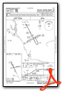
Instrument Approach Procedure (IAP) Charts
Nearby Airports with Instrument Procedures
| ID | Name | Heading / Distance | ||
|---|---|---|---|---|
 |
KDAF | Necedah Airport | 288° | 13.6 |
|
82C | Mauston/New Lisbon Union Airport | 244° | 16.8 |
|
KVOK | Volk Field Airport | 266° | 20.2 |
|
Y50 | Wautoma Municipal Airport | 076° | 21.5 |
|
KISW | Alexander Field South Wood County Airport | 354° | 24.1 |
|
KDLL | Baraboo/Wisconsin Dells Regional Airport | 178° | 26.3 |
|
C35 | Reedsburg Municipal Airport | 198° | 27.4 |
|
C47 | Portage Municipal Airport | 150° | 27.5 |
|
Y72 | Bloyer Field Airport | 272° | 30.0 |
|
KSTE | Stevens Point Municipal Airport | 017° | 36.8 |
|
91C | Sauk/Prairie Airport | 177° | 39.8 |
|
KPCZ | Waupaca Municipal Airport | 055° | 40.0 |
Airport Images
Do you have a recent image of this airport? Upload it here!


