Login
Register


Y50
Wautoma Municipal Airport
Official FAA Data Effective 2025-11-27 0901Z
Chart Supplement

VFR Chart of Y50
Sectional Charts at SkyVector.com
IFR Chart of Y50
Enroute Charts at SkyVector.com
Location Information for Y50
Coordinates: N44°2.59' / W89°18.34'Located 02 miles SW of Wautoma, Wisconsin on 353 acres of land. View all Airports in Wisconsin.
Surveyed Elevation is 859 feet MSL.
Operations Data
|
|
Airport Communications
| AWOS-3PT: | 119.475 Tel. 920-787-0515 |
|---|---|
| MILWAUKEE APPROACH: | 127.0 263.075 |
| MILWAUKEE DEPARTURE: | 127.0 263.075 |
| CTAF: | 122.800 |
| UNICOM: | 122.800 |
| AWOS-3 at PCZ (21.3 NE): | 118.625 920-867-2407 |
| ASOS at ISW (29.8 NW): | 126.575 715-421-2120 |
| AWOS-3 at STE (31.6 N): | 119.275 715-344-5960 |
Nearby Navigation Aids
|
| ||||||||||||||||||||||||||||||||||||||||||||||||||||||||||||


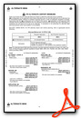
Runway 13/31
| Dimensions: | 3300 x 60 feet / 1006 x 18 meters | |
|---|---|---|
| Surface: | Asphalt in Fair Condition | |
| Weight Limits: | S-12 | |
| Edge Lighting: | Medium Intensity | |
| Runway 13 | Runway 31 | |
| Coordinates: | N44°2.68' / W89°18.55' | N44°2.32' / W89°17.99' |
| Elevation: | 858.5 | 855.9 |
| Traffic Pattern: | Left | Left |
| Runway Heading: | 132° True | 312° True |
| Markings: | Non-Precision Instrument in good condition. | Non-Precision Instrument in good condition. |
| Obstacles: | 88 ft Trees 1350 ft from runway, 350 ft left of center | 67 ft Tree 1075 ft from runway, 275 ft left of center |
Runway 08/26
RY 08/26 CLSD WINTER MONTHS EXCEPT FOR SKI EQUIPPED ACFT. E 430 FT CLSD IN WINTER. | ||
| Dimensions: | 2334 x 120 feet / 711 x 37 meters | |
|---|---|---|
| Surface: | Turf in Good Condition | |
| Runway 08 | Runway 26 | |
| Coordinates: | N44°2.69' / W89°18.71' | N44°2.74' / W89°18.18' |
| Elevation: | 858.9 | 856.9 |
| Traffic Pattern: | Left | Left |
| Runway Heading: | 83° True | 263° True |
| Markings: | None | None |
| Obstacles: | 60 ft Trees 850 ft from runway, 75 ft right of center | |
Services Available
| Fuel: | 100LL (blue) |
|---|---|
| Transient Storage: | Hangars,Tiedowns |
| Airframe Repair: | MINOR |
| Engine Repair: | MAJOR |
| Bottled Oxygen: | NONE |
| Bulk Oxygen: | NONE |
| Other Services: | PILOT INSTRUCTION |
Ownership Information
| Ownership: | Publicly owned | |
|---|---|---|
| Owner: | CITY OF WAUTOMA | |
| CITY HALL | ||
| WAUTOMA, WI 54982 | ||
| 920-787-4044 | ||
| Manager: | RICHARD JORGENSEN | |
| W8471 COTTONVILLE DRIVE | ||
| WAUTOMA, WI 54982 | ||
| 920-787-3030 | ||
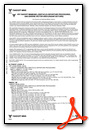
Other Remarks
- WATERFOWL AND DEER ON AND INVOF ARPT.
- ULTRALIGHT ACTIVITY ON & INVOF ARPT.
- FOR CD CTC CHICAGO ARTCC AT 630-906-8921.
- MKD WITH WHITE HALF BARRELS.
- MKD WITH WHITE HALF BARRELS.
- 0LL 24 HR SELF SVC FUEL AVBL WITH CREDIT CARD.
- MIRL RWY 13/31 PRESET TO LOW SS-SR; TO INCR INTST AND ACTVT - CTAF.
Weather Minimums
Instrument Approach Procedure (IAP) Charts


Nearby Airports with Instrument Procedures
| ID | Name | Heading / Distance | ||
|---|---|---|---|---|
 |
KPCZ | Waupaca Municipal Airport | 035° | 21.3 |
|
63C | Adams County Legion Field Airport | 256° | 21.5 |
|
KISW | Alexander Field South Wood County Airport | 309° | 29.9 |
|
C47 | Portage Municipal Airport | 194° | 30.0 |
|
KSTE | Stevens Point Municipal Airport | 342° | 31.6 |
|
KOSH | Wittman Regional Airport | 095° | 32.6 |
|
KDAF | Necedah Airport | 269° | 33.7 |
|
KATW | Appleton International Airport | 068° | 36.3 |
|
KDLL | Baraboo/Wisconsin Dells Regional Airport | 213° | 37.2 |
|
82C | Mauston/New Lisbon Union Airport | 251° | 38.1 |
|
KFLD | Fond Du Lac County Airport | 114° | 39.0 |
|
KVOK | Volk Field Airport | 261° | 41.5 |
Airport Images
Do you have a recent image of this airport? Upload it here!


