Login
Register
65G
Maple Grove Airport
Official FAA Data Effective 2025-12-25 0901Z
VFR Chart of 65G
Sectional Charts at SkyVector.com
IFR Chart of 65G
Enroute Charts at SkyVector.com
Location Information for 65G
Coordinates: N42°43.08' / W84°3.64'Located 03 miles N of Fowlerville, Michigan on 25 acres of land. View all Airports in Michigan.
Estimated Elevation is 906 feet MSL.
Operations Data
|
|
Airport Communications
| UNICOM: | 122.800 |
|---|---|
| CTAF: | 122.800 |
| AWOS-3P at OZW (6.1 SE): | 118.875 517-546-4450 |
| AWOS-3 at RNP (16.9 N): | 118.025 989-729-2967 |
| AWOS-3P at TEW (18.5 SW): | 119.425 517-676-5607 |
Nearby Navigation Aids
|
| ||||||||||||||||||||||||||||||||||||||||||||||||||||||||||||
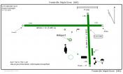
Runway 09/27
| Dimensions: | 3050 x 110 feet / 930 x 34 meters | |
|---|---|---|
| Surface: | Turf in Good Condition | |
| Edge Lighting: | Low Intensity | |
| Runway 09 | Runway 27 | |
| Coordinates: | N42°43.12' / W84°4.07' | N42°43.12' / W84°3.39' |
| Elevation: | 906.0 | 901.0 |
| Traffic Pattern: | Left | Left |
| Runway Heading: | 90° True | 270° True |
| Displaced Threshold: | 200 Feet | 300 Feet |
| Obstacles: | 20 ft Ground 345 ft from runway, 125 ft right of center APCH RATIO 20:1 TO DTHR. |
15 ft Road 30 ft from runway, 125 ft right of center APCH RATIO 20:1 TO DTHR. |
Runway 18/36
| Dimensions: | 2000 x 113 feet / 610 x 34 meters | |
|---|---|---|
| Surface: | Turf in Good Condition | |
| Edge Lighting: | Low Intensity | |
| Runway 18 | Runway 36 | |
| Coordinates: | N42°43.19' / W84°3.51' | N42°42.86' / W84°3.49' |
| Elevation: | 898.0 | 903.0 |
| Traffic Pattern: | Left | Left |
| Displaced Threshold: | 550 Feet | 275 Feet |
| Obstacles: | 4 ft Fence 0 ft from runway, 75 ft left of center APCH RATIO 20:1 TO DTHR OVR +55 FT MKD & LGTD PLINE, 550 FT DIST, 180 FT L/R. |
15 ft Road 25 ft from runway, 125 ft right of center APCH RATIO 20:1 TO DTHR. |
Services Available
| Fuel: | NONE |
|---|---|
| Transient Storage: | Tiedowns |
| Airframe Repair: | MAJOR |
| Engine Repair: | MAJOR |
| Bottled Oxygen: | NOT AVAILABLE |
| Bulk Oxygen: | NOT AVAILABLE |
| Other Services: | PARACHUTE JUMP ACTIVITY |
Ownership Information
| Ownership: | Privately Owned | |
|---|---|---|
| Owner: | LUNDY LLC | |
| 102 CHICAGO AVE | ||
| CHARLEVOIX, MI 49720-1549 | ||
| 231-622-2052 | ||
| Manager: | PAULO ROBERTO PINTO DA SILVA | ALTN CTC E66 AMGR. |
| 7080 W SHERWOOD RD | ||
| FOWLERVILLE, MI 48836-9371 | ||
| 517-245-4387 | ||
Other Remarks
- ARPT IS COLOCATED WITH E66 HLP, BE ALERT FOR ROTARY WING ACFT.
- EXTSV ACFT TRG, TWO-WAY RDO COMS RQRD.
- FOR CD CTC GREAT LAKES APCH AT 269-459-3345, WHEN APCH CLSD CTC CLEVELAND ARTCC AT 440-774-0224/0490.
- FICONS UNMON NOV-MAY. NO SNOW REMOVAL.
- DEER & LRG BIRDS ON & INVOF ARPT.
- RWY & DTHR MKD WITH 3 FT YELLOW CONES.
- RWY & DTHR MKD WITH 3 FT YELLOW CONES.
- RWY & DTHR MKD WITH 3 FT YELLOW CONES.
- RWY & DTHR MKD WITH 3 FT YELLOW CONES.
Nearby Airports with Instrument Procedures
| ID | Name | Heading / Distance | ||
|---|---|---|---|---|
 |
KOZW | Livingston County/Spencer J Hardy Airport | 146° | 6.4 |
 |
9G2 | Prices Airport | 067° | 14.0 |
 |
KRNP | Owosso Community Airport | 348° | 16.8 |
 |
KTEW | Mason Jewett Field Airport | 240° | 18.5 |
 |
KFNT | Bishop International Airport | 043° | 20.4 |
 |
Y47 | Oakland Southwest Airport | 123° | 23.3 |
 |
KLAN | Capital Region International Airport | 279° | 23.5 |
 |
KPTK | Oakland County International Airport | 096° | 28.5 |
 |
4D0 | Abrams Municipal Airport | 276° | 29.9 |
 |
KJXN | Jackson County/Reynolds Field Airport | 213° | 32.7 |
 |
KARB | Ann Arbor Municipal Airport | 154° | 32.8 |
 |
KFPK | Fitch H Beach Airport | 255° | 34.4 |


