Login
Register


6K3
Creighton Municipal Airport
Official FAA Data Effective 2026-02-19 0901Z
Chart Supplement

VFR Chart of 6K3
Sectional Charts at SkyVector.com
IFR Chart of 6K3
Enroute Charts at SkyVector.com
Location Information for 6K3
Coordinates: N42°28.28' / W97°53.08'Located 01 miles E of Creighton, Nebraska on 202 acres of land. View all Airports in Nebraska.
Surveyed Elevation is 1653 feet MSL.
Operations Data
|
|
Airport Communications
| CTAF: | 122.900 |
|---|---|
| AWOS-3PT at 4V9 (22.7 S): | 119.275 402-887-5233 |
| AWOS-3PT at YKN (34.6 NE): | 119.05 605-665-6072 |
| AWOS-3 at ONL (35.6 W): | 121.125 402-336-4834 |
- APCH/DEP SVC PRVDD BY MINNEAPOLIS ARTCC ON FREQS 128.0/257.95 (O'NEILL RCAG).
Nearby Navigation Aids
|
| ||||||||||||||||||||||||||||||||||||||||||||||||||||||||||||


Runway 13/31
| Dimensions: | 3700 x 60 feet / 1128 x 18 meters | |
|---|---|---|
| Surface: | Concrete in Excellent Condition | |
| Weight Limits: | S-12 | |
| Edge Lighting: | Medium Intensity | |
| Runway 13 | Runway 31 | |
| Coordinates: | N42°28.50' / W97°53.41' | N42°28.11' / W97°52.78' |
| Elevation: | 1641.8 | 1644.0 |
| Traffic Pattern: | Left | Left |
| Runway Heading: | 130° True | 310° True |
| Markings: | Non-Precision Instrument in good condition. | Non-Precision Instrument in good condition. |
| Glide Slope Indicator | P2L (3.00° Glide Path Angle) | P2L (3.00° Glide Path Angle) |
Runway 18/36
| Dimensions: | 2100 x 200 feet / 640 x 61 meters | |
|---|---|---|
| Surface: | Turf in Fair Condition | |
| Runway 18 | Runway 36 | |
| Coordinates: | N42°28.40' / W97°53.02' | N42°28.06' / W97°53.11' |
| Elevation: | 1653.0 | 1628.0 |
| Traffic Pattern: | Left | Left |
| Runway Heading: | 190° True | 10° True |
Services Available
| Fuel: | 100LL (blue) |
|---|---|
| Transient Storage: | Hangars,Tiedowns |
| Airframe Repair: | NONE |
| Engine Repair: | NONE |
| Bottled Oxygen: | NONE |
| Bulk Oxygen: | NONE |
| Other Services: | CROP DUSTING SERVICES |
Ownership Information
| Ownership: | Publicly owned | |
|---|---|---|
| Owner: | CREIGHTON AIRPORT AUTHORITY | |
| PO BOX 188 | ||
| CREIGHTON, NE 68729-0188 | ||
| 402-358-3343 | ||
| Manager: | ROBERT BORGMANN | BOB BORGMANN, SECRETARY, CREIGHTON AIRPORT AUTHORITY. |
| P.O. BOX 51 | ||
| CREIGHTON, NE 68729-0051 | ||
| (402) 360-2916 | MANAGER HOME PHONE 402-358-3343. | |
Other Remarks
- FOR CD CTC MINNEAPOLIS ARTCC AT 651-463-5588.
- 0LL SELF SVR CC 24 HR
- DUSK-2300. FOR MIRL RY 13/31 AFT 2300 ACTVT - CTAF. ACTVT PAPI RY 13-31 - CTAF.
Weather Minimums

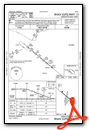
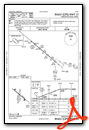
Instrument Approach Procedure (IAP) Charts
Nearby Airports with Instrument Procedures
| ID | Name | Heading / Distance | ||
|---|---|---|---|---|
 |
4V9 | Antelope County Airport | 197° | 22.6 |
|
0B4 | Hartington Municipal/Bud Becker Field Airport | 074° | 29.1 |
|
KYKN | Chan Gurney Municipal Airport | 039° | 34.7 |
|
KOFK | Norfolk Regional/Karl Stefan Memorial Field Airport | 145° | 35.4 |
|
KONL | The O'Neill Municipal-John L Baker Field Airport | 270° | 35.7 |
|
KAGZ | Wagner Municipal Airport | 333° | 39.9 |
|
KLCG | Wayne Municipal/Stan Morris Field Airport | 108° | 42.4 |
|
KBVN | Albion Municipal Airport | 189° | 45.2 |
|
KVMR | Harold Davidson Field Airport | 066° | 45.7 |
|
8V2 | Stuart-Atkinson Municipal Airport | 276° | 51.5 |
|
8V3 | Parkston Municipal Airport | 355° | 54.6 |
|
0C4 | Pender Municipal Airport | 112° | 55.8 |
Airport Images
Do you have a recent image of this airport? Upload it here!


