Login
Register


AGZ
Wagner Municipal Airport
Official FAA Data Effective 2026-02-19 0901Z
Chart Supplement

VFR Chart of KAGZ
Sectional Charts at SkyVector.com
IFR Chart of KAGZ
Enroute Charts at SkyVector.com
Location Information for KAGZ
Coordinates: N43°3.85' / W98°17.78'Located 01 miles S of Wagner, South Dakota on 167 acres of land. View all Airports in South Dakota.
Surveyed Elevation is 1477 feet MSL.
Operations Data
|
|
Airport Communications
| AWOS-3P: | 128.325 Tel. 605-384-3922 |
|---|---|
| UNICOM: | 122.800 |
| CTAF: | 122.800 |
| AWOS-3 at ONL (39.7 SW): | 121.125 402-336-4834 |
| AWOS-3PT at YKN (41.0 E): | 119.05 605-665-6072 |
| ASOS at MHE (44.1 N): | 124.175 605-995-5803 |
- APCH/DEP SVC PRVDD BY MINNEAPOLIS ARTCC (ZMP) ON FREQS 128.0/257.95 (O'NEILL RCAG).
Nearby Navigation Aids
|
| ||||||||||||||||||||||||||||||||||||||||||||||||||||||


Runway 09/27
| Dimensions: | 3500 x 60 feet / 1067 x 18 meters | |
|---|---|---|
| Surface: | Asphalt in Good Condition | |
| Weight Limits: | S-12 | |
| Edge Lighting: | Medium Intensity | |
| Runway 09 | Runway 27 | |
| Coordinates: | N43°3.91' / W98°18.23' | N43°3.88' / W98°17.45' |
| Elevation: | 1477.5 | 1465.3 |
| Traffic Pattern: | Left | Left |
| Runway Heading: | 94° True | 274° True |
| Markings: | Non-Precision Instrument in fair condition. | Non-Precision Instrument in fair condition. |
| Glide Slope Indicator | P2L (3.00° Glide Path Angle) | P2L (3.00° Glide Path Angle) |
| Obstacles: | 28 ft Power Line 1205 ft from runway, 90 ft left of center | 15 ft Road 620 ft from runway |
Runway 14/32
| Dimensions: | 2252 x 150 feet / 686 x 46 meters | |
|---|---|---|
| Surface: | Turf in Good Condition | |
| Runway 14 | Runway 32 | |
| Coordinates: | N43°3.93' / W98°17.83' | N43°3.62' / W98°17.56' |
| Elevation: | 1467.0 | 1464.7 |
| Traffic Pattern: | Left | Left |
| Runway Heading: | 148° True | 328° True |
| Obstacles: | 19 ft Road 470 ft from runway | 141 ft Power Line 3392 ft from runway |
Services Available
| Fuel: | 100LL (blue) |
|---|---|
| Transient Storage: | Hangars,Tiedowns |
| Airframe Repair: | MAJOR |
| Engine Repair: | MAJOR |
| Bottled Oxygen: | NONE |
| Bulk Oxygen: | NONE |
| Other Services: | CROP DUSTING SERVICES |
Ownership Information
| Ownership: | Publicly owned | |
|---|---|---|
| Owner: | CITY OF WAGNER | |
| PO BOX 40 | ||
| WAGNER, SD 57380 | ||
| 605-384-3741 | ||
| Manager: | JOHN OTTE | |
| PO BOX 576 | ||
| WAGNER, SD 57380 | ||
| 605-384-5858 | ||
Other Remarks
- SPRAY ACFT OPERATING INVOF ARPT APR-NOV.
- RY 14/32 CLSD 1 NOV-15 APR.
- FOR CD CTC MINNEAPOLIS ARTCC AT 651-463-5588.
- MKD WITH BLACK AND W CONES.
- MKD WITH BLACK AND W CONES.
- ACTVT PAPI RWY 9 & RWY 27; MIRL RWY 09/27 OPERATE DUSK-0000. AFT 0000 ACTVT - CTAF.
- AUTOMATED UNICOM.
Weather Minimums

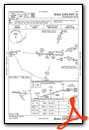
Instrument Approach Procedure (IAP) Charts

Nearby Airports with Instrument Procedures
| ID | Name | Heading / Distance | ||
|---|---|---|---|---|
 |
8V3 | Parkston Municipal Airport | 035° | 23.1 |
|
KONL | The O'Neill Municipal-John L Baker Field Airport | 205° | 39.7 |
|
6K3 | Creighton Municipal Airport | 152° | 39.9 |
|
KYKN | Chan Gurney Municipal Airport | 102° | 41.1 |
|
KMHE | Mitchell Municipal Airport | 014° | 44.1 |
|
8V2 | Stuart-Atkinson Municipal Airport | 227° | 44.5 |
|
9D1 | Gregory Municipal/Flynn Field Airport | 281° | 49.5 |
|
0B4 | Hartington Municipal/Bud Becker Field Airport | 120° | 53.7 |
|
4V9 | Antelope County Airport | 168° | 58.2 |
|
4X4 | Wessington Springs Airport | 350° | 60.7 |
|
9V9 | Chamberlain Municipal Airport | 313° | 61.5 |
|
KVMR | Harold Davidson Field Airport | 106° | 62.7 |
Airport Images
Do you have a recent image of this airport? Upload it here!


