Login
Register


7K5
Kenmare Municipal Airport
Official FAA Data Effective 2025-11-27 0901Z
Chart Supplement

VFR Chart of 7K5
Sectional Charts at SkyVector.com
IFR Chart of 7K5
Enroute Charts at SkyVector.com
Location Information for 7K5
Coordinates: N48°40.06' / W102°2.88'Located 01 miles SE of Kenmare, North Dakota on 158 acres of land. View all Airports in North Dakota.
Surveyed Elevation is 1962 feet MSL.
Operations Data
|
|
Airport Communications
| MINOT APPROACH: | 119.6 363.8 |
|---|---|
| MINOT DEPARTURE: | 119.6 363.8 |
| UNICOM: | 122.800 |
| CTAF: | 122.800 |
| AWOS-3 at 08D (26.1 SW): | 121.1 701-628-1737 |
| ATIS at MIB (31.3 SE): | 278.8 |
| ASOS at MIB (32.2 SE): |
- APCH/DEP SVC PRVDD BY MINNEAPOLIS ARTCC ON FREQS 127.6/279.6 ( MINOT RCAG) WHEN MINOT APCH CTL CLSD.
Nearby Navigation Aids
|
| ||||||||||||||||||||||||||||||


Runway 08/26
| Dimensions: | 3700 x 60 feet / 1128 x 18 meters | |
|---|---|---|
| Surface: | Asphalt in Good Condition | |
| Weight Limits: | S-12 | |
| Edge Lighting: | Medium Intensity | |
| Runway 08 | Runway 26 | |
| Coordinates: | N48°40.06' / W102°3.34' | N48°40.06' / W102°2.42' |
| Elevation: | 1962.0 | 1955.0 |
| Traffic Pattern: | Left | Left |
| Runway Heading: | 90° True | 270° True |
| Markings: | Non-Precision Instrument in fair condition. | Non-Precision Instrument in fair condition. |
| Glide Slope Indicator | P2L (3.00° Glide Path Angle) | P2L (3.00° Glide Path Angle) |
| REIL: | Yes | |
Services Available
| Fuel: | 100LL (blue) |
|---|---|
| Transient Storage: | Tiedowns |
| Airframe Repair: | NOT AVAILABLE |
| Engine Repair: | NOT AVAILABLE |
| Bottled Oxygen: | NONE |
| Bulk Oxygen: | NONE |
| Other Services: | CROP DUSTING SERVICES FOR AGRI SVC CALL (701) 848-6116. |
Ownership Information
| Ownership: | Publicly owned | |
|---|---|---|
| Owner: | KENMARE ARPT AUTH | |
| 320 N CENTRAL AVE | ||
| KENMARE, ND 58746 | ||
| 701-848-6160 | ||
| Manager: | DEREK PETERSON | |
| 310 6TH AVE NE | ||
| KENMARE, ND 58746 | ||
| 701-848-6160 | ||
Other Remarks
- CONFIRM WINTER CONDS & SNOW REMOVAL WITH AMGR 701-848-6160.
- WILDLIFE REFUGE LCTD 3500 FT W.
- WATERFOWL ON OR INVOF ARPT.
- FOR CD CTC MINNEAPOLIS ARTCC AT 651-463-5588.
- 0LL SELF SVC FUEL AVBL H24 VIA CREDIT CARD.
- ACTVT REIL RY 26; PAPI RY 08/26; MIRL RY 08/26 - CTAF. LGTS OPER FOR 1 HR AT SS.
Weather Minimums

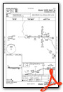
Instrument Approach Procedure (IAP) Charts
Nearby Airports with Instrument Procedures
| ID | Name | Heading / Distance | ||
|---|---|---|---|---|
 |
KHBC | Mohall Municipal Airport | 073° | 21.2 |
|
08D | Stanley Municipal Airport | 213° | 26.3 |
|
KMIB | Minot AFB Airport | 118° | 31.4 |
|
D60 | Tioga Municipal Airport | 243° | 38.0 |
|
KMOT | Minot International Airport | 128° | 39.4 |
|
05D | New Town Municipal Airport | 202° | 45.4 |
|
D50 | Crosby Municipal Airport | 287° | 52.0 |
|
D09 | Bottineau Municipal Airport | 080° | 65.5 |
|
D05 | Garrison Municipal Airport | 157° | 65.5 |
|
S25 | Watford City Municipal Airport | 222° | 71.3 |
|
KXWA | Williston Basin International Airport | 250° | 72.3 |
|
9Y1 | Dunn County Weydahl Field Airport | 201° | 82.0 |
Airport Images
Do you have a recent image of this airport? Upload it here!


