Login
Register


84D
Cheyenne Eagle Butte Airport
Official FAA Data Effective 2026-01-22 0901Z
Chart Supplement

VFR Chart of 84D
Sectional Charts at SkyVector.com
IFR Chart of 84D
Enroute Charts at SkyVector.com
Location Information for 84D
Coordinates: N44°59.06' / W101°15.06'Located 01 miles S of Eagle Butte, South Dakota on 142 acres of land. View all Airports in South Dakota.
Surveyed Elevation is 2448 feet MSL.
Operations Data
|
|
Airport Communications
| UNICOM: | 122.800 |
|---|---|
| CTAF: | 122.800 |
| ASOS at MBG (49.1 NE): | 121.425 605-206-3018 |
| AWOS-3P at 98D (51.7 E): | 120.0 |
| ASOS at PIR (54.8 SE): | 119.025 605-224-6087 |
- APCH/DEP SVC PRVDD BY MINNEAPOLIS ARTCC ON FREQS 135.25/256.7 (DUPREE RCAG).
Nearby Navigation Aids
|
| ||||||||||||||||||||||||||||||||||||


Runway 13/31
| Dimensions: | 4200 x 75 feet / 1280 x 23 meters | |
|---|---|---|
| Surface: | Asphalt in Excellent Condition | |
| Weight Limits: | S-12 | |
| Edge Lighting: | Medium Intensity | |
| Runway 13 | Runway 31 | |
| Coordinates: | N44°59.31' / W101°15.41' | N44°58.82' / W101°14.72' |
| Elevation: | 2432.2 | 2448.8 |
| Traffic Pattern: | Left | Left |
| Runway Heading: | 135° True | 315° True |
| Markings: | Non-Precision Instrument in good condition. | Non-Precision Instrument in good condition. |
| Glide Slope Indicator | P2L (3.00° Glide Path Angle) | P2L (3.00° Glide Path Angle) |
| Obstacles: | 7 ft Road 470 ft from runway | |
Services Available
| Fuel: | NONE |
|---|---|
| Transient Storage: | Hangars,Tiedowns |
| Airframe Repair: | NOT AVAILABLE |
| Engine Repair: | NOT AVAILABLE |
| Bottled Oxygen: | NOT AVAILABLE |
| Bulk Oxygen: | NOT AVAILABLE |
| Other Services: | AIR AMBULANCE SERVICES |
Ownership Information
| Ownership: | Publicly owned | |
|---|---|---|
| Owner: | CITY EAG BUTTE&CHEY RVR SIOUX TRIBE | |
| PO BOX 150 | ||
| EAGLE BUTTE, SD 57625 | ||
| 605-964-8783 | ||
| Manager: | JAMES TRAVERSIE | |
| PO BOX 150 | ||
| EAGLE BUTTE, SD 57636 | ||
| 605-964-8783 | ||
Other Remarks
- WILDLIFE ON & INVOF ARPT.
- FOR CD CTC MINNEAPOLIS ARTCC AT 651-463-5588.
- ACTVT PAPI RWY 13 & 31; MIRL RWY 13/31 - CTAF.
- AUTOMATED UNICOM.
Weather Minimums

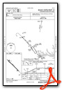
Instrument Approach Procedure (IAP) Charts
Nearby Airports with Instrument Procedures
| ID | Name | Heading / Distance | ||
|---|---|---|---|---|
 |
KMBG | Mobridge Municipal Airport | 046° | 49.2 |
|
98D | Onida Municipal Airport | 108° | 51.9 |
|
KPIR | Pierre Regional Airport | 130° | 54.9 |
|
0D8 | Gettysburg Municipal Airport | 089° | 55.3 |
|
KPHP | Philip Airport | 195° | 58.1 |
|
KLEM | Lemmon Municipal Airport | 327° | 66.7 |
|
9D0 | Highmore Municipal Airport | 108° | 81.4 |
|
7L2 | Linton Municipal Airport | 029° | 85.4 |
|
KHEI | Hettinger/Jb Lindquist Regional Airport | 316° | 85.7 |
|
KRCA | Ellsworth AFB Airport | 238° | 94.1 |
|
3P3 | Mott Municipal Airport | 331° | 94.1 |
|
KRAP | Rapid City Regional Airport | 234° | 95.9 |
Airport Images
Do you have a recent image of this airport? Upload it here!


