Login
Register


97M
Ekalaka Airport
Official FAA Data Effective 2026-01-22 0901Z
Chart Supplement

VFR Chart of 97M
Sectional Charts at SkyVector.com
IFR Chart of 97M
Enroute Charts at SkyVector.com
Location Information for 97M
Coordinates: N45°52.59' / W104°32.25'Located 02 miles SE of Ekalaka, Montana on 162 acres of land. View all Airports in Montana.
Surveyed Elevation is 3504 feet MSL.
Operations Data
|
|
Airport Communications
| CTAF: | 122.900 |
|---|---|
| ASOS at BHK (30.6 NE): | 135.475 406-778-3312 |
| AWOS-3PT at BWW (54.6 E): | 118.075 701-523-3412 |
| ASOS at MLS (65.1 NW): | 135.575 406-232-1465 |
- APCH/DEP SVC PRVDD BY SALT LAKE ARTCC (ZLC) ON FREQS 126.85/305.2 (MILES CITY RCAG).
Nearby Navigation Aids
|
| ||||||||||||||||||||||||||||||


Runway 13/31
| Dimensions: | 3798 x 75 feet / 1158 x 23 meters | |
|---|---|---|
| Surface: | Asphalt in Fair Condition | |
| Weight Limits: | S-12 | |
| Edge Lighting: | Medium Intensity | |
| Runway 13 | Runway 31 | |
| Coordinates: | N45°52.82' / W104°32.55' | N45°52.36' / W104°31.96' |
| Elevation: | 3473.5 | 3504.9 |
| Runway Heading: | 138° True | 318° True |
| Markings: | Basic in fair condition. | Basic in fair condition. |
| Glide Slope Indicator | P2L (3.00° Glide Path Angle) | P2L (3.00° Glide Path Angle) |
Services Available
| Fuel: | 100LL (blue) |
|---|---|
| Transient Storage: | Tiedowns |
| Airframe Repair: | NOT AVAILABLE |
| Engine Repair: | NOT AVAILABLE |
| Bottled Oxygen: | NOT AVAILABLE |
| Bulk Oxygen: | NOT AVAILABLE |
Ownership Information
| Ownership: | Publicly owned | |
|---|---|---|
| Owner: | COUNTY OF CARTER | |
| COUNTY COURT HOUSE PO BOX 315 | ||
| EKALAKA, MT 59324 | ||
| 406-775-8749 | ||
| Manager: | TROY FRUIT | |
| PO BOX 315 | ||
| EKALAKA, MT 59324 | ||
| 406-853-5377 | ||
Other Remarks
- FOR CD IF UNA TO CTC ON FSS FREQ, CTC SALT LAKE ARTCC AT 801-320-2568.
- 0LL SELF SVC CREDIT CARD 24/7
- DUSK-0000. MIRL RWY 13/31 & PAPI RWYS 13 & 31 PRESET MEDIUM INTST DUSK-0000; OTHER HRS ACTVT - CTAF.
Weather Minimums

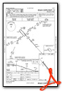
Instrument Approach Procedure (IAP) Charts

Nearby Airports with Instrument Procedures
| ID | Name | Heading / Distance | ||
|---|---|---|---|---|
 |
KBHK | Baker Municipal Airport | 022° | 30.5 |
|
KBWW | Bowman Regional Airport | 071° | 54.5 |
|
KMLS | Frank Wiley Field Airport | 300° | 65.3 |
|
20U | Beach Airport | 019° | 67.0 |
|
W43 | Hulett Municipal Airport | 181° | 72.8 |
|
KEFC | Belle Fourche Municipal Airport | 157° | 74.3 |
|
KGDV | Dawson Community Airport | 351° | 76.6 |
|
KHEI | Hettinger/Jb Lindquist Regional Airport | 083° | 79.2 |
|
KSPF | Black Hills-Clyde Ice Field Airport | 158° | 89.6 |
|
1S3 | Tillitt Field Airport | 285° | 90.3 |
|
KDIK | Dickinson/Theodore Roosevelt Regional Airport | 051° | 90.9 |
|
M46 | Colstrip Airport | 269° | 91.1 |
Airport Images
Do you have a recent image of this airport? Upload it here!


