Login
Register


ADC
Wadena Municipal Airport
Official FAA Data Effective 2026-01-22 0901Z
Chart Supplement

VFR Chart of KADC
Sectional Charts at SkyVector.com
IFR Chart of KADC
Enroute Charts at SkyVector.com
Location Information for KADC
Coordinates: N46°26.84' / W95°12.68'Located 03 miles W of Wadena, Minnesota. View all Airports in Minnesota.
Surveyed Elevation is 1368 feet MSL.
Operations Data
|
|
Airport Communications
| AWOS-3PT: | 118.875 Tel. 218-631-7774 |
|---|---|
| UNICOM: | 122.800 |
| CTAF: | 122.800 |
| AWOS-3 at SAZ (17.2 E): | 118.325 218-894-3666 |
| ASOS at PKD (27.8 N): | 119.25 218-732-0920 |
| ASOS at AXN (35.7 S): | 118.375 320-763-7174 |
- APCH/DEP SVC PRVDD BY MINNEAPOLIS ARTCC ON FREQS 126.1/269.2 (ALEXANDRIA RCAG).
Nearby Navigation Aids
|
| ||||||||||||||||||||||||||||||||||||||||||||||||||||||||||||


Runway 16/34
| Dimensions: | 4007 x 75 feet / 1221 x 23 meters | |
|---|---|---|
| Surface: | Asphalt in Good Condition | |
| Weight Limits: | S-27, D-42 | |
| Edge Lighting: | Medium Intensity | |
| Runway 16 | Runway 34 | |
| Coordinates: | N46°27.31' / W95°12.79' | N46°26.68' / W95°12.51' |
| Elevation: | 1367.9 | 1355.2 |
| Runway Heading: | 163° True | 343° True |
| Markings: | Non-Precision Instrument in good condition. | Non-Precision Instrument in good condition. |
| Glide Slope Indicator | P4L (3.00° Glide Path Angle) | P4L (3.00° Glide Path Angle) |
| REIL: | Yes | Yes |
Runway 03/21
| Dimensions: | 2100 x 75 feet / 640 x 23 meters | |
|---|---|---|
| Surface: | Turf in Fair Condition | |
| Runway 03 | Runway 21 | |
| Coordinates: | N46°26.40' / W95°12.87' | N46°26.69' / W95°12.60' |
| Elevation: | 1365.1 | 1356.2 |
| Runway Heading: | 33° True | 213° True |
Services Available
| Fuel: | 100LL (blue) |
|---|---|
| Transient Storage: | Hangars,Tiedowns |
| Airframe Repair: | NONE |
| Engine Repair: | NONE |
| Bottled Oxygen: | NOT AVAILABLE |
| Bulk Oxygen: | NOT AVAILABLE |
| Other Services: | PILOT INSTRUCTION,AIRCRAFT RENTAL |
Ownership Information
| Ownership: | Publicly owned | |
|---|---|---|
| Owner: | CITY OF WADENA | |
| 8 BRYANT AVE SE, PO BOX 30 | ||
| WADENA, MN 56482-0030 | ||
| 218-631-7707 | ||
| Manager: | KIM SCHROEDER | CITYADMIN@WADENA.ORG. |
| PO BOX 30 | ||
| WADENA, MN 56482-0030 | ||
| 218-631-7707 | ||
Other Remarks
- GCO AVBL ON FREQ 121.725 THRU MINNEAPOLIS ARTCC & FLT SVCS.
- FOR CD IF UNA VIA GCO CTC MINNEAPOLIS ARTCC AT 651-463-5588.
- 0LL FUEL AVBL H24 VIA CREDIT CARD.
- ACTVT OR INCR INTST REIL RWY 16 & 34; PAPI RWY 16 & 34; MIRL RWY 16/34 - CTAF. MIRL RWY 16/34 PRESET LOW INTST.
Weather Minimums


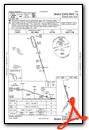
Instrument Approach Procedure (IAP) Charts

Nearby Airports with Instrument Procedures
| ID | Name | Heading / Distance | ||
|---|---|---|---|---|
 |
KSAZ | Staples Municipal Airport | 103° | 17.3 |
|
16D | Perham Municipal Airport | 301° | 19.1 |
|
KPKD | Park Rapids Municipal/Konshok Field Airport | 011° | 27.8 |
|
KDTL | Detroit Lakes/Wething Field Airport | 309° | 35.8 |
|
KAXN | Alexandria Regional/Chandler Field Airport | 192° | 35.7 |
|
14Y | Todd Field Airport | 156° | 35.9 |
|
KPWC | Pine River Regional Airport | 063° | 38.2 |
|
KFFM | Fergus Falls Regional Airport | 256° | 40.5 |
|
KRYM | Ray S Miller AAF Airport | 120° | 41.4 |
|
Y63 | Elbow Lake Municipal/Pride of The Prairie Airport | 229° | 42.5 |
|
KBRD | Brainerd Lakes Regional Airport | 092° | 44.8 |
|
D39 | Sauk Centre Municipal Airport | 165° | 46.0 |
Airport Images
Do you have a recent image of this airport? Upload it here!


