
Login
Register


AEG
Double Eagle II Airport
Official FAA Data Effective 2026-01-22 0901Z
Chart Supplement

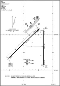
KAEG Airport Diagram
VFR Chart of KAEG
Sectional Charts at SkyVector.com
IFR Chart of KAEG
Enroute Charts at SkyVector.com
Location Information for KAEG
Coordinates: N35°8.69' / W106°47.71'Located 07 miles NW of Albuquerque, New Mexico on 4257 acres of land. View all Airports in New Mexico.
Surveyed Elevation is 5837 feet MSL.
Operations Data
|
|
Airport Communications
| ATIS: | 119.025 |
|---|---|
| AWOS-3PT: | Tel. 505-842-2009 |
| DOUBLE EAGLE II TOWER: | 120.15 |
| DOUBLE EAGLE II GROUND: | 121.625 |
| ALBUQUERQUE APPROACH: | 127.4 253.5 |
| ALBUQUERQUE DEPARTURE: | 127.4 253.5 |
| CLEARANCE DELIVERY: | 124.8 ;WHEN TWR CLSD |
| LAVAN STAR: | 123.9 354.1 |
| CURLY STAR: | 127.4 253.5 |
| CTAF: | 120.150 |
| MIERA STAR: | 123.9 354.1 |
| ASOS at ABQ (11.1 SE): | 505-373-2492 |
| D-ATIS at ABQ (11.2 SE): | 118.0 |
| AWOS-3PT at BRG (30.1 S): | 118.55 505-864-4375 |
Nearby Navigation Aids
|
| ||||||||||||||||||||||||||||||||||||||||||


Runway 04/22
| Dimensions: | 7398 x 100 feet / 2255 x 30 meters | |
|---|---|---|
| Surface: | Asphalt / Porous Friction Course in Good Condition | |
| Weight Limits: | 16 /F/C/X/T, S-30 | |
| Edge Lighting: | Medium Intensity | |
| Runway 04 | Runway 22 | |
| Coordinates: | N35°8.32' / W106°48.55' | N35°9.17' / W106°47.48' |
| Elevation: | 5837.4 | 5810.1 |
| Traffic Pattern: | Right | |
| Runway Heading: | 46° True | 226° True |
| Markings: | Precision Instrument in good condition. | Precision Instrument in good condition. |
| Glide Slope Indicator | P4L (3.00° Glide Path Angle) | |
| Approach Lights: | MALSR 1,400 Foot Medium-intensity Approach Lighting System with runway alignment indicator lights. | |
Runway 17/35
| Dimensions: | 5983 x 100 feet / 1824 x 30 meters | |
|---|---|---|
| Surface: | Asphalt in Excellent Condition | |
| Weight Limits: | 11 /F/D/X/T, S-30 | |
| Edge Lighting: | Medium Intensity | |
| Runway 17 | Runway 35 | |
| Coordinates: | N35°9.12' / W106°47.33' | N35°8.14' / W106°47.33' |
| Elevation: | 5805.9 | 5798.2 |
| Traffic Pattern: | Right | |
| Runway Heading: | 180° True | 360° True |
| Markings: | Non-Precision Instrument in good condition. | Non-Precision Instrument in good condition. |
| Glide Slope Indicator | P4L (3.00° Glide Path Angle) | |
| REIL: | Yes | Yes |
Services Available
| Fuel: | 100LL (blue), Jet A-1 |
|---|---|
| Transient Storage: | Hangars,Tiedowns CALL AHEAD FOR AVAILABILITY 505-352-0292. |
| Airframe Repair: | MAJOR |
| Engine Repair: | MAJOR |
| Bottled Oxygen: | HIGH |
| Bulk Oxygen: | HIGH |
| Other Services: | AIR AMBULANCE SERVICES,CHARTER SERVICE,PILOT INSTRUCTION,AIRCRAFT RENTAL |
Ownership Information
| Ownership: | Publicly owned | |
|---|---|---|
| Owner: | CITY OF ALBUQUERQUE | |
| PO BOX 9948 | ||
| ALBUQUERQUE, NM 87119 | ||
| (505) 244-7888 | ||
| Manager: | GAVINO GALLEGOS | |
| PO BOX 9948 | ||
| ALBUQUERQUE, NM 87119 | ||
| 505-259-8113 | ||
Other Remarks
- WILDLIFE ON AND INVOF ARPT.
- LIVE FIRE RANGE 1.6NM WEST OF THE APPROACH END OF RWY 04 AVOIDANCE ADVISED.
- 0LL 100LL AVBL 24 HRS SELF-SERVICE WITH MAJOR CREDIT CARD.
- $150 CALL-OUT FEE FOR JET A1.
- ACTVT MALSR RWY 22; REIL RWY 17 & 35; PAPI RWY 04 & 17; MIRL RWY 04/22 & 17/35 - CTAF.
Weather Minimums

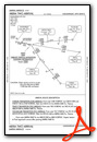
Standard Terminal Arrival (STAR) Charts
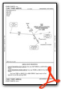

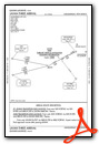
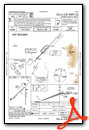
Instrument Approach Procedure (IAP) Charts
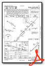
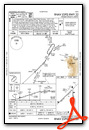
Nearby Airports with Instrument Procedures
| ID | Name | Heading / Distance | ||
|---|---|---|---|---|
 |
KABQ | Albuquerque International Sunport Airport | 124° | 11.2 |
|
KBRG | Belen Regional Airport | 183° | 30.0 |
|
0E0 | Moriarty Municipal Airport | 104° | 40.4 |
|
KSAF | Santa Fe Regional Airport | 050° | 44.7 |
|
KLAM | Los Alamos Airport | 030° | 51.0 |
|
KGNT | Grants-Milan Municipal Airport | 271° | 54.5 |
|
KONM | Socorro Municipal Airport | 184° | 67.4 |
|
KLVS | Las Vegas Municipal Airport | 068° | 86.6 |
|
KSKX | Taos Regional Airport | 034° | 95.5 |
|
KGUP | Gallup Municipal Airport | 283° | 100.3 |
|
KAXX | Angel Fire Airport | 043° | 106.1 |
|
KRQE | Window Rock Airport | 285° | 115.5 |
Airport Images
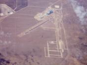
By: Dave



Comments
Shout out for Bode Aero
Bode Aviation helped me out of a jam when my alternator went out on my way into Double Eagle. They replaced the alternator and fixed another potentially dangerous problem (leaking throttle body). We rented a car, which they had on hand, to continue our trip to Las Vegas. Stuart Miles, chief mechanic, was great - communicated the whole time and even shot me a video of the leaking fuel valve. If you have to break, this was a good place to do it.
The airport itself is a good location to stay out of the ABQ Class C, and there are still plenty of hotels within 15 minutes.