Login
Register


C75
Marshall County Airport
Official FAA Data Effective 2026-02-19 0901Z
Chart Supplement

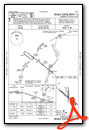
VFR Chart of C75
Sectional Charts at SkyVector.com
IFR Chart of C75
Enroute Charts at SkyVector.com
Location Information for C75
Coordinates: N41°1.13' / W89°23.15'Located 01 miles E of Lacon, Illinois on 247 acres of land. View all Airports in Illinois.
Surveyed Elevation is 584 feet MSL.
Operations Data
|
|
Airport Communications
| AWOS-3: | 119.425 Tel. 309-246-3089 |
|---|---|
| CTAF: | 122.800 |
| UNICOM: | 122.800 |
| AWOS-3 at VYS (22.6 NE): | 120.025 815-223-8442 |
| ASOS at PIA (25.5 SW): | 309-322-3740 |
| ATIS at PIA (25.5 SW): | 126.1 |
- APCH/DEP SVC PRVDD BY CHICAGO ARTCC (ZAU) ON FREQS 124.55/307.125 (BRADFORD RCAG).
Nearby Navigation Aids
|
| ||||||||||||||||||||||||||||||||||||||||||||||||||||||||||||


Runway 13/31
| Dimensions: | 4003 x 75 feet / 1220 x 23 meters | |
|---|---|---|
| Surface: | Asphalt in Good Condition | |
| Edge Lighting: | Medium Intensity | |
| Runway 13 | Runway 31 | |
| Coordinates: | N41°1.31' / W89°23.49' | N41°0.90' / W89°22.81' |
| Elevation: | 538.5 | 584.5 |
| Traffic Pattern: | Right | |
| Runway Heading: | 128° True | 308° True |
| Markings: | Non-Precision Instrument in fair condition. | Non-Precision Instrument in fair condition. |
| Glide Slope Indicator | P4L (4.00° Glide Path Angle) | |
| REIL: | Yes | |
| Obstacles: | 56 ft Ground 1336 ft from runway | |
Runway 18/36
| Dimensions: | 2199 x 50 feet / 670 x 15 meters | |
|---|---|---|
| Surface: | Asphalt in Good Condition | |
| Weight Limits: | S-4 | |
| Edge Lighting: | Low Intensity | |
| Runway 18 | Runway 36 | |
| Coordinates: | N41°1.36' / W89°23.13' | N41°0.99' / W89°23.14' |
| Elevation: | 554.2 | 547.7 |
| Traffic Pattern: | Left | Left |
| Runway Heading: | 181° True | 1° True |
| Markings: | Basic in good condition. | Basic in good condition. |
| Obstacles: | 9 ft Road 334 ft from runway | |
Services Available
| Fuel: | 100LL (blue), UL94 |
|---|---|
| Transient Storage: | Hangars,Tiedowns |
| Airframe Repair: | MAJOR |
| Engine Repair: | MAJOR |
| Bottled Oxygen: | NONE |
| Bulk Oxygen: | NONE |
| Other Services: | AVIONICS |
Ownership Information
| Ownership: | Publicly owned | |
|---|---|---|
| Owner: | MARSHALL COUNTY | |
| 122 N PRAIRIE ST | ||
| LACON, IL 61540 | ||
| 309-246-3667 | ||
| Manager: | JOE TROGLIO | |
| 1315 IL-17, PO BOX 38 | ||
| LACON, IL 61540 | ||
| 309-246-2870 | CELL PHONE: 309-863-5216 | |
Other Remarks
- RY 31 DEPARTURES ENCOURAGED TO BEGIN RIGHT TURN AS SOON AS PRACTICAL FOR NOISE ABATEMENT
- FOR CD CTC CHICAGO ARTCC AT 630-906-8921.
- BIRDS AND ANIMALS ON AND INVOF ARPT.
- RWY 31 R TFC & RWY 13 L TFC DUE TO NOISE ABATEMENT.
- 0LL 100LL & UL94 AVBL 24HR SELF SVC VIA CREDIT CARD.
- ACTVT MIRL RY 13/31; REIL RY 13 & PAPI RY 31 - CTAF.
Weather Minimums


Instrument Approach Procedure (IAP) Charts
Nearby Airports with Instrument Procedures
| ID | Name | Heading / Distance | ||
|---|---|---|---|---|
 |
3MY | Mount Hawley Auxiliary Airport | 217° | 16.9 |
|
KVYS | Illinois Valley Regional-Walter A Duncan Field Airport | 027° | 22.5 |
|
KPIA | General Downing - Peoria International Airport | 213° | 25.5 |
|
KEZI | Kewanee Municipal Airport | 293° | 28.5 |
|
C15 | Pekin Municipal Airport | 202° | 34.5 |
|
KPNT | Pontiac Municipal Airport | 099° | 35.1 |
|
KBMI | Central Il Regional/Bloomington-Normal Airport | 146° | 38.9 |
|
KCTK | Ingersoll Airport | 229° | 41.4 |
|
KSQI | Whiteside County/Jos H Bittorf Field Airport | 343° | 45.4 |
|
KGBG | Harrel W Timmons Galesburg Regional Airport | 264° | 47.8 |
|
C73 | Dixon Municipal-Charles R Walgreen Field Airport | 356° | 48.9 |
|
C09 | Morris Municipal/James R Washburn Field Airport | 060° | 50.1 |
Airport Images

By: spidey9691


