Login
Register
C09
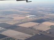
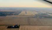
Morris Municipal/James R Washburn Field Airport
Official FAA Data Effective 2026-01-22 0901Z
VFR Chart of C09
Sectional Charts at SkyVector.com
IFR Chart of C09
Enroute Charts at SkyVector.com
Location Information for C09
Coordinates: N41°25.49' / W88°25.12'Located 04 miles N of Morris, Illinois on 240 acres of land. View all Airports in Illinois.
Surveyed Elevation is 584 feet MSL.
Operations Data
|
|
Airport Communications
| AWOS-3: | 118.175 Tel. 815-941-1815 |
|---|---|
| CHICAGO APPROACH: | 119.35 354.075 |
| CHICAGO DEPARTURE: | 119.35 354.075 |
| IC: | 119.35 |
| UNICOM: | 122.800 |
| CTAF: | 122.800 |
| AWOS-3 at JOT (12.3 NE): | 119.975 815-730-9560 |
| AWOS-3PT at LOT (17.8 NE): | 126.675 815-588-4802 |
| D-ATIS at LOT (18.2 NE): | 126.675 |
Nearby Navigation Aids
|
| ||||||||||||||||||||||||||||||||||||||||||||||||||||||||||||
Runway 18/36
| Dimensions: | 5501 x 75 feet / 1677 x 23 meters | |
|---|---|---|
| Surface: | Asphalt in Good Condition | |
| Weight Limits: | S-4, D-125 | |
| Edge Lighting: | Medium Intensity | |
| Runway 18 | Runway 36 | |
| Coordinates: | N41°25.94' / W88°25.13' | N41°25.03' / W88°25.11' |
| Elevation: | 584.1 | 564.6 |
| Traffic Pattern: | Left | Left |
| Runway Heading: | 179° True | 359° True |
| Markings: | Non-Precision Instrument in good condition. | Non-Precision Instrument in good condition. |
| Glide Slope Indicator | P4L (3.00° Glide Path Angle) | P4R (3.00° Glide Path Angle) |
| REIL: | Yes | Yes |
Services Available
| Fuel: | 100LL (blue), Jet-A, Jet A+ |
|---|---|
| Transient Storage: | Hangars,Tiedowns |
| Airframe Repair: | MAJOR |
| Engine Repair: | MAJOR |
| Bottled Oxygen: | NOT AVAILABLE |
| Bulk Oxygen: | NOT AVAILABLE |
| Other Services: | PILOT INSTRUCTION |
Ownership Information
| Ownership: | Publicly owned | |
|---|---|---|
| Owner: | CITY OF MORRIS | |
| 700 N. DIVISION ST | ||
| MORRIS, IL 60450 | ||
| 815-942-5438 | ||
| Manager: | JEFF VOGEN | |
| 9980 NO. HIGHWAY 47 | ||
| MORRIS, IL 60450 | ||
| 815-942-1600 | ||
Other Remarks
- FOR CD CTC CHICAGO APCH AT 847-289-0926.
- RWY 18/36 MIRL AND RWY 18 & 36 REIL ON PHOTO CELL. MIRL RWY 18/36 PRESET ON LOW INTST; TO INCR INTST & ACTVT REIL RWY 18 & 36 - CTAF.
Weather Minimums
Instrument Approach Procedure (IAP) Charts
Nearby Airports with Instrument Procedures
| ID | Name | Heading / Distance | ||
|---|---|---|---|---|
 |
KLOT | Lewis University Airport | 052° | 18.2 |
 |
1C5 | Bolingbrook's Clow International Airport | 038° | 20.8 |
 |
KARR | Aurora Municipal Airport | 352° | 21.0 |
 |
KDPA | Dupage Airport | 014° | 29.9 |
 |
KPNT | Pontiac Municipal Airport | 197° | 31.4 |
 |
KDKB | De Kalb Taylor Municipal Airport | 337° | 33.1 |
 |
KVYS | Illinois Valley Regional-Walter A Duncan Field Airport | 262° | 33.5 |
 |
C56 | Bult Field Airport | 094° | 33.5 |
 |
KIKK | Greater Kankakee Airport | 129° | 33.5 |
 |
KMDW | Chicago Midway International Airport | 053° | 37.0 |
 |
KORD | Chicago O'Hare International Airport | 034° | 40.3 |
 |
KIGQ | Lansing Municipal Airport | 080° | 40.6 |


Comments
C09
No longer parachute activity at Morris. Also curent 100LL is $5.50