Login
Register
CHT
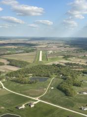
Chillicothe Municipal Airport
Official FAA Data Effective 2026-02-19 0901Z
VFR Chart of KCHT
Sectional Charts at SkyVector.com
IFR Chart of KCHT
Enroute Charts at SkyVector.com
Location Information for KCHT
Coordinates: N39°46.92' / W93°29.77'Located 03 miles E of Chillicothe, Missouri on 272 acres of land. View all Airports in Missouri.
Surveyed Elevation is 783 feet MSL.
Operations Data
|
|
Airport Communications
| AWOS-3: | 118.175 Tel. 660-646-0713 |
|---|---|
| UNICOM: | 122.800 |
| CTAF: | 122.800 |
| AWOS-2 at MO8 (22.3 E): | 118.425 660-258-2151 |
| AWOS-3PT at EZZ (36.2 W): | 121.05 816-933-2124 |
| AWOS-3PT at MHL (43.6 S): | 118.675 660-886-9130 |
- APCH/DEP SVC PRVDD BY KANSAS CITY ARTCC ON FREQS 125.25/235.975 (CHILLICOTHE RCAG).
Nearby Navigation Aids
|
| ||||||||||||||||||||||||||||||||||||||||||||||||
Runway 14/32
| Dimensions: | 3899 x 75 feet / 1188 x 23 meters | |
|---|---|---|
| Surface: | Concrete in Excellent Condition | |
| Weight Limits: | 11 /R/C/W/T, S-33, D-44 | |
| Edge Lighting: | Medium Intensity | |
| Runway 14 | Runway 32 | |
| Coordinates: | N39°47.19' / W93°29.99' | N39°46.67' / W93°29.49' |
| Elevation: | 782.9 | 763.5 |
| Traffic Pattern: | Left | Left |
| Runway Heading: | 143° True | 323° True |
| Markings: | Non-Precision Instrument in good condition. | Non-Precision Instrument in good condition. |
| Glide Slope Indicator | P4L (3.00° Glide Path Angle) | P4R (3.50° Glide Path Angle) |
| REIL: | Yes | Yes |
Runway 02/20
| Dimensions: | 3503 x 110 feet / 1068 x 34 meters | |
|---|---|---|
| Surface: | Turf in Good Condition | |
| Runway 02 | Runway 20 | |
| Coordinates: | N39°46.65' / W93°29.97' | N39°47.17' / W93°29.65' |
| Elevation: | 756.9 | 772.4 |
| Traffic Pattern: | Left | Left |
| Runway Heading: | 26° True | 206° True |
| Displaced Threshold: | 206 Feet | 389 Feet |
| Markings: | in good condition. | |
| Obstacles: | RWY 20 - 23:1 BASED ON DSPLCD THR |
39 ft Tree 544 ft from runway, 130 ft left of center |
Services Available
| Fuel: | 100LL (blue) |
|---|---|
| Transient Storage: | Hangars,Tiedowns |
| Airframe Repair: | NOT AVAILABLE |
| Engine Repair: | NOT AVAILABLE |
| Bottled Oxygen: | NONE |
| Bulk Oxygen: | NONE |
| Other Services: | PILOT INSTRUCTION |
Ownership Information
| Ownership: | Publicly owned | |
|---|---|---|
| Owner: | CITY OF CHILLICOTHE | |
| 715 WASHINGTON | ||
| CHILLICOTHE, MO 64601 | ||
| 660-646-1877 | ||
| Manager: | TOBY CALIVERE | |
| 13844 LIV 253 | ||
| CHILLICOTHE, MO 64601 | ||
| 660-646-5270 | ||
Other Remarks
- WILDLIFE, MIGRATORY BIRDS & GEESE ON & INVOF ARPT.
- NTSD RWY SAFETY AREA BYND BOTH ENDS OF RWY 02/20; INCORRECT TERRAIN GRADES AND CROPS.
- PAEW INVOF ARPT.
- FOR CD IF UNA TO CTC ON FSS FREQ, CTC KANSAS CITY ARTCC AT 913-254-8508.
- RWY 02/20 MARKED WITH LARGE YELLOW CONES. DSPLCD THRS MARKED WITH 3 LARGE YELLOW CONES ON EACH SIDE OF RWY.
- ACTVT REIL RWYS 14 & 32; PAPI RWYS 14 & 32; MIRL RWY 14 & 32 - CTAF.
Weather Minimums
Instrument Approach Procedure (IAP) Charts
Nearby Airports with Instrument Procedures
| ID | Name | Heading / Distance | ||
|---|---|---|---|---|
 |
KTRX | Trenton Municipal Airport | 346° | 18.6 |
 |
MO8 | North Central Missouri Regional Airport | 091° | 22.4 |
 |
KEZZ | Cameron Memorial Airport | 265° | 36.2 |
 |
3EX | Excelsior Springs Memorial Airport | 230° | 42.1 |
 |
KMHL | Marshall Memorial Municipal Airport | 161° | 43.4 |
 |
KHIG | Higginsville Industrial Municipal Airport | 191° | 43.4 |
 |
KGPH | Midwest Ntl Air Center Airport | 234° | 46.4 |
 |
KIRK | Kirksville Regional Airport | 066° | 47.7 |
 |
K89 | Macon-Fower Memorial Airport | 093° | 48.2 |
 |
KMBY | Omar N Bradley Airport | 110° | 53.2 |
 |
KLWD | Lamoni Municipal Airport | 340° | 54.3 |
 |
3GV | East Kansas City Airport | 216° | 56.9 |


