Login
Register
CPL3
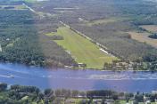
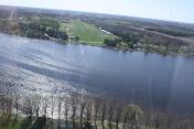
Kars/Rideau Valley Air Park Airport
VFR Chart of CPL3
Sectional Charts at SkyVector.com
IFR Chart of CPL3
Enroute Charts at SkyVector.com
Location Information for CPL3
Coordinates: N45°6.00' / W75°38.00'View all Airports in Ontario, Canada.
Elevation is 286 feet MSL.
Magnetic Variation is 14° West
Time Zone is UTC-5(4).
Operations Data
|
|
Airport Communications
| Aerodrome Traffic Frequency (ATF) | traffic 123.4 5NM 3300 ASL excluding the airspace that lies within Ottawa TCA class C airspace |
|---|
Nearby Navigation Aids
|
| ||||||||||||||||||||||||||||||||||||||||||||||||||||||||||||
Runway 08/26
| Dimensions: | 1800 x 100 feet. | |
|---|---|---|
| Surface: | ||
| Remarks | GRASS | |
| Runway 08 | Runway 26 | |
| Runway Heading: | ||
Runway Conditions Reporting Source
Operator No win maint. May be soft in
spring.
Public Facilities
| Location | Facilities | Remarks |
|---|---|---|
| Within 5 NM | Telephone, Food, Medical Aid, Accomodations | |
| Within 30 NM | Taxi, Car Rental |
Flight Planning
| Instructions | (bil) |
|---|---|
| Flight Information Centre (FIC) | Québec 866-GOMÉTÉO or 866-WXBRIEF (Toll free within Canada) or 866-541-4105 (Toll free within Canada & USA) |
Aerodrome Operator
Chris Williams 613-296-3391 Reg
PPR
Nearby Airports with Instrument Procedures
| ID | Name | Heading / Distance | ||
|---|---|---|---|---|
 |
CYOW | Ottawa/Macdonald-Cartier International Airport | 007° | 13.4 |
 |
CYSH | Smiths Falls-Montague (Russ Beach) Airport | 248° | 16.0 |
 |
CYND | Ottawa/Gatineau Airport | 020° | 25.5 |
 |
KOGS | Ogdensburg International Airport | 177° | 26.1 |
 |
KMSS | Massena International-Richards Field Airport | 120° | 35.0 |
 |
CMB7 | Maxville (Bourdon Farm) Airport | 089° | 36.3 |
 |
KPTD | Potsdam Municipal/Damon Field Airport | 144° | 38.7 |
 |
KMAL | Malone-Dufort Airport | 118° | 57.5 |
 |
KGTB | Wheeler-Sack AAF Airport | 197° | 62.8 |
 |
CYGK | Kingston Airport | 232° | 66.7 |
 |
KART | Watertown International Airport | 208° | 68.5 |
 |
KSLK | Adirondack Regional Airport | 138° | 74.6 |


