Login
Register


DUH
Toledo Suburban Airport
Official FAA Data Effective 2026-02-19 0901Z
Chart Supplement

VFR Chart of KDUH
Sectional Charts at SkyVector.com
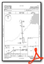
IFR Chart of KDUH
Enroute Charts at SkyVector.com
Location Information for KDUH
Coordinates: N41°44.15' / W83°39.35'Located 02 miles SW of Lambertville, Michigan on 90 acres of land. View all Airports in Michigan.
Surveyed Elevation is 671 feet MSL.
Operations Data
|
|
Airport Communications
| AWOS-3P: | 119.175 Tel. 734-856-1563 |
|---|---|
| TOLEDO APPROACH: | 126.1 317.55 |
| TOLEDO DEPARTURE: | 126.1 317.55 |
| UNICOM: | 122.700 |
| CTAF: | 122.700 |
| ASOS at TOL (11.2 SW): | 419-210-1094 |
| ATIS at TOL (11.3 SW): | 118.75 |
| ASOS at TDZ (12.9 SE): | 121.575 419-838-5034 |
Nearby Navigation Aids
|
| ||||||||||||||||||||||||||||||||||||||||||||||||||||||||||||


Runway 09/27
| Dimensions: | 4807 x 50 feet / 1465 x 15 meters | |
|---|---|---|
| Surface: | Asphalt in Good Condition | |
| Edge Lighting: | Non-Standard NSTD MIRL DUE TO LCTN 15 FT FM RWY EDGE. | |
| Runway 09 | Runway 27 | |
| Coordinates: | N41°44.13' / W83°39.87' | N41°44.17' / W83°38.82' |
| Elevation: | 665.3 | 667.1 |
| Traffic Pattern: | Left | Left |
| Runway Heading: | 87° True | 267° True |
| Displaced Threshold: | 1274 Feet | 992 Feet |
| Markings: | Basic in poor condition. | Basic in poor condition. |
| Obstacles: | 14 ft Tree 200 ft from runway, 98 ft left of center CTLG OBSTN EXCEEDS A 45 DEG SLP. APCH RATIO 20:1 TO DTHR. |
84 ft Tree 536 ft from runway, 157 ft right of center APCH RATIO 18:1 TO DTHR OVR +79 FT TREE, 1407 FT DIST, 40 FT L. |
Services Available
| Fuel: | 100LL (blue) |
|---|---|
| Transient Storage: | Hangars,Tiedowns FOR TSNT HNGR STORAGE CTC AMGR. |
| Airframe Repair: | MAJOR |
| Engine Repair: | MAJOR |
| Bottled Oxygen: | NONE |
| Bulk Oxygen: | NONE |
| Other Services: | PILOT INSTRUCTION,AIRCRAFT RENTAL |
Ownership Information
| Ownership: | Privately Owned | |
|---|---|---|
| Owner: | SUBURBAN HOLDINGS INC | |
| 4383 SECTION RD | ||
| OTTAWA LAKE, MI 49267-9620 | ||
| 734-856-6103 | ||
| Manager: | LUKAS RODRIGUEZ | |
| 4383 SECTION RD | ||
| OTTAWA LAKE, MI 49267-9620 | ||
| 734-856-6103 | ||
Other Remarks
- 4 FT FENCE, 110 FT NORTH OF RWY; +8 FT SEASONAL CROPS, 50 FT SOUTH OF RWY IN PRI SFC.
- DEER & LRG BIRDS ON & INVOF ARPT.
- FOR CD CTC TOLEDO APCH AT 419-865-1495.
- FADED.
- FADED.
- ACTVT NSTD MIRL RWY 09/27 - CTAF.
Weather Minimums

Instrument Approach Procedure (IAP) Charts
Nearby Airports with Instrument Procedures
| ID | Name | Heading / Distance | ||
|---|---|---|---|---|
 |
KTOL | Eugene F Kranz Toledo Express Airport | 217° | 11.3 |
|
KTDZ | Toledo Exec Airport | 142° | 12.9 |
|
KTTF | Custer Airport | 038° | 15.7 |
|
KADG | Lenawee County Airport | 292° | 20.5 |
|
1G0 | Wood County Airport | 176° | 20.7 |
|
KUSE | Fulton County Airport | 250° | 22.5 |
|
7W5 | Henry County Airport | 220° | 28.5 |
|
KARB | Ann Arbor Municipal Airport | 352° | 29.5 |
|
KYIP | Willow Run Airport | 010° | 30.8 |
|
KONZ | Grosse Ile Municipal Airport | 045° | 31.1 |
|
KDTW | Detroit Metro Wayne County Airport | 025° | 31.6 |
|
14G | Fremont Airport | 137° | 32.9 |
Airport Images
Do you have a recent image of this airport? Upload it here!


