Login
Register


DUX
Moore County Airport
Official FAA Data Effective 2025-12-25 0901Z
Chart Supplement

VFR Chart of KDUX
Sectional Charts at SkyVector.com
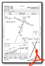
IFR Chart of KDUX
Enroute Charts at SkyVector.com
Location Information for KDUX
Coordinates: N35°51.45' / W102°0.80'Located 02 miles W of Dumas, Texas on 326 acres of land. View all Airports in Texas.
Surveyed Elevation is 3706 feet MSL.
Operations Data
|
|
Airport Communications
| AWOS-3: | 118.075 Tel. 806-934-3390 |
|---|---|
| CTAF: | 122.800 |
| UNICOM: | 122.800 |
| ASOS at DHT (27.8 W): | 134.075 806-249-5671 |
| ASOS at BGD (31.6 E): | 118.325 806-274-7318 |
| ASOS at AMA (41.1 S): | 118.85 806-223-2973 |
- APCH/DEP SVC PRVDD BY ALBUQUERQUE ARTCC (ZAB) ON FREQS 127.85/285.475 (AMARILLO RCAG).
Nearby Navigation Aids
|
| ||||||||||||||||||||||||||||||||||||||||||||||||||||||


Runway 01/19
| Dimensions: | 6001 x 100 feet / 1829 x 30 meters | |
|---|---|---|
| Surface: | Asphalt in Good Condition | |
| Weight Limits: | S-30, D-45 | |
| Edge Lighting: | Medium Intensity | |
| Runway 01 | Runway 19 | |
| Coordinates: | N35°50.93' / W102°1.06' | N35°51.84' / W102°0.58' |
| Elevation: | 3706.4 | 3698.1 |
| Traffic Pattern: | Left | Left |
| Runway Heading: | 23° True | 203° True |
| Markings: | Non-Precision Instrument in good condition. | Non-Precision Instrument in good condition. |
| Glide Slope Indicator | P4L (3.00° Glide Path Angle) | P4L (3.00° Glide Path Angle) |
| Obstacles: | 15 ft Road 500 ft from runway, 295 ft right of center | |
Runway 14/32
| Dimensions: | 3100 x 60 feet / 945 x 18 meters | |
|---|---|---|
| Surface: | Asphalt in Fair Condition | |
| Weight Limits: | S-21, D-32 | |
| Edge Lighting: | Medium Intensity | |
| Runway 14 | Runway 32 | |
| Coordinates: | N35°51.79' / W102°0.91' | N35°51.34' / W102°0.61' |
| Elevation: | 3698.5 | 3700.1 |
| Traffic Pattern: | Left | Left |
| Runway Heading: | 152° True | 332° True |
| Markings: | Basic in fair condition. | Basic in fair condition. |
| Obstacles: | 29 ft Power Line 790 ft from runway, 190 ft left of center | |
Services Available
| Fuel: | 100LL (blue), Jet-A |
|---|---|
| Transient Storage: | Hangars,Tiedowns |
| Airframe Repair: | MAJOR |
| Engine Repair: | MAJOR |
| Bottled Oxygen: | NONE |
| Bulk Oxygen: | NONE |
| Other Services: | CROP DUSTING SERVICES |
Ownership Information
| Ownership: | Publicly owned | |
|---|---|---|
| Owner: | MOORE COUNTY | |
| 715 DUMAS AVE. RM 202 | ||
| DUMAS, TX 79029 | ||
| 806-935-5588 | ||
| Manager: | DON WILLINGHAM | |
| 5932 US 87 | ||
| DUMAS, TX 79029 | ||
| 806-935-6995 | ||
Other Remarks
- EXTSV CROP DUSTING MAR-SEP.
- FOR CD CTC ALBUQUERQUE ARTCC AT 505-856-4861.
- 0LL 100 LL SELF-SERVE FUEL AVBL 24 HRS.
- MIRL RWY 01/19 PRESET LOW INTST; TO INCR INTST ACTVT - CTAF. PAPI RWY 01 & 19 OPR CONSLY.
Weather Minimums
Instrument Approach Procedure (IAP) Charts

Nearby Airports with Instrument Procedures
| ID | Name | Heading / Distance | ||
|---|---|---|---|---|
 |
KDHT | Dalhart Municipal Airport | 290° | 27.8 |
|
KBGD | Hutchinson County Airport | 107° | 31.7 |
|
E19 | Gruver Municipal Airport | 051° | 36.2 |
|
KAMA | Rick Husband Amarillo International Airport | 158° | 41.1 |
|
KTDW | Tradewind Airport | 167° | 42.2 |
|
T45 | Panhandle-Carson County Airport | 132° | 43.4 |
|
E42 | Major Samuel B Cornelius Field Airport | 061° | 45.4 |
|
KPPA | Perry Lefors Field Airport | 106° | 51.8 |
|
KGUY | Guymon Municipal Airport | 026° | 55.3 |
|
17K | Boise City Airport | 336° | 60.0 |
|
KHRX | Hereford Municipal Airport | 194° | 61.6 |
|
KCAO | Clayton Municipal Airpark Airport | 302° | 65.5 |
Airport Images
Do you have a recent image of this airport? Upload it here!


Comments
Moore County in Dumas, TX is my favorite airport
Moore County airport is a great place to stop for fuel or stayover. They have courtesy cars so you can go into town and Hoggs Restaurant is on the airport near the Pilot lounge and has great TX BBQ. The staff is super friendly and helpful. Their fuel price is always competitive and often is the lowest in the area. I highly recommend Moore County airport... it's my favorite stopping point!
Jim Hefner