Login
Register


FLD
Fond Du Lac County Airport
Official FAA Data Effective 2025-12-25 0901Z
Chart Supplement

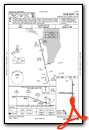
VFR Chart of KFLD
Sectional Charts at SkyVector.com
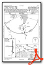
IFR Chart of KFLD
Enroute Charts at SkyVector.com
Location Information for KFLD
Coordinates: N43°46.27' / W88°29.31'Located 01 miles W of Fond Du Lac, Wisconsin on 586 acres of land. View all Airports in Wisconsin.
Surveyed Elevation is 808 feet MSL.
Operations Data
|
|
Airport Communications
| ASOS: | 134.0 Tel. 920-922-4444 |
|---|---|
| MILWAUKEE APPROACH: | 127.0 263.075 |
| MILWAUKEE DEPARTURE: | 127.0 263.075 |
| CTAF: | 123.050 |
| UNICOM: | 123.050 |
| ASOS at OSH (12.1 N): | 920-426-1644 |
| ATIS at OSH (13.1 N): | 125.9 |
| AWOS-3 at UNU (22.7 SW): | 120.825 920-386-5682 |
Nearby Navigation Aids
|
| ||||||||||||||||||||||||||||||||||||||||||||||||||||||||||||


Runway 18/36
| Dimensions: | 5941 x 100 feet / 1811 x 30 meters | |
|---|---|---|
| Surface: | Asphalt in Fair Condition | |
| Weight Limits: | D-60 | |
| Edge Lighting: | High Intensity | |
| Runway 18 | Runway 36 | |
| Coordinates: | N43°46.75' / W88°29.17' | N43°45.77' / W88°29.17' |
| Elevation: | 782.5 | 794.2 |
| Traffic Pattern: | Right | Left |
| Runway Heading: | 180° True | 0 |
| Markings: | Non-Precision Instrument in fair condition. | Non-Precision Instrument in fair condition. |
| Glide Slope Indicator | P4L (3.00° Glide Path Angle) | P4L (3.00° Glide Path Angle) |
| Approach Lights: | MALSR 1,400 Foot Medium-intensity Approach Lighting System with runway alignment indicator lights. | |
| REIL: | Yes | |
| Obstacles: | 7 ft Building 200 ft from runway, 440 ft left of center CTLNG OBSTN EXCEEDS A 45 DEG SLP. 7 FT BLDG 180 FT FM RWY END, 440 L. |
17 ft Tree 425 ft from runway, 480 ft left of center |
Runway 09/27
| Dimensions: | 3604 x 75 feet / 1098 x 23 meters | |
|---|---|---|
| Surface: | Asphalt in Fair Condition | |
| Weight Limits: | S-22 | |
| Edge Lighting: | Medium Intensity | |
| Runway 09 | Runway 27 | |
| Coordinates: | N43°46.30' / W88°29.94' | N43°46.28' / W88°29.12' |
| Elevation: | 808.6 | 788.1 |
| Traffic Pattern: | Right | Left |
| Runway Heading: | 92° True | 272° True |
| Markings: | Non-Precision Instrument in fair condition. | Non-Precision Instrument in fair condition. |
Services Available
| Fuel: | 100LL (blue), Jet-A |
|---|---|
| Transient Storage: | Hangars,Tiedowns |
| Airframe Repair: | MAJOR |
| Engine Repair: | MAJOR |
| Bottled Oxygen: | NONE |
| Bulk Oxygen: | NONE |
| Other Services: | CHARTER SERVICE,PILOT INSTRUCTION,AIRCRAFT RENTAL,AIRCRAFT SALES |
Ownership Information
| Ownership: | Publicly owned | |
|---|---|---|
| Owner: | FOND DU LAC COUNTY | |
| 160 S MACY | ||
| FOND DU LAC, WI 54935 | ||
| 920-922-4162 | ||
| Manager: | BRYAN LINGER | |
| 260 S. ROLLING MEADOWS DRIVE | ||
| FOND DU LAC, WI 54937 | ||
| 920-926-0653 | ||
Other Remarks
- FOR CD IF UNA TO CTC ON FSS FREQ, CTC CHICAGO ARTCC AT 630-906-8921.
- HIRL RWY 18/36 PRESET TO LOW SS-SR; TO INCR INTST AND ACTVT MALSR RWY 36; REIL RWY 18; PAPI RWY 18 & 36; MIRL RWY 09/27 - CTAF.
Weather Minimums
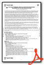
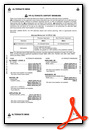
Instrument Approach Procedure (IAP) Charts


Nearby Airports with Instrument Procedures
| ID | Name | Heading / Distance | ||
|---|---|---|---|---|
 |
KOSH | Wittman Regional Airport | 346° | 13.1 |
|
8D1 | New Holstein Municipal Airport | 057° | 19.3 |
|
KUNU | Dodge County Airport | 204° | 22.7 |
|
KHXF | Hartford Municipal Airport | 170° | 25.6 |
|
KETB | West Bend Municipal Airport | 142° | 26.2 |
|
KSBM | Sheboygan County Memorial International Airport | 089° | 27.7 |
|
KATW | Appleton International Airport | 357° | 29.2 |
|
KRYV | Watertown Municipal Airport | 195° | 37.5 |
|
Y50 | Wautoma Municipal Airport | 294° | 39.0 |
|
KPCZ | Waupaca Municipal Airport | 325° | 40.8 |
|
KMTW | Manitowoc County Airport | 058° | 41.1 |
|
KMWC | Lawrence J Timmerman Airport | 153° | 44.3 |
Airport Images
Do you have a recent image of this airport? Upload it here!


