Login
Register


H19
Bowling Green Municipal Airport
Official FAA Data Effective 2026-01-22 0901Z
Chart Supplement

VFR Chart of H19
Sectional Charts at SkyVector.com
IFR Chart of H19
Enroute Charts at SkyVector.com
Location Information for H19
Coordinates: N39°22.24' / W91°13.22'Located 02 miles NW of Bowling Green, Missouri on 42 acres of land. View all Airports in Missouri.
Surveyed Elevation is 891 feet MSL.
Operations Data
|
|
Airport Communications
| UNICOM: | 122.800 |
|---|---|
| CTAF: | 122.800 |
| AWOS-3PT at HAE (23.7 NW): | 120.775 573-600-5226 |
| AWOS-3T at PPQ (25.9 NE): | 118.525 217-285-1428 |
| AWOS-3PT at MYJ (30.5 SW): | 120.575 573-581-7868 |
- APCH/DEP SVC PRVDD BY KANSAS CITY ARTCC ON FREQS 126.225/317.775 (QUINCY RCAG).
Nearby Navigation Aids
|
| ||||||||||||||||||||||||||||||||||||||||||||||||||||||||||||


Runway 13/31
| Dimensions: | 3203 x 75 feet / 976 x 23 meters | |
|---|---|---|
| Surface: | Concrete in Excellent Condition | |
| Weight Limits: | S-12 | |
| Edge Lighting: | Medium Intensity | |
| Runway 13 | Runway 31 | |
| Coordinates: | N39°22.43' / W91°13.46' | N39°22.06' / W91°12.97' |
| Elevation: | 871.6 | 891.4 |
| Traffic Pattern: | Left | Left |
| Runway Heading: | 134° True | 314° True |
| Markings: | Non-Precision Instrument in good condition. | Non-Precision Instrument in good condition. |
| Glide Slope Indicator | P2L (3.00° Glide Path Angle) | P2L (3.00° Glide Path Angle) |
| REIL: | Yes | Yes |
| Obstacles: | 30-50 FT TALL TREES 0-125 FT FROM RWY 13 THRESHOLD 150-250 FT R |
48 ft Tree 655 ft from runway, 170 ft left of center |
Services Available
| Fuel: | 100LL (blue) |
|---|---|
| Transient Storage: | Tiedowns |
| Airframe Repair: | NOT AVAILABLE |
| Engine Repair: | NOT AVAILABLE |
| Bottled Oxygen: | NONE |
| Bulk Oxygen: | NONE |
| Other Services: | CROP DUSTING SERVICES |
Ownership Information
| Ownership: | Publicly owned | |
|---|---|---|
| Owner: | CITY OF BOWLING GREEN | |
| 16 W CHURCH ST | ||
| BOWLING GREEN, MO 63334 | ||
| 573-324-5451 | ||
| Manager: | LINDA LUEBRECHT | EMAIL: IAMJAKEMCDONALD@GMAIL.COM. |
| 16 W CHURCH ST | ||
| BOWLING GREEN, MO 63334 | ||
| 573-470-2930 | ||
Other Remarks
- DO NOT OVERFLY PRISON AREA.
- FOR CD CTC KANSAS CITY ARTCC AT 913-254-8508.
- ACTVT REIL RWY 13 AND 31; PAPI RWY 13 AND 31; MIRL RWY 13/31 - CTAF.
- UNICOM IREG MNTD.
Weather Minimums

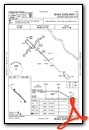
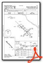
Instrument Approach Procedure (IAP) Charts
Nearby Airports with Instrument Procedures
| ID | Name | Heading / Distance | ||
|---|---|---|---|---|
 |
KHAE | Hannibal Regional Airport | 334° | 23.6 |
|
KPPQ | Pittsfield Penstone Municipal Airport | 051° | 26.1 |
|
K52 | Cpt Ben Smith Airfield/Monroe City Airport | 304° | 28.4 |
|
KMYJ | Mexico Memorial Airport | 245° | 30.7 |
|
KUIN | Quincy Regional-Baldwin Field Airport | 002° | 34.3 |
|
I63 | Mount Sterling Municipal Airport | 027° | 41.6 |
|
KSET | St Charles County Regional/Smartt Field Airport | 125° | 45.4 |
|
KFYG | Washington Regional Airport | 167° | 48.1 |
|
KFTT | Elton Hensley Memorial Airport | 229° | 48.5 |
|
KSUS | Spirit of St Louis Airport | 147° | 50.1 |
|
6M6 | Lewis County Regional Airport | 335° | 50.2 |
|
1H0 | Creve Coeur Airport | 138° | 50.9 |
Airport Images
Do you have a recent image of this airport? Upload it here!


