Login
Register


HAI
Three Rivers Municipal/Dr Haines Airport
Official FAA Data Effective 2026-01-22 0901Z
Chart Supplement

VFR Chart of KHAI
Sectional Charts at SkyVector.com
IFR Chart of KHAI
Enroute Charts at SkyVector.com
Location Information for KHAI
Coordinates: N41°57.58' / W85°35.58'Located 02 miles NE of Three Rivers, Michigan on 305 acres of land. View all Airports in Michigan.
Surveyed Elevation is 822 feet MSL.
Operations Data
|
|
Airport Communications
| AWOS-3P: | 119.975 Tel. 269-273-6705 |
|---|---|
| GREAT LAKES APPROACH: | 121.2 239.25 |
| GREAT LAKES DEPARTURE: | 121.2 239.25 |
| UNICOM: | 122.800 |
| CTAF: | 122.800 |
| AWOS-3 at IRS (11.2 SE): | 121.325 269-659-8715 |
| ASOS at AZO (16.3 N): | 269-459-3391 |
| ATIS at AZO (16.6 N): | 127.25 |
- APCH/DEP SVC PRVDD BY CHICAGO ARTCC ON 127.55/307.175 (GOSHEN RCAG) WHEN GREAT LAKES APCH CTL CLSD.
Nearby Navigation Aids
|
| ||||||||||||||||||||||||||||||||||||||||||||||||||||||||||||


Runway 09/27
| Dimensions: | 4000 x 75 feet / 1219 x 23 meters | |
|---|---|---|
| Surface: | Asphalt in Good Condition | |
| Weight Limits: | S-26, D-30 | |
| Edge Lighting: | Medium Intensity | |
| Runway 09 | Runway 27 | |
| Coordinates: | N41°57.63' / W85°36.07' | N41°57.63' / W85°35.19' |
| Elevation: | 819.9 | 822.4 |
| Traffic Pattern: | Left | Left |
| Runway Heading: | 90° True | 270° True |
| Markings: | Non-Precision Instrument in good condition. | Non-Precision Instrument in good condition. |
| Glide Slope Indicator | P4L (3.00° Glide Path Angle) | P4L (4.00° Glide Path Angle) |
| REIL: | Yes | Yes |
| Obstacles: | 90 ft Trees 3778 ft from runway | 75 ft Trees 1442 ft from runway |
Runway 05/23
| Dimensions: | 2719 x 60 feet / 829 x 18 meters | |
|---|---|---|
| Surface: | Asphalt in Fair Condition | |
| Weight Limits: | S-16 | |
| Edge Lighting: | Medium Intensity | |
| Runway 05 | Runway 23 | |
| Coordinates: | N41°57.36' / W85°35.72' | N41°57.68' / W85°35.30' |
| Elevation: | 822.5 | 821.0 |
| Traffic Pattern: | Left | Left |
| Runway Heading: | 45° True | 225° True |
| Markings: | Non-Precision Instrument in good condition. | Non-Precision Instrument in good condition. |
| Obstacles: | 16 ft Road 450 ft from runway, 150 ft right of center | 13 ft Road 275 ft from runway, 130 ft right of center |
Services Available
| Fuel: | 100LL (blue), Jet-A |
|---|---|
| Transient Storage: | Tiedowns |
| Airframe Repair: | MAJOR |
| Engine Repair: | MAJOR |
| Bottled Oxygen: | NONE |
| Bulk Oxygen: | NONE |
| Other Services: | PILOT INSTRUCTION,AIRCRAFT RENTAL |
Ownership Information
| Ownership: | Publicly owned | |
|---|---|---|
| Owner: | CITY OF THREE RIVERS | |
| MUNICIPAL BLDG, 333 W MICHIGAN AVE | ||
| THREE RIVERS, MI 49093-2193 | ||
| 269-273-1075 | ||
| Manager: | DAN MILLER | |
| 333 W MICHIGAN AVE | ||
| THREE RIVERS, MI 49093-2193 | ||
| 269-273-1845 | CELL 269-506-3878. | |
Other Remarks
- ADMIN BLDG ACCESS, 5-3-2-1, OR 1-2-0-0.
- FOR CD CTC GREAT LAKES APCH AT 269-459-3344, WHEN APCH CLSD CTC CHICAGO ARTCC AT 630-906-8921.
- PSBL OF CROP IRRIGATION EQUIP OPERG NE APCH TO RWY 23.
- RWY 23 15 FT VERT CLNC OVR ROAD IS WAIVED BY FAA.
- RDO CTLD ACFT OPERATE .5 MI NW OF RWY 09.
- RWY 5 15 FT VERT CLNC OVR ROAD WAIVED BY FAA (10/06/2009 ALP APVL LTR).
- SNOW PLOWING SRY PRIORITY, CALL 269-273-1845 AMGR TO CFM CONDS.
- DEER & LARGE BIRDS ON & INVOF ARPT.
- ACTVT REIL RWY 09 & 27; PAPI RWY 09 & 27; MIRL RWY 05/23 & 09/27 - CTAF.
Weather Minimums

Instrument Approach Procedure (IAP) Charts
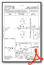
Nearby Airports with Instrument Procedures
| ID | Name | Heading / Distance | ||
|---|---|---|---|---|
 |
KIRS | Kirsch Municipal Airport | 141° | 11.2 |
|
KAZO | Kalamazoo/Battle Creek International Airport | 006° | 16.6 |
|
KEKM | Elkhart Municipal Airport | 232° | 23.4 |
|
C91 | Dowagiac Municipal Airport | 274° | 24.0 |
|
KOEB | Branch County Memorial Airport | 093° | 24.3 |
|
KBTL | Battle Creek Exec At Kellogg Field Airport | 036° | 25.8 |
|
KGSH | Goshen Municipal Airport | 199° | 27.5 |
|
3TR | Jerry Tyler Memorial Airport | 255° | 29.3 |
|
KANQ | Tri-State Steuben County Airport | 129° | 29.9 |
|
C62 | Kendallville Municipal Airport | 152° | 32.8 |
|
KRMY | Brooks Field Airport | 058° | 33.4 |
|
C03 | Nappanee Municipal Airport | 206° | 34.4 |
Airport Images

By: 2flaps

By: sunmanav8


