Login
Register


IRS
Kirsch Municipal Airport
Official FAA Data Effective 2026-01-22 0901Z
Chart Supplement

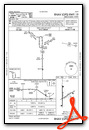
VFR Chart of KIRS
Sectional Charts at SkyVector.com
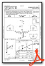
IFR Chart of KIRS
Enroute Charts at SkyVector.com
Location Information for KIRS
Coordinates: N41°48.80' / W85°26.34'Located 02 miles NW of Sturgis, Michigan on 148 acres of land. View all Airports in Michigan.
Surveyed Elevation is 924 feet MSL.
Operations Data
|
|
Airport Communications
| AWOS-3: | 121.325 Tel. 269-659-8715 |
|---|---|
| GREAT LAKES APPROACH: | 121.2 239.25 |
| GREAT LAKES DEPARTURE: | 121.2 239.25 |
| CTAF: | 123.050 |
| UNICOM: | 123.050 |
| AWOS-3P at HAI (11.1 NW): | 119.975 269-273-6705 |
| AWOS-3 at OEB (18.6 E): | 118.125 517-279-1810 |
| AWOS-3 at ANQ (19.0 SE): | 118.175 260-668-5630 |
- APCH/DEP SVC PRVDD BY CHICAGO ARTCC ON FREQS 127.55/307.175 (GOSHEN RCAG) WHEN GREAT LAKES APCH CTL CLSD.
Nearby Navigation Aids
|
| ||||||||||||||||||||||||||||||||||||||||||||||||||||||||||||


Runway 01/19
| Dimensions: | 5201 x 100 feet / 1585 x 30 meters | |
|---|---|---|
| Surface: | Asphalt in Good Condition | |
| Weight Limits: | S-47, D-57, ST-90 | |
| Edge Lighting: | Medium Intensity | |
| Runway 01 | Runway 19 | |
| Coordinates: | N41°48.36' / W85°26.45' | N41°49.21' / W85°26.46' |
| Elevation: | 912.0 | 908.2 |
| Traffic Pattern: | Left | Left |
| Runway Heading: | 360° True | 180° True |
| Markings: | Non-Precision Instrument in good condition. | Non-Precision Instrument in good condition. |
| Glide Slope Indicator | P4L (3.00° Glide Path Angle) | P4L (3.00° Glide Path Angle) |
| REIL: | Yes | Yes |
| Obstacles: | 55 ft Trees 1700 ft from runway, 150 ft left of center | |
Runway 06/24
| Dimensions: | 3601 x 75 feet / 1098 x 23 meters | |
|---|---|---|
| Surface: | Asphalt in Good Condition | |
| Weight Limits: | S-19, D-25, ST-58 | |
| Edge Lighting: | Medium Intensity | |
| Runway 06 | Runway 24 | |
| Coordinates: | N41°48.66' / W85°26.51' | N41°48.97' / W85°25.83' |
| Elevation: | 912.2 | 924.8 |
| Traffic Pattern: | Left | Left |
| Runway Heading: | 59° True | 239° True |
| Markings: | Basic in poor condition. | Basic in poor condition. |
| Glide Slope Indicator | P2L (4.00° Glide Path Angle) | |
| REIL: | Yes | |
| Obstacles: | 75 ft Trees 1450 ft from runway, 125 ft right of center | |
Services Available
| Fuel: | 100LL (blue), Jet A+ |
|---|---|
| Transient Storage: | Hangars,Tiedowns |
| Airframe Repair: | MAJOR |
| Engine Repair: | MAJOR |
| Bottled Oxygen: | LOW |
| Bulk Oxygen: | NOT AVAILABLE |
| Other Services: | CHARTER SERVICE,AIRCRAFT SALES |
Ownership Information
| Ownership: | Publicly owned | |
|---|---|---|
| Owner: | CITY OF STURGIS | |
| 130 N NOTTAWA ST | ||
| STURGIS, MI 49091-1197 | ||
| 269-651-2321 | ARPT/CITY MGR. | |
| Manager: | ANDREW KUK, CITY MGR | |
| 130 N NOTTAWA ST, PO BOX 280 | ||
| STURGIS, MI 49091-1197 | ||
| 269-651-2821 | FBO. | |
Other Remarks
- FOR CD CTC GREAT LAKES APCH AT 269-459-3344, WHEN APCH CLSD CTC CHICAGO ARTCC AT 630-906-8921.
- CALL FOR SNOW REMOVAL INFO & RWY COND RPRT.
- DEER AND BIRDS ON & INVOF RWYS.
- FADED.
- FADED.
- ACTVT REIL RWY 24, 01, & 19; PAPI RWY 24, 01, & 19; MIRL RWY 06/24 & 01/19 - CTAF.
Weather Minimums

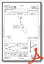
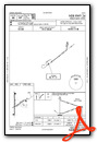
Instrument Approach Procedure (IAP) Charts
Nearby Airports with Instrument Procedures
| ID | Name | Heading / Distance | ||
|---|---|---|---|---|
 |
KHAI | Three Rivers Municipal/Dr Haines Airport | 321° | 11.2 |
|
KOEB | Branch County Memorial Airport | 067° | 18.8 |
|
KANQ | Tri-State Steuben County Airport | 122° | 19.1 |
|
C62 | Kendallville Municipal Airport | 158° | 21.9 |
|
KGSH | Goshen Municipal Airport | 222° | 23.5 |
|
KAZO | Kalamazoo/Battle Creek International Airport | 348° | 25.8 |
|
KEKM | Elkhart Municipal Airport | 257° | 26.0 |
|
KBTL | Battle Creek Exec At Kellogg Field Airport | 015° | 30.8 |
|
C03 | Nappanee Municipal Airport | 225° | 31.4 |
|
C91 | Dowagiac Municipal Airport | 289° | 32.7 |
|
KRMY | Brooks Field Airport | 039° | 34.0 |
|
KGWB | Auburn/Dekalb Exec Airport | 150° | 34.8 |
Airport Images

By: sunmanav8


