Login
Register
I40
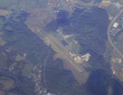
Richard Downing Airport
Official FAA Data Effective 2025-11-27 0901Z
VFR Chart of I40
Sectional Charts at SkyVector.com
IFR Chart of I40
Enroute Charts at SkyVector.com
Location Information for I40
Coordinates: N40°18.61' / W81°51.15'Located 03 miles N of Coshocton, Ohio on 290 acres of land. View all Airports in Ohio.
Surveyed Elevation is 978 feet MSL.
Operations Data
|
|
Airport Communications
| AWOS-3: | 118.875 Tel. 740-295-7370 |
|---|---|
| CTAF: | 123.000 |
| UNICOM: | 123.000 |
| AWOS-3 at 10G (14.4 N): | 128.325 330-674-6279 |
| ASOS at PHD (21.9 NE): | 121.425 330-339-1125 |
| ASOS at ZZV (21.9 S): | 127.0 740-453-8139 |
- APCH/DEP SVC PRVDD BY INDIANAPOLIS ARTCC ON FREQS 124.45/323.275 (ZANESVILLE RCAG).
Nearby Navigation Aids
|
| ||||||||||||||||||||||||||||||||||||||||||||||||||||||||||||
Runway 04/22
| Dimensions: | 5001 x 75 feet / 1524 x 23 meters | |
|---|---|---|
| Surface: | Asphalt in Good Condition | |
| Weight Limits: | S-30, D-35 | |
| Edge Lighting: | Medium Intensity | |
| Runway 04 | Runway 22 | |
| Coordinates: | N40°18.28' / W81°51.47' | N40°18.94' / W81°50.82' |
| Elevation: | 973.1 | 978.6 |
| Traffic Pattern: | Left | Left |
| Runway Heading: | 37° True | 217° True |
| Markings: | Non-Precision Instrument in fair condition. | Non-Precision Instrument in fair condition. |
| Glide Slope Indicator | P2L (3.50° Glide Path Angle) | P4R (3.00° Glide Path Angle) UNUSBL BYD 8 DEGS L OF CRS. |
| REIL: | Yes | |
| Obstacles: | +10 BRUSH, 0-150 FT DIST, 105 FT L. |
21 ft Trees 378 ft from runway, 170 ft left of center |
Services Available
| Fuel: | 100LL (blue), Jet A+ |
|---|---|
| Transient Storage: | Hangars,Tiedowns ROPES NOT PRVDD. |
| Airframe Repair: | MAJOR |
| Engine Repair: | MAJOR |
| Bottled Oxygen: | NONE |
| Bulk Oxygen: | NONE |
| Other Services: | AIR AMBULANCE SERVICES,PILOT INSTRUCTION |
Ownership Information
| Ownership: | Publicly owned | |
|---|---|---|
| Owner: | COSHOCTON CO RGNL ARPT AUTH | |
| 24569 AIRPORT RD | ||
| COSHOCTON, OH 43812-9219 | ||
| 740-622-2252 | ||
| Manager: | MARTY DOBSON | |
| 24569 AIRPORT RD | ||
| COSHOCTON, OH 43812-9219 | ||
| 740-622-2252 | ||
Other Remarks
- DEER, BIRDS, & OTR WILDLIFE ON & INVOF ARPT.
- GCO AVBL ON FREQ 121.725 INDIANAPOLIS CENTER.
- FOR CD IF UNA VIA GCO CTC INDIANAPOLIS ARTCC AT 317-247-2411.
- 0LL 100LL & JET A+ AVBL FULL SVC FM TRUCK.
- ACTVT REIL RWY 22; MIRL RWY 04/22 - 122.9. PAPI RWY 04 & 22 OPR CONSLY.
Weather Minimums
Instrument Approach Procedure (IAP) Charts
Nearby Airports with Instrument Procedures
| ID | Name | Heading / Distance | ||
|---|---|---|---|---|
 |
10G | Holmes County Airport | 340° | 14.4 |
 |
KPHD | Harry Clever Field Airport | 064° | 22.0 |
 |
KZZV | Zanesville Municipal Airport | 184° | 22.0 |
 |
KCDI | Cambridge Municipal Airport | 147° | 23.7 |
 |
4I3 | Knox County Airport | 272° | 30.9 |
 |
KVTA | Licking County Regional Airport | 238° | 32.8 |
 |
I10 | Noble County Airport | 154° | 33.8 |
 |
KBJJ | Wayne County Airport | 357° | 33.9 |
 |
6G5 | Barnesville/Bradfield Airport | 121° | 35.6 |
 |
KTSO | Carroll County/Tolson Airport | 066° | 38.5 |
 |
8G6 | Harrison County Airport | 096° | 38.8 |
 |
3G4 | Ashland County Airport | 332° | 40.0 |


