Login
Register


PHD
Harry Clever Field Airport
Official FAA Data Effective 2026-01-22 0901Z
Chart Supplement

VFR Chart of KPHD
Sectional Charts at SkyVector.com
IFR Chart of KPHD
Enroute Charts at SkyVector.com
Location Information for KPHD
Coordinates: N40°28.21' / W81°25.20'Located 02 miles SE of New Philadelphia, Ohio on 65 acres of land. View all Airports in Ohio.
Surveyed Elevation is 894 feet MSL.
Operations Data
|
|
Airport Communications
| ASOS: | 121.425 Tel. 330-339-1125 |
|---|---|
| CLEVELAND APPROACH: | 125.5 371.875 |
| CLEVELAND DEPARTURE: | 125.5 371.875 |
| CTAF: | 122.800 |
| UNICOM: | 122.800 |
| AWOS-3 at I40 (22.1 SW): | 118.875 740-295-7370 |
| AWOS-3 at 10G (24.8 W): | 128.325 330-674-6279 |
| ASOS at CAK (26.7 N): | 330-227-8682 |
- APCH/DEP SVC PRVDD BY CLEVELAND APCH (CLE) 0600-0100. APCH/DEP SVC PRVDD BY CLEVELAND ARTCC (ZOB) ON FREQS 120.6/379.275 (MOUNT HOPE RCAG) 0100-0600.
Nearby Navigation Aids
|
| ||||||||||||||||||||||||||||||||||||||||||||||||||||||||||||


Runway 15/33
| Dimensions: | 3951 x 100 feet / 1204 x 30 meters | |
|---|---|---|
| Surface: | Asphalt in Good Condition | |
| Weight Limits: | S-52, D-67, ST-140 | |
| Edge Lighting: | Medium Intensity | |
| Runway 15 | Runway 33 | |
| Coordinates: | N40°28.50' / W81°25.46' | N40°28.01' / W81°24.91' |
| Elevation: | 894.4 | 886.1 |
| Traffic Pattern: | Left | Left |
| Runway Heading: | 139° True | 319° True |
| Displaced Threshold: | 330 Feet | |
| Declared Distances: | TORA:3951 TODA:3951 ASDA:3951 LDA:3621 | TORA:3951 TODA:3951 ASDA:3634 LDA:3634 |
| Markings: | Non-Precision Instrument in fair condition. | Non-Precision Instrument in fair condition. |
| Glide Slope Indicator | P4R (4.00° Glide Path Angle) | P4L (4.00° Glide Path Angle) PAPI UNUSBL BYD 5 DEGS LEFT OF CNTRLN. |
| REIL: | Yes | Yes |
| Obstacles: | 15 ft Road 200 ft from runway, 9 ft right of center APCH SLP 1:1 TO DTHR OVR +45 FT TREE, 45 FT DIST, 215 FT L. +15 FT ROAD, 0-200 FT DIST, 7-115 FT R; +7 FT FENCE, 0-200 FT DIST, 15 FT L TO 90 FT R; +16 FT BLDG, 168 FT DIST, 237 FT L. |
46 ft Trees 401 ft from runway, 170 ft right of center +18-25 TREES, 0-100 FT DIST, 230 FT L. |
Runway 12/30
| Dimensions: | 1907 x 70 feet / 581 x 21 meters | |
|---|---|---|
| Surface: | Turf in Good Condition | |
| Runway 12 | Runway 30 | |
| Coordinates: | N40°28.17' / W81°25.42' | N40°28.07' / W81°25.03' |
| Elevation: | 890.4 | 885.9 |
| Traffic Pattern: | Left | Left |
| Runway Heading: | 109° True | 289° True |
| Declared Distances: | TORA:1907 TODA:1907 ASDA:1907 LDA:1758 | TORA:1907 TODA:1907 ASDA:1758 LDA:1758 |
| Markings: | in good condition. | in good condition. |
| Obstacles: | 70 ft Trees 428 ft from runway, 80 ft right of center | 81 ft Trees 593 ft from runway, 170 ft right of center |
Services Available
| Fuel: | 100LL (blue), Jet-A |
|---|---|
| Transient Storage: | Hangars,Tiedowns PRIOR CDN RQRD. |
| Airframe Repair: | MAJOR |
| Engine Repair: | MAJOR |
| Bottled Oxygen: | NONE |
| Bulk Oxygen: | NONE |
| Other Services: | AVIONICS,PILOT INSTRUCTION,AIRCRAFT RENTAL |
Ownership Information
| Ownership: | Publicly owned | |
|---|---|---|
| Owner: | CITY OF NEW PHILADELPHIA | |
| SERVICE DIRECTOR, 150 E HIGH AVE STE 200 | ||
| NEW PHILADELPHIA, OH 44663-4500 | ||
| 330-364-4491 | ||
| Manager: | ERIC HUBBARD | |
| 1834 E HIGH AVE | ||
| NEW PHILADELPHIA, OH 44663-3239 | ||
| 330-339-6078 | CELL 330-827-0820. | |
Other Remarks
- TWY A CLSD WHEN ACFT ON APCH OR DEP; SFC MKG CONFLICT.
- FOR CD CTC CLEVELAND APCH AT 216-352-2323, WHEN APCH CLSD CTC CLEVELAND ARTCC AT 440-774-0223/0490.
- YELLOW CONES.
- YELLOW CONES.
- ACTVT REIL RWY 15 & 33; MIRL RWY 15/33 - 123.3. PAPI RWY 15 & 33 OPR CONSLY.
Weather Minimums


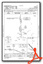
Instrument Approach Procedure (IAP) Charts


Nearby Airports with Instrument Procedures
| ID | Name | Heading / Distance | ||
|---|---|---|---|---|
 |
KTSO | Carroll County/Tolson Airport | 070° | 16.6 |
|
I40 | Richard Downing Airport | 244° | 22.0 |
|
8G6 | Harrison County Airport | 126° | 23.3 |
|
10G | Holmes County Airport | 279° | 24.9 |
|
KCAK | Akron-Canton Regional Airport | 357° | 26.7 |
|
6G5 | Barnesville/Bradfield Airport | 159° | 29.9 |
|
KCDI | Cambridge Municipal Airport | 193° | 30.6 |
|
KBJJ | Wayne County Airport | 318° | 32.3 |
|
3G6 | Tri-City Airport | 036° | 32.4 |
|
2G2 | Geary A Bates/Jefferson County Airpark Airport | 101° | 33.6 |
|
KAKR | Akron Fulton International Airport | 356° | 34.1 |
|
3G3 | Wadsworth Municipal Airport | 334° | 35.4 |
Airport Images
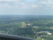
By: lwfrank


