Login
Register


8G6
Harrison County Airport
Official FAA Data Effective 2026-01-22 0901Z
Chart Supplement

VFR Chart of 8G6
Sectional Charts at SkyVector.com
IFR Chart of 8G6
Enroute Charts at SkyVector.com
Location Information for 8G6
Coordinates: N40°14.30' / W81°0.77'Located 02 miles S of Cadiz, Ohio on 72 acres of land. View all Airports in Ohio.
Surveyed Elevation is 1176 feet MSL.
Operations Data
|
|
Airport Communications
| CTAF: | 122.800 |
|---|---|
| UNICOM: | 122.800 |
| AWOS-3 at 2G2 (16.1 NE): | 121.625 740-275-4862 |
| ASOS at HLG (17.2 E): | 127.375 304-277-3504 |
| ASOS at PHD (23.3 NW): | 121.425 330-339-1125 |
- APCH/DEP SVC PRVDD BY CLEVELAND ARTCC (ZOB) ON FREQS 126.95/239.3 (BELMONT RCAG).
Nearby Navigation Aids
|
| ||||||||||||||||||||||||||||||||||||||||||||||||||||||||||||


Runway 13/31
| Dimensions: | 4154 x 60 feet / 1266 x 18 meters | |
|---|---|---|
| Surface: | Asphalt in Good Condition | |
| Weight Limits: | S-30 | |
| Edge Lighting: | Medium Intensity | |
| Runway 13 | Runway 31 | |
| Coordinates: | N40°14.50' / W81°1.13' | N40°14.10' / W81°0.41' |
| Elevation: | 1176.2 | 1105.5 |
| Traffic Pattern: | Right | Left |
| Runway Heading: | 126° True | 306° True |
| Displaced Threshold: | 874 Feet | 410 Feet |
| Markings: | Non-Precision Instrument in fair condition. | Non-Precision Instrument in fair condition. |
| Glide Slope Indicator | P2L (4.00° Glide Path Angle) | P2L (4.00° Glide Path Angle) |
| Obstacles: | 40 ft Hill 201 ft from runway, 118 ft right of center APCH SLP 0:1 TO DTHR DUE TO +40 FT HNGR, 0 FT DIST, 198 FT R. 0-40 FT HILL, 0-200 FT DIST, 100 FT L TO 140 FT R. |
44 ft Trees 435 ft from runway, 238 ft right of center APCH SLP 0:1 TO DTHR OVR +29 FT TREE, 9 FT DIST, 179 FT R. 6 FT MOUND, 115-200 FT DIST, 165-250 FT L. |
Services Available
| Fuel: | 100LL (blue) |
|---|---|
| Transient Storage: | Hangars |
| Airframe Repair: | NONE PAINT SHOP ON FLD CALL AMGR. |
| Engine Repair: | NONE |
| Bottled Oxygen: | NONE |
| Bulk Oxygen: | NONE |
Ownership Information
| Ownership: | Publicly owned | |
|---|---|---|
| Owner: | HARRISON CO ARPT AUTH | |
| 43000 AIRPORT RD | ||
| CADIZ, OH 43907-9605 | ||
| 740-942-2316 | ||
| Manager: | MARK MILLER | |
| 43000 AIRPORT RD | ||
| CADIZ, OH 43907-9605 | ||
| 740-491-2815 | ||
Other Remarks
- FOR CD CTC CLEVELAND ARTCC AT 440-774-0226/0490.
- DEER ON & INVOF ARPT.
- ACTVT PAPI RWY 13 & 31; MIRL RWY 13/31 - CTAF.
Weather Minimums

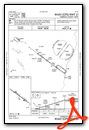
Instrument Approach Procedure (IAP) Charts

Nearby Airports with Instrument Procedures
| ID | Name | Heading / Distance | ||
|---|---|---|---|---|
 |
2G2 | Geary A Bates/Jefferson County Airpark Airport | 062° | 16.1 |
|
6G5 | Barnesville/Bradfield Airport | 210° | 16.4 |
|
KHLG | Wheeling Ohio County Airport | 102° | 17.3 |
|
KTSO | Carroll County/Tolson Airport | 351° | 19.6 |
|
KPHD | Harry Clever Field Airport | 306° | 23.3 |
|
KMPG | Marshall County Airport | 149° | 24.9 |
|
4G5 | Monroe County Airport | 188° | 27.8 |
|
KCDI | Cambridge Municipal Airport | 238° | 30.4 |
|
02G | Columbiana County Airport | 033° | 31.1 |
|
KAFJ | Washington County Airport | 100° | 33.8 |
|
I10 | Noble County Airport | 222° | 35.6 |
|
I40 | Richard Downing Airport | 276° | 38.8 |
Airport Images
Do you have a recent image of this airport? Upload it here!


