Login
Register


6G5
Barnesville/Bradfield Airport
Official FAA Data Effective 2026-02-19 0901Z
Chart Supplement

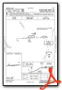
VFR Chart of 6G5
Sectional Charts at SkyVector.com
IFR Chart of 6G5
Enroute Charts at SkyVector.com
Location Information for 6G5
Coordinates: N40°0.14' / W81°11.51'Located 01 miles NW of Barnesville, Ohio on 55 acres of land. View all Airports in Ohio.
Surveyed Elevation is 1312 feet MSL.
Operations Data
|
|
Airport Communications
| CTAF: | 123.000 |
|---|---|
| UNICOM: | 123.000 |
| AWOS-3 at CDI (17.8 W): | 118.525 740-435-0086 |
| AWOS-3 at MPG (22.2 E): | 119.05 304-845-2959 |
| ASOS at HLG (27.1 E): | 127.375 304-277-3504 |
- APCH/DEP SVC PRVDD BY CLEVELAND ARTCC (ZOB) ON FREQS 126.95/239.30 (BELMONT RCAG).
Nearby Navigation Aids
|
| ||||||||||||||||||||||||||||||||||||||||||||||||||||||||||||


Runway 09/27
| Dimensions: | 4003 x 60 feet / 1220 x 18 meters | |
|---|---|---|
| Surface: | Asphalt in Excellent Condition | |
| Weight Limits: | S-30 | |
| Edge Lighting: | Medium Intensity | |
| Runway 09 | Runway 27 | |
| Coordinates: | N40°0.12' / W81°11.94' | N40°0.17' / W81°11.08' |
| Elevation: | 1309.5 | 1312.3 |
| Traffic Pattern: | Left | Left |
| Runway Heading: | 86° True | 266° True |
| Markings: | Non-Precision Instrument in good condition. | Non-Precision Instrument in good condition. |
| REIL: | Yes | |
| Obstacles: | CTLG OBSTN EXCEEDS A 45 DEG SLP. |
5 ft Trees 201 ft from runway, 110 ft left of center +8-10 FT TREE/BRUSH, 200 FT DIST, 130 FT R; +8 FT FENCE, 200 FT DIST, 220 FT L. |
Services Available
| Fuel: | 100LL (blue), Jet-A |
|---|---|
| Transient Storage: | Hangars,Tiedowns |
| Airframe Repair: | NONE |
| Engine Repair: | NONE |
| Bottled Oxygen: | NONE |
| Bulk Oxygen: | NONE |
Ownership Information
| Ownership: | Publicly owned | |
|---|---|---|
| Owner: | BELMONT COUNTY RGNL ARPT AUTH | |
| PO BOX 83 | ||
| BARNESVILLE, OH 43713-0083 | ||
| 740-425-1976 | ||
| Manager: | ALEX STEPHEN | |
| 62299 FAIRVIEW RD | ||
| BARNESVILLE, OH 43713 | ||
| 740-213-0902 | ||
Other Remarks
- BIRDS & OTR WILDLIFE ON & INVOF ARPT.
- FOR CD CTC CLEVELAND ARTCC AT 440-774-0226/0490.
- ARPT ACES CTLD BY GATE - CTC AMGR.
- 0LL FUEL AVBL H24 SELF SVC VIA CREDIT CARD.
- ACTVT REIL RWY 27; MIRL RWY 09/27 - CTAF.
- ACTVT ROTG BCN - CTAF.
Weather Minimums

Instrument Approach Procedure (IAP) Charts

Nearby Airports with Instrument Procedures
| ID | Name | Heading / Distance | ||
|---|---|---|---|---|
 |
4G5 | Monroe County Airport | 162° | 14.0 |
|
8G6 | Harrison County Airport | 030° | 16.4 |
|
KCDI | Cambridge Municipal Airport | 264° | 17.9 |
|
I10 | Noble County Airport | 232° | 20.0 |
|
KMPG | Marshall County Airport | 108° | 22.3 |
|
KHLG | Wheeling Ohio County Airport | 067° | 27.2 |
|
KPHD | Harry Clever Field Airport | 339° | 29.9 |
|
2G2 | Geary A Bates/Jefferson County Airpark Airport | 046° | 31.1 |
|
KZZV | Zanesville Municipal Airport | 264° | 32.5 |
|
KTSO | Carroll County/Tolson Airport | 008° | 33.9 |
|
I40 | Richard Downing Airport | 301° | 35.6 |
|
KPKB | Mid-Ohio Valley Regional Airport | 196° | 41.0 |
Airport Images

By: Dave


