Login
Register


IFP
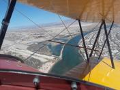
Laughlin/Bullhead International Airport
Official FAA Data Effective 2026-01-22 0901Z
Chart Supplement

KIFP Airport Diagram

VFR Chart of KIFP
Sectional Charts at SkyVector.com
IFR Chart of KIFP
Enroute Charts at SkyVector.com
Location Information for KIFP
Coordinates: N35°9.28' / W114°33.56'Located 01 miles N of Bullhead City, Arizona on 650 acres of land. View all Airports in Arizona.
Surveyed Elevation is 707 feet MSL.
Operations Data
|
|
Airport Communications
| ATIS: | 119.825 |
|---|---|
| AWOS-3PT: | 119.825 Tel. 928-754-4462 |
| BULLHEAD TOWER TOWER: | 123.9 |
| BULLHEAD TOWER GROUND: | 118.25 |
| CTAF: | 123.900 |
| ASOS at EED (23.5 S): | 128.325 760-326-4281 |
| ASOS at IGM (31.3 E): | 119.275 928-263-6453 |
| AWOS-3 at HII (36.8 S): | 119.025 928-764-2309 |
- APCH/DEP CTL SVC PRVDD BY LOS ANGELES ARTCC (ZLA) ON FREQS 134.65/360.65 (NELSON RCAG).
- LOS ANGELES ARTCC CLNC DEL 118.25 WHEN TOWER CLSD.
Nearby Navigation Aids
|
| ||||||||||||||||||||||||||||||||||||


Runway 16/34
| Dimensions: | 8501 x 150 feet / 2591 x 46 meters | |
|---|---|---|
| Surface: | Asphalt / Grooved in Good Condition | |
| Weight Limits: | S-120, D-214, ST-403, DT-847
PCR VALUE: 480/F/A/X/T
| |
| Edge Lighting: | Medium Intensity | |
| Runway 16 | Runway 34 | |
| Coordinates: | N35°9.98' / W114°33.61' | N35°8.58' / W114°33.51' |
| Elevation: | 625.5 | 707.1 |
| Traffic Pattern: | Right | |
| Runway Heading: | 176° True | 356° True |
| Declared Distances: | TORA:8500 TODA:8500 ASDA:8500 LDA:8500 | TORA:8500 TODA:8500 ASDA:8500 LDA:8500 |
| Markings: | Non-Precision Instrument in good condition. | Non-Precision Instrument in good condition. |
| Glide Slope Indicator | P4L (3.13° Glide Path Angle) | P4L (3.00° Glide Path Angle) PAPI UNUSBL BYD 7 DEGS RIGHT OF CNTRLN. |
| REIL: | Yes | Yes |
| Obstacles: | 123 ft Pole 3200 ft from runway, 550 ft left of center | |
Services Available
| Fuel: | 100LL (blue), Jet-A |
|---|---|
| Transient Storage: | Hangars,Tiedowns |
| Airframe Repair: | NOT AVAILABLE |
| Engine Repair: | NOT AVAILABLE |
| Bottled Oxygen: | NOT AVAILABLE |
| Bulk Oxygen: | HIGH/LOW |
| Other Services: | AIR FREIGHT SERVICES,AIR AMBULANCE SERVICES,CHARTER SERVICE |
Ownership Information
| Ownership: | Publicly owned | |
|---|---|---|
| Owner: | MOHAVE COUNTY | |
| BOX 390 | ||
| KINGMAN, AZ 86402 | ||
| 928-754-2134 | ||
| Manager: | JAMES SCHELLER | |
| 2550 LAUGHLIN VIEW DR | ||
| BULLHEAD CITY, AZ 86429 | ||
| 928-754-2134 X24 | 941-323-2178. | |
Other Remarks
- MTNS NW, NE, E AND SE. RISING TRRN N & S OF RWY ENDS.
- NOISE SENSITIVE AREAS NE & SE.
- SFC COND UNMNT 0600Z-1200Z.
- TWY A5 BTN TWY A & GEN AVN APRON LTD TO WINGSPAN LESS THAN 79 FT.
- RADAR SVC BLW 6000 FT NA.
- GA LNDG FEE - 928-754-2134.
- TPA FOR LIGHT ACFT 999 FT AGL, TPA FOR HIGH PERFORMANCE ACFT 1499 FT AGL.
- TWY ALPHA 4 LTD TO WINGSPANS LESS THAN 79 FT.
- CTN: LRG COML OPS AFT ATCT HRS; BIRDS ON & INVOF ARPT SEP-DEC.
- 66 FT PLINE PARL TO RWY 625 FT L 1300 FT FM RWY END.
- ACTVT REIL RWY 16 & 34; PAPI RWY 16 & 34; MIRL RWY 16/34 - CTAF.
Weather Minimums

Instrument Approach Procedure (IAP) Charts

Nearby Airports with Instrument Procedures
| ID | Name | Heading / Distance | ||
|---|---|---|---|---|
 |
KEED | Needles Airport | 187° | 23.5 |
|
KIGM | Kingman Airport | 078° | 31.2 |
|
KHII | Lake Havasu City Airport | 164° | 36.3 |
|
KBVU | Boulder City Municipal Airport | 342° | 49.7 |
|
KHND | Henderson Exec Airport | 330° | 56.5 |
|
P20 | Avi Suquilla Airport | 166° | 61.9 |
|
KLAS | Harry Reid International Airport | 332° | 62.6 |
|
KLSV | Nellis AFB Airport | 340° | 68.8 |
|
KVGT | North Las Vegas Airport | 334° | 70.5 |
|
KTNP | Twentynine Palms Airport | 228° | 92.0 |
|
KBLH | Blythe Airport | 184° | 92.3 |
|
67L | Mesquite Airport | 013° | 103.5 |