
Login
Register


JVY
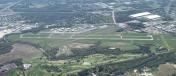
Clark Regional Airport
Official FAA Data Effective 2026-01-22 0901Z
Chart Supplement

VFR Chart of KJVY
Sectional Charts at SkyVector.com
IFR Chart of KJVY
Enroute Charts at SkyVector.com
Location Information for KJVY
Coordinates: N38°22.00' / W85°44.29'Located 05 miles N of Jeffersonville, Indiana on 800 acres of land. View all Airports in Indiana.
Surveyed Elevation is 477 feet MSL.
Operations Data
|
|
Airport Communications
| AWOS-3: | 118.575 Tel. 812-246-1278 |
|---|---|
| LOUISVILLE APPROACH: | 132.075 327.0 |
| LOUISVILLE DEPARTURE: | 132.075 327.0 |
| CLEARANCE DELIVERY: | 118.05 |
| UNICOM: | 122.700 |
| CTAF: | 122.700 |
| ASOS at LOU (8.9 SE): | 502-473-0693 |
| ATIS at LOU (9.0 S): | 124.15 |
| ASOS at SDF (11.4 S): | 502-676-6814 |
Nearby Navigation Aids
|
| ||||||||||||||||||||||||||||||||||||||||||||||||||||||||||||


Runway 18/36
| Dimensions: | 7000 x 100 feet / 2134 x 30 meters | |
|---|---|---|
| Surface: | Asphalt / Grooved in Good Condition | |
| Weight Limits: | S-45, D-60 | |
| Edge Lighting: | Medium Intensity | |
| Runway 18 | Runway 36 | |
| Coordinates: | N38°22.57' / W85°44.27' | N38°21.42' / W85°44.27' |
| Elevation: | 477.5 | 461.2 |
| Runway Heading: | 180° True | 360° True |
| Markings: | Precision Instrument in good condition. | Precision Instrument in good condition. |
| Glide Slope Indicator | P4L (3.00° Glide Path Angle) | P4L (3.00° Glide Path Angle) |
| Approach Lights: | MALSR 1,400 Foot Medium-intensity Approach Lighting System with runway alignment indicator lights. | |
| REIL: | Yes | |
| Obstacles: | 70 ft Power Line 3150 ft from runway, 894 ft left of center | |
Runway 14/32
| Dimensions: | 3899 x 75 feet / 1188 x 23 meters | |
|---|---|---|
| Surface: | Asphalt in Good Condition | |
| Weight Limits: | S-12 | |
| Edge Lighting: | Medium Intensity | |
| Runway 14 | Runway 32 | |
| Coordinates: | N38°22.25' / W85°44.59' | N38°21.77' / W85°44.04' |
| Elevation: | 468.8 | 460.9 |
| Runway Heading: | 138° True | 318° True |
| Markings: | Basic in fair condition. | Basic in fair condition. |
| Glide Slope Indicator | P2L (3.90° Glide Path Angle) | P2L (3.90° Glide Path Angle) |
| REIL: | Yes | Yes |
Services Available
| Fuel: | 100LL (blue), Jet-A |
|---|---|
| Transient Storage: | Hangars,Tiedowns |
| Airframe Repair: | MAJOR |
| Engine Repair: | MAJOR |
| Bottled Oxygen: | HIGH |
| Bulk Oxygen: | HIGH |
| Other Services: | AIR FREIGHT SERVICES,CARGO HANDLING SERVICES,CHARTER SERVICE,PILOT INSTRUCTION,AIRCRAFT RENTAL,AIRCRAFT SALES |
Ownership Information
| Ownership: | Publicly owned | |
|---|---|---|
| Owner: | SOUTH CENTRAL REGIONAL AIRPORT AUTH | |
| 6003 PROPELLER LANE | ||
| SELLERSBURG, IN 47172 | ||
| 812-246-7460 | ||
| Manager: | JOHN SECOR | |
| 6003 PROPELLER LANE | ||
| SELLERSBURG, IN 47172 | ||
| 812-246-7460 | ||
Other Remarks
- STUDENT ACT & WILDLIFE ON & INVOF ARPT.
- LNDG FEE FOR NON BASE ACFT.
- EMERG PHONE LCTD N SIDE OF AUTH BLDG - CTAF TO OPEN.
- FOR CD CTC LOUISVILLE APCH AT 502-375-7499
- REIL RWY 14 & 32; REIL RWY 36; MIRL RWY 18/36 & 14/32 OPR SS-SR AND PRESET MED INTST; TO INCR INTST AND ACTVT MALSR RWY 18 - CTAF. PAPI RWY 18 & 36; PAPI RWY 14 & 32 OPR CONSLY.
Weather Minimums


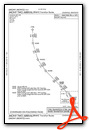
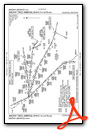
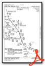
Standard Terminal Arrival (STAR) Charts


Instrument Approach Procedure (IAP) Charts

Nearby Airports with Instrument Procedures
| ID | Name | Heading / Distance | ||
|---|---|---|---|---|
 |
KLOU | Bowman Field Airport | 157° | 9.0 |
|
KSDF | Louisville Muhammad Ali International Airport | 179° | 11.5 |
|
KIMS | Madison Regional Airport | 028° | 26.9 |
|
KFTK | Godman AAF Airport | 201° | 29.7 |
|
KSER | Freeman Municipal Airport | 346° | 34.4 |
|
KBRY | Samuels Field Airport | 161° | 35.0 |
|
KFFT | Capital City Airport | 105° | 40.8 |
|
KOVO | North Vernon Airport | 008° | 41.2 |
|
KEKX | Addington Field Airport | 192° | 41.7 |
|
KFRH | French Lick Municipal Airport | 281° | 43.2 |
|
KBFR | Virgil I Grissom Municipal Airport | 310° | 43.7 |
|
I93 | Breckinridge County Airport | 223° | 48.2 |





Comments
Clark Regional Airport
Clark Regional Airport charges landing fees to helicopters regardless of fuel purchase. Given the amount of business my company does in the area, we expected to be treated a little better. We will be avoiding this airport like the plague.
Pages