Login
Register


K88
Allen County Airport
Official FAA Data Effective 2026-01-22 0901Z
Chart Supplement

VFR Chart of K88
Sectional Charts at SkyVector.com
IFR Chart of K88
Enroute Charts at SkyVector.com
Location Information for K88
Coordinates: N37°52.09' / W95°23.22'Located 03 miles SE of Iola, Kansas on 340 acres of land. View all Airports in Kansas.
Surveyed Elevation is 1015 feet MSL.
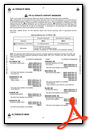
Operations Data
|
|
Airport Communications
| AWOS-3PT: | 128.325 Tel. 620-365-1466 |
|---|---|
| CTAF: | 122.800 |
| UNICOM: | 122.800 |
| ASOS at CNU (12.7 S): | 127.075 620-431-6781 |
| AWOS-3P at FSK (29.6 E): | 124.425 620-215-5899 |
| AWOS-3PT at UKL (30.6 NW): | 121.125 620-364-2435 |
- APCH/DEP CTL SVC PRVDD BY KANSAS CITY ARTCC (ZKC) ON FREQS 127.725/270.25 (EMPORIA RCAG).
Nearby Navigation Aids
|
| ||||||||||||||||||||||||||||||||||||||||||||||||||||||||||||


Runway 01/19
| Dimensions: | 5501 x 100 feet / 1677 x 30 meters | |
|---|---|---|
| Surface: | Concrete in Good Condition | |
| Weight Limits: | 11 /R/C/X/U | |
| Edge Lighting: | Medium Intensity | |
| Runway 01 | Runway 19 | |
| Coordinates: | N37°51.65' / W95°23.35' | N37°52.53' / W95°23.08' |
| Elevation: | 1004.9 | 1015.6 |
| Runway Heading: | 13° True | 193° True |
| Markings: | Non-Precision Instrument in good condition. | Non-Precision Instrument in good condition. |
| Glide Slope Indicator | P4L (3.00° Glide Path Angle) | P4L (3.00° Glide Path Angle) |
| REIL: | Yes | Yes |
| Obstacles: | 42 ft Pole 1330 ft from runway | 33 ft Tree 1180 ft from runway, 200 ft left of center |
Services Available
| Fuel: | 100LL (blue), Jet-A, Automotive Gasoline |
|---|---|
| Transient Storage: | Hangars,Tiedowns |
| Airframe Repair: | MAJOR |
| Engine Repair: | MAJOR |
| Bottled Oxygen: | NONE |
| Bulk Oxygen: | NONE |
| Other Services: | PILOT INSTRUCTION |
Ownership Information
| Ownership: | Publicly owned | |
|---|---|---|
| Owner: | ALLEN COUNTY | |
| COUNTY COURTHOUSE | ||
| IOLA, KS 66749 | ||
| 620-365-1422 | ||
| Manager: | ROBERT POYDACK | |
| 1705 MINNESOTA RD | ||
| IOLA, KS 66749 | ||
| 620-212-1316 | ||
Other Remarks
- COURTESY CAR AVBL.
- WILDLIFE ON & INVOF AIRPORT.
- FOR CD CTC KANSAS CITY ARTCC AT 913-254-8508.
- ACTVT MIRL RWY 01/19 & PAPI RWYS 01 & 19 - CTAF.
Weather Minimums

Instrument Approach Procedure (IAP) Charts
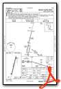
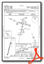
Nearby Airports with Instrument Procedures
| ID | Name | Heading / Distance | ||
|---|---|---|---|---|
 |
KCNU | Chanute Martin Johnson Airport | 201° | 12.9 |
|
2K7 | Neodesha Municipal Airport | 205° | 28.7 |
|
KFSK | Fort Scott Municipal Airport | 097° | 29.7 |
|
KUKL | Coffey County Airport | 328° | 30.6 |
|
KPPF | Tri-City Airport | 190° | 32.7 |
|
KPTS | Atkinson Municipal Airport | 128° | 40.1 |
|
KOWI | Ottawa Municipal Airport | 008° | 40.7 |
|
13K | Lt William M Milliken Airport | 268° | 43.0 |
|
K81 | Miami County Airport | 028° | 46.0 |
|
KIDP | Independence Municipal Airport | 203° | 46.5 |
|
KEMP | Emporia Municipal Airport | 306° | 47.1 |
|
KCFV | Coffeyville Municipal Airport | 190° | 47.2 |
Airport Images
Do you have a recent image of this airport? Upload it here!


Comments
K88 is always a good fuel stop choice
Allen County airport, near Iola, KS is a good choice for a fuel stop. They have 100LL, Jet A and 91 octane Mogas for those that burn mogas. I have stopped here many times over the years and never have had any problems. Their fuel price is always one of the best in the area.
Jim Hefner
Fuel
Thanks for your comment. It looks like they still have the best fuel price.