Login
Register


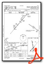
PTS
Atkinson Municipal Airport
Official FAA Data Effective 2026-02-19 0901Z
Chart Supplement

VFR Chart of KPTS
Sectional Charts at SkyVector.com
IFR Chart of KPTS
Enroute Charts at SkyVector.com
Location Information for KPTS
Coordinates: N37°27.00' / W94°43.87'Located 03 miles NW of Pittsburg, Kansas on 742 acres of land. View all Airports in Kansas.
Surveyed Elevation is 946 feet MSL.
Operations Data
|
|
Airport Communications
| AWOS-3PT: | 118.775 Tel. 620-404-5654 |
|---|---|
| UNICOM: | 123.000 |
| CTAF: | 123.000 |
| AWOS-3P at FSK (21.0 N): | 124.425 620-215-5899 |
| ATIS at JLN (21.0 SE): | 120.85 |
| ASOS at JLN (21.1 SE): | 417-623-8892 |
- APCH/DEP CTL SVC PRVDD BY KANSAS CITY ARTCC (ZKC) ON FREQS 128.6/282.325 (EDNA RCAG).
Nearby Navigation Aids
|
| ||||||||||||||||||||||||||||||||||||||||||


Runway 17/35
| Dimensions: | 6100 x 100 feet / 1859 x 30 meters | |
|---|---|---|
| Surface: | Asphalt in Good Condition | |
| Weight Limits: | 17 /F/D/X/T, S-44, D-58 | |
| Edge Lighting: | Medium Intensity | |
| Runway 17 | Runway 35 | |
| Coordinates: | N37°27.60' / W94°43.96' | N37°26.61' / W94°43.73' |
| Elevation: | 936.3 | 926.5 |
| Traffic Pattern: | Left | Left |
| Runway Heading: | 170° True | 350° True |
| Markings: | Non-Precision Instrument in poor condition. | Non-Precision Instrument in poor condition. |
| Glide Slope Indicator | P4L (3.00° Glide Path Angle) | P4L (3.00° Glide Path Angle) |
| REIL: | Yes | Yes |
| Obstacles: | 46 ft Trees 1136 ft from runway, 195 ft right of center | 53 ft Trees 1230 ft from runway, 396 ft right of center |
Runway 04/22
| Dimensions: | 4000 x 75 feet / 1219 x 23 meters | |
|---|---|---|
| Surface: | Asphalt in Good Condition | |
| Weight Limits: | 9 /F/D/X/T, S-24 | |
| Edge Lighting: | Medium Intensity | |
| Runway 04 | Runway 22 | |
| Coordinates: | N37°26.59' / W94°44.18' | N37°27.09' / W94°43.65' |
| Elevation: | 946.2 | 922.3 |
| Traffic Pattern: | Left | Left |
| Runway Heading: | 40° True | 220° True |
| Markings: | Non-Precision Instrument in good condition. | Non-Precision Instrument in good condition. |
| Glide Slope Indicator | P4L (3.00° Glide Path Angle) | P4L (3.80° Glide Path Angle) |
| REIL: | Yes | Yes |
| Obstacles: | 44 ft Trees 450 ft from runway, 148 ft left of center | 47 ft Trees 377 ft from runway, 204 ft right of center |
Services Available
| Fuel: | 100LL (blue), Jet-A |
|---|---|
| Transient Storage: | Hangars,Tiedowns |
| Airframe Repair: | MAJOR |
| Engine Repair: | MAJOR |
| Bottled Oxygen: | HIGH/LOW |
| Bulk Oxygen: | NONE |
| Other Services: | AIR AMBULANCE SERVICES,PILOT INSTRUCTION,AIRCRAFT RENTAL |
Ownership Information
| Ownership: | Publicly owned | |
|---|---|---|
| Owner: | CITY OF PITTSBURG | |
| 201 W 4TH ST | ||
| PITTSBURG, KS 66762 | ||
| 620-231-4100 | ||
| Manager: | BILL PYLE | |
| 3510 ARPT DR | ||
| PITTSBURG, KS 66762 | ||
| 620-231-5760 | ||
Other Remarks
- BIRDS ON & INVOF ARPT.
- FOR CD IF UNA TO CTC ON FSS FREQ, CTC KANSAS CITY ARTCC AT 913-254-8508.
- MKGS FADED.
- MKGS FADED.
- ACTVT MIRL RWYS 04/22 & 17/35; PAPI & REIL RWYS 17, 35, 04 & 22 - CTAF.
Weather Minimums


Instrument Approach Procedure (IAP) Charts


Nearby Airports with Instrument Procedures
| ID | Name | Heading / Distance | ||
|---|---|---|---|---|
 |
KLLU | Lamar Municipal Airport | 083° | 20.1 |
|
KFSK | Fort Scott Municipal Airport | 355° | 21.0 |
|
KJLN | Joplin Regional Airport | 147° | 21.0 |
|
KNVD | Nevada Municipal Airport | 039° | 31.5 |
|
KMIO | Miami Regional Airport | 193° | 33.3 |
|
KPPF | Tri-City Airport | 259° | 37.7 |
|
KCNU | Chanute Martin Johnson Airport | 290° | 38.3 |
|
K88 | Allen County Airport | 308° | 40.1 |
|
KEOS | Neosho Hugh Robinson Airport | 156° | 41.6 |
|
2K7 | Neodesha Municipal Airport | 269° | 43.7 |
|
MO3 | Stockton Lake Airport | 073° | 45.4 |
|
KCFV | Coffeyville Municipal Airport | 242° | 45.6 |
Airport Images
Do you have a recent image of this airport? Upload it here!


