Login
Register


BBB
Benson Municipal Airport
Official FAA Data Effective 2025-12-25 0901Z
Chart Supplement

VFR Chart of KBBB
Sectional Charts at SkyVector.com
IFR Chart of KBBB
Enroute Charts at SkyVector.com
Location Information for KBBB
Coordinates: N45°19.92' / W95°39.03'Located 02 miles W of Benson, Minnesota on 331 acres of land. View all Airports in Minnesota.
Surveyed Elevation is 1039 feet MSL.
Operations Data
|
|
Airport Communications
| AWOS-3PT: | 118.45 Tel. 320-843-3242 |
|---|---|
| CTAF: | 122.800 |
| UNICOM: | 122.800 |
| AWOS-3 at AQP (16.2 W): | 118.5 320-289-1265 |
| AWOS-3PT at MOX (19.4 NW): | 118.6 320-589-1303 |
| AWOS-3PT at MVE (22.0 S): | 119.675 320-269-5830 |
- APCH/DEP SVC PRVDD BY MINNEAPOLIS ARTCC ON FREQS 125.5/323.1 (DARWIN RCAG).
Nearby Navigation Aids
|
| ||||||||||||||||||||||||||||||||||||||||||||||||||||||||||||


Runway 14/32
| Dimensions: | 4000 x 75 feet / 1219 x 23 meters | |
|---|---|---|
| Surface: | Asphalt in Fair Condition | |
| Weight Limits: | S-40, D-50 | |
| Edge Lighting: | Medium Intensity | |
| Runway 14 | Runway 32 | |
| Coordinates: | N45°20.18' / W95°39.31' | N45°19.65' / W95°38.76' |
| Elevation: | 1038.5 | 1038.6 |
| Traffic Pattern: | Right | Left |
| Runway Heading: | 144° True | 324° True |
| Markings: | Non-Precision Instrument in fair condition. | Non-Precision Instrument in fair condition. |
| Glide Slope Indicator | P4L (3.00° Glide Path Angle) RY 14 PAPI UNUSEABLE BYD 2 NM. | P4L (3.00° Glide Path Angle) |
| REIL: | Yes | Yes |
| Obstacles: | 7 ft Brush 334 ft from runway, 139 ft right of center | 33 ft Trees 773 ft from runway, 221 ft right of center |
Services Available
| Fuel: | 100LL (blue), Jet-A |
|---|---|
| Transient Storage: | Hangars,Tiedowns |
| Airframe Repair: | MINOR |
| Engine Repair: | MINOR |
| Bottled Oxygen: | NONE |
| Bulk Oxygen: | NONE |
| Other Services: | CROP DUSTING SERVICES,AIRCRAFT SALES |
Ownership Information
| Ownership: | Publicly owned | |
|---|---|---|
| Owner: | CITY OF BENSON | |
| 1410 KANSAS AVE | ||
| BENSON, MN 56215 | ||
| 320-843-4775 | ||
| Manager: | MATT SKARET | |
| 1410 KANSAS AVE | ||
| BENSON, MN 56215 | ||
| 320-843-4775 | ||
Other Remarks
- CATEGORY 'C' & 'D' ACFT OPNS PROHIBITED.
- FOR CD CTC MINNEAPOLIS ARTCC AT 651-463-5588.
- 0LL SELF SERVE FUEL AVAIL 24 HRS WITH CREDIT CARD.
- MIRL RY 14/32 PRESET LOW INTST TO INCR INTST AND ACTVT REIL RY 14/32; PAPI RY 14//32; MIRL RY 14/32 - CTAF.
Weather Minimums
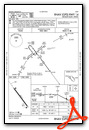
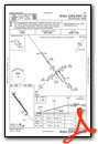
Instrument Approach Procedure (IAP) Charts
Nearby Airports with Instrument Procedures
| ID | Name | Heading / Distance | ||
|---|---|---|---|---|
 |
KAQP | Appleton Municipal Airport | 247° | 16.3 |
|
KMOX | Morris Municipal/Charlie Schmidt Field Airport | 316° | 19.2 |
|
KMVE | Montevideo-Chippewa County Airport | 186° | 21.9 |
|
KGHW | Glenwood Municipal Airport | 036° | 23.3 |
|
KBDH | Willmar Municipal/John L Rice Field Airport | 120° | 25.6 |
|
KDXX | Lac Qui Parle County Airport | 227° | 30.5 |
|
KVVV | Ortonville Municipal/Martinson Field Airport | 267° | 32.8 |
|
KAXN | Alexandria Regional/Chandler Field Airport | 018° | 33.8 |
|
KGDB | Granite Falls Municipal/Lenzen-Roe-Fagen Memorial Field Airport | 173° | 35.0 |
|
D39 | Sauk Centre Municipal Airport | 053° | 37.7 |
|
KPEX | Paynesville Municipal Airport | 086° | 38.4 |
|
1D1 | Milbank Municipal Airport | 261° | 39.3 |
Airport Images
Do you have a recent image of this airport? Upload it here!


