Login
Register


MOX
Morris Municipal/Charlie Schmidt Field Airport
Official FAA Data Effective 2025-12-25 0901Z
Chart Supplement

VFR Chart of KMOX
Sectional Charts at SkyVector.com
IFR Chart of KMOX
Enroute Charts at SkyVector.com
Location Information for KMOX
Coordinates: N45°33.82' / W95°57.90'Located 03 miles SW of Morris, Minnesota on 163 acres of land. View all Airports in Minnesota.
Surveyed Elevation is 1135 feet MSL.
Operations Data
|
|
Airport Communications
| AWOS-3PT: | 118.6 Tel. 320-589-1303 |
|---|---|
| CTAF: | 122.800 |
| UNICOM: | 122.800 |
| AWOS-3PT at BBB (19.2 SE): | 118.45 320-843-3242 |
| AWOS-3 at AQP (20.2 S): | 118.5 320-289-1265 |
| AWOS-3 at VVV (24.9 SW): | 119.225 320-839-2363 |
- APCH/DEP SVC PRVDD BY MINNEAPOLIS ARTCC ON FREQ 126.1/269.2 (ALEXANDRIA RCAG).
Nearby Navigation Aids
|
| ||||||||||||||||||||||||||||||||||||||||||||||||||||||


Runway 14/32
| Dimensions: | 4899 x 75 feet / 1493 x 23 meters | |
|---|---|---|
| Surface: | Asphalt in Excellent Condition | |
| Weight Limits: | S-14, D-19 | |
| Edge Lighting: | High Intensity | |
| Runway 14 | Runway 32 | |
| Coordinates: | N45°34.14' / W95°58.24' | N45°33.49' / W95°57.56' |
| Elevation: | 1127.5 | 1117.8 |
| Traffic Pattern: | Left | Left |
| Runway Heading: | 144° True | 324° True |
| Markings: | Non-Precision Instrument in good condition. | Non-Precision Instrument in good condition. |
| Glide Slope Indicator | P4L (3.00° Glide Path Angle) | P4L (3.00° Glide Path Angle) |
| REIL: | Yes | Yes |
Services Available
| Fuel: | 100LL (blue), Jet-A |
|---|---|
| Transient Storage: | Hangars,Tiedowns FOR TSNT HNGR CALL AMGR, AFT HRS CALL DISPATCH 320-208-6500. |
| Airframe Repair: | NONE |
| Engine Repair: | NONE |
| Bottled Oxygen: | NONE |
| Bulk Oxygen: | NONE |
| Other Services: | AIRCRAFT SALES |
Ownership Information
| Ownership: | Publicly owned | |
|---|---|---|
| Owner: | CITY OF MORRIS | |
| 609 OREGON AVE, PO BOX 438 | ||
| MORRIS, MN 56267-0438 | ||
| 320-589-3141 | AFT HRS CALL DISPATCH 320-208-6500. | |
| Manager: | THOMAS KLOOS | |
| 50725 STATE HIGHWAY 28 | ||
| MORRIS, MN 56267-4412 | ||
| 320-589-2083 | CELL 320-287-1645. | |
Other Remarks
- DEER & WATERFOWL ON & INVOF ARPT.
- FLD CONDS NOT UPDTD NGTS & WKENDS DURG WINTER MONTHS.
- TRML BLDG ACES: 3-2-1-4.
- FOR CD IF UNA TO CTC ON FSS FREQ, CTC MINNEAPOLIS ARTCC AT 651-463-5588.
- 0LL FUEL AVBL H24 VIA CREDIT CARD.
- ACTVT OR INCR INTST REIL RWY 14 & 32; PAPI RWY 14 & 32; HIRL RWY 14/32 - CTAF. HIRL RWY 14/32 PRESET LOW INTST.
Weather Minimums
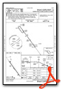
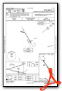
Instrument Approach Procedure (IAP) Charts


Nearby Airports with Instrument Procedures
| ID | Name | Heading / Distance | ||
|---|---|---|---|---|
 |
KBBB | Benson Municipal Airport | 136° | 19.2 |
|
KAQP | Appleton Municipal Airport | 184° | 20.2 |
|
KVVV | Ortonville Municipal/Martinson Field Airport | 231° | 24.9 |
|
Y63 | Elbow Lake Municipal/Pride of The Prairie Airport | 358° | 25.4 |
|
KGHW | Glenwood Municipal Airport | 079° | 27.6 |
|
KETH | Wheaton Municipal Airport | 298° | 27.6 |
|
KAXN | Alexandria Regional/Chandler Field Airport | 052° | 30.1 |
|
1D1 | Milbank Municipal Airport | 232° | 32.3 |
|
KDXX | Lac Qui Parle County Airport | 194° | 35.8 |
|
KMVE | Montevideo-Chippewa County Airport | 163° | 37.3 |
|
8D3 | Sisseton Municipal Airport | 278° | 43.8 |
|
KFFM | Fergus Falls Regional Airport | 349° | 44.0 |
Airport Images
Do you have a recent image of this airport? Upload it here!


