Login
Register


BPG
Big Spring/Mc Mahon-Wrinkle Airport
Official FAA Data Effective 2026-01-22 0901Z
Chart Supplement

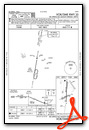
VFR Chart of KBPG
Sectional Charts at SkyVector.com
IFR Chart of KBPG
Enroute Charts at SkyVector.com
Location Information for KBPG
Coordinates: N32°12.76' / W101°31.30'Located 02 miles SW of Big Spring, Texas on 2086 acres of land. View all Airports in Texas.
Surveyed Elevation is 2572 feet MSL.
Operations Data
|
|
Airport Communications
| AWOS-3PT: | 118.025 Tel. 432-264-7475 |
|---|---|
| UNICOM: | 122.800 |
| CTAF: | 122.800 |
| AWOS-3 at MDD (31.2 W): | 118.125 432-687-4605 |
| AWOS-3PT at LUV (37.5 NW): | 124.175 806-872-0659 |
| ASOS at MAF (38.2 SW): | 432-201-2813 |
- APCH/DEP CTL SVC PRVDD BY FORT WORTH ARTCC (ZFW) ON FREQS 133.7/350.2 (BIG SPRING RCAG).
Nearby Navigation Aids
|
| ||||||||||||||||||||||||||||||||||||||||||||||||||||||


Runway 17/35
| Dimensions: | 8803 x 100 feet / 2683 x 30 meters | |
|---|---|---|
| Surface: | Concrete in Fair Condition | |
| Weight Limits: | S-60, D-150, ST-200 | |
| Edge Lighting: | Medium Intensity | |
| Runway 17 | Runway 35 | |
| Coordinates: | N32°13.61' / W101°31.25' | N32°12.16' / W101°31.31' |
| Elevation: | 2549.9 | 2561.8 |
| Traffic Pattern: | Right | Left |
| Runway Heading: | 182° True | 2° True |
| Markings: | Non-Precision Instrument in fair condition. | Non-Precision Instrument in fair condition. |
| Glide Slope Indicator | P4L (3.00° Glide Path Angle) | P4L (3.00° Glide Path Angle) |
| Approach Lights: | SSALS Simplified Short Approach Lighting System. | |
Runway 06/24
| Dimensions: | 4601 x 75 feet / 1402 x 23 meters | |
|---|---|---|
| Surface: | Asphalt in Fair Condition | |
| Edge Lighting: | Medium Intensity | |
| Runway 06 | Runway 24 | |
| Coordinates: | N32°12.37' / W101°31.75' | N32°12.66' / W101°30.92' |
| Elevation: | 2547.0 | 2572.8 |
| Traffic Pattern: | Right | |
| Runway Heading: | 67° True | 247° True |
| Markings: | Non-Precision Instrument in fair condition. | Non-Precision Instrument in fair condition. |
| Glide Slope Indicator | P2L (3.00° Glide Path Angle) | P2L (3.00° Glide Path Angle) |
| Obstacles: | 5 ft Fence 200 ft from runway, 332 ft left of center | |
Services Available
| Fuel: | 100LL (blue), Jet-A |
|---|---|
| Transient Storage: | Hangars,Tiedowns |
| Airframe Repair: | MAJOR |
| Engine Repair: | MAJOR |
| Bottled Oxygen: | NOT AVAILABLE |
| Bulk Oxygen: | NOT AVAILABLE |
| Other Services: | CROP DUSTING SERVICES,PILOT INSTRUCTION |
Ownership Information
| Ownership: | Publicly owned | |
|---|---|---|
| Owner: | CITY OF BIG SPRING | |
| 310 NOLAN | ||
| BIG SPRING, TX 79720 | ||
| 432-264-2400 | ||
| Manager: | MICHAEL FEELEY | |
| 3200 RICKABAUGH DRIVE WEST | ||
| BIG SPRING, TX 79720 | ||
| 432-264-2362 | MGR CELL 432-466-3385. | |
Other Remarks
- FBO 432-264-7124. AFT HRS 432-935-1238.
- SANDHILL CRANES XNG IN THE SPRING & FALL.
- PRAIRIE DOGS ON RWYS & TWYS.
- FOR CD CTC FORT WORTH ARTCC AT 817-858-7584.
- 100 LL & JET-A FULL & SELF SERVE.
- MIRL RWYS 06/24 & 17/35 PRESET LOW INTST; TO INCR INTST & ACTVT SSALS RWY 17 - CTAF.
Weather Minimums

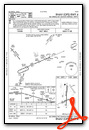
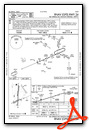
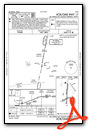
Instrument Approach Procedure (IAP) Charts


Nearby Airports with Instrument Procedures
| ID | Name | Heading / Distance | ||
|---|---|---|---|---|
 |
KMDD | Midland Airpark Airport | 250° | 31.4 |
|
KMAF | Midland International Air and Space Port Airport | 245° | 38.3 |
|
KLUV | Lamesa Municipal Airport | 328° | 38.3 |
|
KSNK | Winston Field Airport | 045° | 40.9 |
|
KODO | Odessa-Schlemeyer Field Airport | 248° | 47.4 |
|
E11 | Andrews County Airport | 278° | 51.8 |
|
KSWW | Avenger Field Airport | 073° | 55.8 |
|
E41 | Reagan County Airport | 177° | 60.8 |
|
KGNC | Gaines County Airport | 296° | 63.8 |
|
KBFE | Terry County Airport | 329° | 66.8 |
|
KSJT | San Angelo Regional/Mathis Field Airport | 134° | 73.3 |
|
F49 | City of Slaton/Larry T Neal Memorial Airport | 354° | 76.5 |
Airport Images
Do you have a recent image of this airport? Upload it here!


