Login
Register


LUV
Lamesa Municipal Airport
Official FAA Data Effective 2026-01-22 0901Z
Chart Supplement

VFR Chart of KLUV
Sectional Charts at SkyVector.com
IFR Chart of KLUV
Enroute Charts at SkyVector.com
Location Information for KLUV
Coordinates: N32°45.38' / W101°55.21'Located 02 miles NE of Lamesa, Texas on 91 acres of land. View all Airports in Texas.
Surveyed Elevation is 2998 feet MSL.
Operations Data
|
|
Airport Communications
| AWOS-3PT: | 124.175 Tel. 806-872-0659 |
|---|---|
| CTAF: | 122.800 |
| UNICOM: | 122.800 |
| AWOS-3 at GNC (37.3 W): | 118.075 432-758-3102 |
| AWOS-3PT at BPG (38.4 SE): | 118.025 432-264-7475 |
| AWOS-3 at E11 (40.1 SW): | 118.2 432-524-2471 |
- APCH/DEP CTL SVC PRVDD BY FORT WORTH ARTCC (ZFW) ON FREQS 132.6/269.05 (LUBBOCK RCAG).
Nearby Navigation Aids
|
| ||||||||||||||||||||||||||||||||||||||||||||||||


Runway 16/34
| Dimensions: | 5002 x 75 feet / 1525 x 23 meters | |
|---|---|---|
| Surface: | Asphalt in Good Condition | |
| Weight Limits: | S-20 | |
| Edge Lighting: | Medium Intensity | |
| Runway 16 | Runway 34 | |
| Coordinates: | N32°45.63' / W101°55.10' | N32°44.83' / W101°54.85' |
| Elevation: | 2991.7 | 2985.5 |
| Traffic Pattern: | Left | Left |
| Runway Heading: | 165° True | 345° True |
| Markings: | Non-Precision Instrument in good condition. | Non-Precision Instrument in good condition. |
| Glide Slope Indicator | P2L (3.00° Glide Path Angle) | P2L (3.00° Glide Path Angle) |
| Obstacles: | 12 ft Road 530 ft from runway | |
Runway 07/25
| Dimensions: | 4006 x 60 feet / 1221 x 18 meters | |
|---|---|---|
| Surface: | Asphalt in Excellent Condition | |
| Weight Limits: | S-12 | |
| Edge Lighting: | Medium Intensity | |
| Runway 07 | Runway 25 | |
| Coordinates: | N32°45.48' / W101°55.89' | N32°45.65' / W101°55.13' |
| Elevation: | 2991.7 | 2991.3 |
| Traffic Pattern: | Left | Left |
| Runway Heading: | 75° True | 255° True |
| Markings: | Basic in good condition. | Basic in good condition. |
| Glide Slope Indicator | P2L (3.00° Glide Path Angle) | P2L (3.00° Glide Path Angle) |
| Obstacles: | 35 ft Tree 1515 ft from runway, 139 ft left of center | 15 ft Road 721 ft from runway |
Services Available
| Fuel: | 100LL (blue), Jet A-1+ |
|---|---|
| Transient Storage: | Tiedowns |
| Airframe Repair: | MAJOR |
| Engine Repair: | MAJOR ACFT MAINT 806-200-5108. |
| Bottled Oxygen: | NOT AVAILABLE |
| Bulk Oxygen: | NOT AVAILABLE |
| Other Services: | CROP DUSTING SERVICES,AIRCRAFT RENTAL |
Ownership Information
| Ownership: | Publicly owned | |
|---|---|---|
| Owner: | LAMESA CITY & DAWSON CO | |
| 601 S. 1ST | ||
| LAMESA, TX 79331 | ||
| 806-872-4321 | ||
| Manager: | JOHN FARRIS | |
| P.O. BOX 259 | ||
| LAMESA, TX 79331 | ||
| 806-759-7747 | ||
Other Remarks
- FOR CD CTC FORT WORTH ARTCC AT 817-858-7584.
- TWO COURTESY CARS AVBL.
- RWY 7/25, DUE TO GRADE, ACFT ON RWY END NOT VSB FM OPPOSITE END.
- + FOR FUEL SVC 806-759-9270, 806-759-7747 OR 806-759-7250.
Weather Minimums

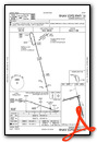
Instrument Approach Procedure (IAP) Charts

Nearby Airports with Instrument Procedures
| ID | Name | Heading / Distance | ||
|---|---|---|---|---|
 |
KBFE | Terry County Airport | 331° | 28.5 |
|
KGNC | Gaines County Airport | 262° | 37.4 |
|
KBPG | Big Spring/Mc Mahon-Wrinkle Airport | 148° | 38.3 |
|
E11 | Andrews County Airport | 230° | 40.1 |
|
F82 | Lubbock Exec Airpark Airport | 007° | 43.9 |
|
KMDD | Midland Airpark Airport | 192° | 44.1 |
|
F49 | City of Slaton/Larry T Neal Memorial Airport | 016° | 45.6 |
|
KSNK | Winston Field Airport | 094° | 49.2 |
|
KMAF | Midland International Air and Space Port Airport | 196° | 50.8 |
|
KLLN | Levelland Municipal Airport | 334° | 52.8 |
|
F98 | Yoakum County Airport | 301° | 53.6 |
|
KLBB | Lubbock Preston Smith International Airport | 005° | 54.6 |
Airport Images
Do you have a recent image of this airport? Upload it here!


