Login
Register


BFE
Terry County Airport
Official FAA Data Effective 2026-02-19 0901Z
Chart Supplement

VFR Chart of KBFE
Sectional Charts at SkyVector.com
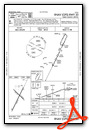
IFR Chart of KBFE
Enroute Charts at SkyVector.com
Location Information for KBFE
Coordinates: N33°10.39' / W102°11.58'Located 04 miles E of Brownfield, Texas on 320 acres of land. View all Airports in Texas.
Surveyed Elevation is 3264 feet MSL.
Operations Data
|
|
Airport Communications
| LUBBOCK APPROACH: | 119.2 119.9 335.6 351.8 |
|---|---|
| LUBBOCK DEPARTURE: | 119.2 119.9 335.6 351.8 |
| CTAF: | 122.800 |
| UNICOM: | 122.800 |
| AWOS-3PT at LLN (24.7 N): | 121.125 806-897-4770 |
| AWOS-3PT at LUV (29.4 SE): | 124.175 806-872-0659 |
| ASOS at LBB (34.9 NE): | 806-766-6432 |
Nearby Navigation Aids
|
| ||||||||||||||||||||||||||||||||||||||||||||||||


Runway 02/20
| Dimensions: | 5218 x 75 feet / 1590 x 23 meters | |
|---|---|---|
| Surface: | Asphalt in Good Condition | |
| Weight Limits: | S-50, D-65 | |
| Edge Lighting: | Medium Intensity | |
| Runway 02 | Runway 20 | |
| Coordinates: | N33°9.95' / W102°11.82' | N33°10.72' / W102°11.37' |
| Elevation: | 3253.2 | 3264.5 |
| Traffic Pattern: | Left | Left |
| Runway Heading: | 26° True | 206° True |
| Markings: | Non-Precision Instrument in good condition. | Non-Precision Instrument in good condition. |
| Glide Slope Indicator | P2L (3.00° Glide Path Angle) | P2L (3.00° Glide Path Angle) |
| Obstacles: | 40 ft Trees 950 ft from runway, 110 ft left of center | |
Runway 13/31
| Dimensions: | 2765 x 75 feet / 843 x 23 meters | |
|---|---|---|
| Surface: | Asphalt in Good Condition | |
| Weight Limits: | S-12 | |
| Runway 13 | Runway 31 | |
| Coordinates: | N33°10.65' / W102°11.73' | N33°10.33' / W102°11.35' |
| Elevation: | 3261.5 | 3250.3 |
| Traffic Pattern: | Left | Left |
| Runway Heading: | 135° True | 315° True |
| Markings: | Basic in good condition. | Basic in good condition. |
| Obstacles: | 48 ft Power Line 1530 ft from runway, 275 ft left of center | 10 ft Road 410 ft from runway, 147 ft right of center |
Services Available
| Fuel: | 100LL (blue), Jet-A |
|---|---|
| Transient Storage: | Tiedowns |
| Airframe Repair: | NOT AVAILABLE |
| Engine Repair: | NOT AVAILABLE |
| Bottled Oxygen: | NOT AVAILABLE |
| Bulk Oxygen: | NOT AVAILABLE |
| Other Services: | CROP DUSTING SERVICES,PILOT INSTRUCTION |
Ownership Information
| Ownership: | Publicly owned | |
|---|---|---|
| Owner: | TERRY COUNTY | |
| TERRY CO COURTHOUSE, 500 W. MAIN | ||
| BROWNFIELD, TX 79316 | ||
| 806-637-3797 | ||
| Manager: | BRAD TANKERSLEY | |
| P.O. BOX 205 | ||
| BROWNFIELD, TX 79316 | ||
| 806-543-9840 | ||
Other Remarks
- FOR CD CTC FORT WORTH ARTCC AT 817-858-7584.
- BIRDS & WILDLIFE ON AND INVOF ARPT.
- RWY 02/20 PARL TWY POOR, EXTSV CRACKS.
- 0LL FUEL SELF SVC 24 HRS.
- MIRL RWY 02/20 PRESET LOW INTST; TO INCR INTST ACTVT - CTAF.
Weather Minimums

Instrument Approach Procedure (IAP) Charts

Nearby Airports with Instrument Procedures
| ID | Name | Heading / Distance | ||
|---|---|---|---|---|
 |
KLLN | Levelland Municipal Airport | 338° | 24.4 |
|
F82 | Lubbock Exec Airpark Airport | 045° | 26.7 |
|
KLUV | Lamesa Municipal Airport | 151° | 28.5 |
|
F98 | Yoakum County Airport | 274° | 32.2 |
|
F49 | City of Slaton/Larry T Neal Memorial Airport | 054° | 32.6 |
|
KLBB | Lubbock Preston Smith International Airport | 032° | 34.8 |
|
KGNC | Gaines County Airport | 218° | 37.8 |
|
KLIU | Littlefield Taylor Brown Municipal Airport | 347° | 46.0 |
|
E11 | Andrews County Airport | 198° | 53.2 |
|
8F3 | Crosbyton Municipal Airport | 060° | 54.9 |
|
KHOB | Lea County Regional Airport | 240° | 59.4 |
|
E06 | Lea County/Zip Franklin Memorial Airport | 258° | 62.7 |
Airport Images
Do you have a recent image of this airport? Upload it here!


