Login
Register


E11
Andrews County Airport
Official FAA Data Effective 2026-02-19 0901Z
Chart Supplement

VFR Chart of E11
Sectional Charts at SkyVector.com
IFR Chart of E11
Enroute Charts at SkyVector.com
Location Information for E11
Coordinates: N32°19.85' / W102°31.78'Located 01 miles NE of Andrews, Texas on 260 acres of land. View all Airports in Texas.
Surveyed Elevation is 3174 feet MSL.
Operations Data
|
|
Airport Communications
| AWOS-3: | 118.2 Tel. 432-524-2471 |
|---|---|
| MIDLAND APPROACH: | 124.6 290.4 |
| MIDLAND DEPARTURE: | 124.6 290.4 |
| CTAF: | 122.800 |
| UNICOM: | 122.800 |
| AWOS-3 at GNC (21.6 N): | 118.075 432-758-3102 |
| ASOS at ODO (25.6 S): | 119.275 432-363-9719 |
| AWOS-3 at MDD (28.1 SE): | 118.125 432-687-4605 |
- APCH/DEP SVC PRVDD BY FORT WORTH ARTCC (ZFW) ON FREQS 133.1/298.95 (MIDLAND RCAG) WHEN MIDLAND APCH CLSD.
Nearby Navigation Aids
|
| ||||||||||||||||||||||||||||||||||||||||||||||||||||||


Runway 16/34
| Dimensions: | 5816 x 75 feet / 1773 x 23 meters | |
|---|---|---|
| Surface: | Asphalt in Excellent Condition | |
| Weight Limits: | S-23, D-37 | |
| Edge Lighting: | Medium Intensity | |
| Runway 16 | Runway 34 | |
| Coordinates: | N32°20.41' / W102°32.04' | N32°19.48' / W102°31.73' |
| Elevation: | 3174.0 | 3167.9 |
| Traffic Pattern: | Left | Right |
| Runway Heading: | 164° True | 344° True |
| Markings: | Non-Precision Instrument in good condition. | Non-Precision Instrument in good condition. |
| Glide Slope Indicator | P4L (3.00° Glide Path Angle) | P4L (3.00° Glide Path Angle) |
| REIL: | Yes | Yes |
| Obstacles: | 64 ft Tree 1200 ft from runway, 542 ft right of center | 46 ft Trees 1190 ft from runway, 126 ft right of center |
Runway 02/20
| Dimensions: | 3893 x 75 feet / 1187 x 23 meters | |
|---|---|---|
| Surface: | Asphalt in Fair Condition | |
| Weight Limits: | S-23 | |
| Edge Lighting: | Medium Intensity | |
| Runway 02 | Runway 20 | |
| Coordinates: | N32°19.50' / W102°31.95' | N32°20.08' / W102°31.61' |
| Elevation: | 3165.5 | 3168.3 |
| Traffic Pattern: | Right | Left |
| Runway Heading: | 26° True | 206° True |
| Displaced Threshold: | 954 Feet | |
| Markings: | Basic in good condition. | Basic in good condition. |
| Glide Slope Indicator | P2L (3.00° Glide Path Angle) | P2L (3.00° Glide Path Angle) |
| Obstacles: | 55 ft Trees 285 ft from runway, 138 ft left of center RWY 02 APCH SLOPE 14:1 AT DSPLCD THR OVR 55 FT TREE, 822 FT DSTC, 205 FT L. 2 FT. POSTS/CABLE FENCE. |
10 ft Ground 514 ft from runway, 125 ft right of center |
Runway 11/29
| Dimensions: | 3048 x 75 feet / 929 x 23 meters | |
|---|---|---|
| Surface: | Asphalt in Fair Condition | |
| Weight Limits: | S-17 | |
| Runway 11 | Runway 29 | |
| Coordinates: | N32°19.86' / W102°31.83' | N32°19.59' / W102°31.33' |
| Elevation: | 3165.9 | 3157.7 |
| Traffic Pattern: | Left | Right |
| Runway Heading: | 123° True | 303° True |
| Markings: | Basic in good condition. | Basic in good condition. |
| Obstacles: | 55 ft Trees 940 ft from runway, 130 ft right of center | 45 ft Pole 1830 ft from runway, 125 ft left of center |
Helipad H1
| Dimensions: | 25 x 25 feet / 8 x 8 meters | |
|---|---|---|
| Surface: | Asphalt in Good Condition | |
| Coordinates: | N32°19.55' / W102°31.87' | N0°0.00' / E0°0.00' |
| Elevation: | 3174.0 | |
| Markings: | None in fair condition. | |
Services Available
| Fuel: | 100LL (blue), Jet-A |
|---|---|
| Transient Storage: | Tiedowns |
| Airframe Repair: | MINOR |
| Engine Repair: | MINOR |
| Bottled Oxygen: | NOT AVAILABLE |
| Bulk Oxygen: | NOT AVAILABLE |
Ownership Information
| Ownership: | Publicly owned | |
|---|---|---|
| Owner: | ANDREWS COUNTY | |
| 201 N. MAIN | ||
| ANDREWS, TX 79714 | ||
| 432-524-1401 | ||
| Manager: | ROBERT VARGAS | |
| 853 E. BROADWAY | ||
| ANDREWS, TX 79714 | ||
| 432-524-1447 | ||
Other Remarks
- FOR CD CTC MIDLAND APCH AT 432-563-2123. WHEN APCH CLSD CTC FORT WORTH ARTCC AT 817-858-7584.
- ACTVT REIL RWYS 16 & 34; PAPI RWYS 02 & 20; MIRL RWYS 02/20 & 16/34 - CTAF.
Weather Minimums


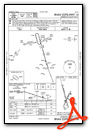
Instrument Approach Procedure (IAP) Charts
Nearby Airports with Instrument Procedures
| ID | Name | Heading / Distance | ||
|---|---|---|---|---|
 |
KGNC | Gaines County Airport | 343° | 21.6 |
|
KODO | Odessa-Schlemeyer Field Airport | 163° | 25.6 |
|
KMDD | Midland Airpark Airport | 128° | 28.0 |
|
KMAF | Midland International Air and Space Port Airport | 144° | 28.6 |
|
KLUV | Lamesa Municipal Airport | 050° | 40.1 |
|
KHOB | Lea County Regional Airport | 301° | 40.9 |
|
KINK | Winkler County Airport | 226° | 47.6 |
|
E01 | Roy Hurd Memorial Airport | 203° | 48.8 |
|
KBPG | Big Spring/Mc Mahon-Wrinkle Airport | 097° | 51.8 |
|
KBFE | Terry County Airport | 018° | 53.2 |
|
F98 | Yoakum County Airport | 344° | 55.2 |
|
E06 | Lea County/Zip Franklin Memorial Airport | 310° | 58.1 |
Airport Images
Do you have a recent image of this airport? Upload it here!


