Login
Register


BQR
Buffalo-Lancaster Regional Airport
Official FAA Data Effective 2026-01-22 0901Z
Chart Supplement

VFR Chart of KBQR
Sectional Charts at SkyVector.com
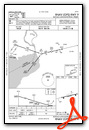
IFR Chart of KBQR
Enroute Charts at SkyVector.com
Location Information for KBQR
Coordinates: N42°55.32' / W78°36.72'Located 12 miles E of Buffalo, New York on 100 acres of land. View all Airports in New York.
Surveyed Elevation is 751 feet MSL.
Operations Data
|
|
Airport Communications
| BUFFALO APPROACH: | 126.15 263.125 |
|---|---|
| BUFFALO DEPARTURE: | 126.15 263.125 |
| CTAF: | 123.050 |
| UNICOM: | 123.050 |
| D-ATIS at BUF (5.3 W): | 135.35 |
| ASOS at BUF (5.6 W): | 716-587-0517 |
| ASOS at IAG (18.2 NW): | 716-297-6984 |
Nearby Navigation Aids
|
| ||||||||||||||||||||||||||||||||||||||||||||||||||||||||||||


Runway 09/27
| Dimensions: | 3199 x 75 feet / 975 x 23 meters | |
|---|---|---|
| Surface: | Asphalt in Fair Condition | |
| Edge Lighting: | Medium Intensity | |
| Runway 09 | Runway 27 | |
| Coordinates: | N42°55.26' / W78°37.07' | N42°55.38' / W78°36.37' |
| Elevation: | 751.6 | 750.5 |
| Traffic Pattern: | Left | Left |
| Markings: | Non-Precision Instrument in fair condition. | Non-Precision Instrument in fair condition. |
| Glide Slope Indicator | P2R (3.00° Glide Path Angle) RWY 09 PAPI UNUSBL BYD 3 DEG RT OF RCL. | P2L (3.00° Glide Path Angle) RWY 27 PAPI UNUSBL BYD 5 DEG LEFT OF RCL. |
| REIL: | Yes | Yes |
| Obstacles: | 23 ft Railroad 201 ft from runway, 215 ft right of center 9 FT FENCE, 15 FT TREES. 9 FT FENCE, 15 FT TREE, 23 FT RR. |
25 ft Railroad 201 ft from runway, 215 ft left of center 9 FT FENCE, 25 FT RR. |
Services Available
| Fuel: | 100LL (blue) |
|---|---|
| Transient Storage: | Hangars,Tiedowns |
| Airframe Repair: | MAJOR |
| Engine Repair: | MAJOR |
| Bottled Oxygen: | NONE |
| Bulk Oxygen: | NONE |
| Other Services: | AIR FREIGHT SERVICES,PILOT INSTRUCTION,AIRCRAFT RENTAL |
Ownership Information
| Ownership: | Privately Owned | |
|---|---|---|
| Owner: | LANCASTER APT INC (THOMAS GELES) | |
| 4343 WALDEN AVE | ||
| LANCASTER, NY 14086 | ||
| 585-591-0366 | ||
| Manager: | GEORGE EZZO | ALTN CTC: ERIC WOBSCHALL 716-208-5460 ERIC@BUFFALOLANCASTER.COM. |
| DARIEN CENTER, NY 14040-1922 | ||
| 716-860-6044 | ||
Other Remarks
- 25 FT RLRD; 215 FT S & PARL TO RWY.
- FOR CD CTC CLEVELAND ARTCC AT 440-774-0490.
- ACTVT REILS RWY 09 & 27; PAPIS RWY 09 & 27; MIRLS RWY 9/27 - CTAF.
- AUTOMATED UNICOM. ADZY ALSO AVBL BY CALLING 617-262-3825.
Weather Minimums
Instrument Approach Procedure (IAP) Charts

Nearby Airports with Instrument Procedures
| ID | Name | Heading / Distance | ||
|---|---|---|---|---|
 |
KBUF | Buffalo Niagara International Airport | 281° | 5.3 |
|
9G0 | Buffalo Airfield Airport | 232° | 5.9 |
|
9G3 | Akron/Jesson Field Airport | 043° | 8.2 |
|
KIAG | Niagara Falls International Airport | 307° | 18.5 |
|
KGVQ | Genesee County Airport | 071° | 20.6 |
|
9G6 | Pine Hill Airport | 044° | 21.2 |
|
CYSN | St Catharines/Niagara District Airport | 303° | 29.4 |
|
5G0 | Le Roy Airport | 082° | 30.0 |
|
7G0 | Ledgedale Airpark Airport | 062° | 34.4 |
|
KDKK | Chautauqua County/Dunkirk Airport | 228° | 38.9 |
|
KOLE | Cattaraugus County-Olean Airport | 165° | 42.2 |
|
KROC | Frederick Douglass/Greater Rochester International Airport | 073° | 43.0 |
Airport Images

By: Jim Cavanaugh


