Login
Register


ROS
Rush City Regional Airport
Official FAA Data Effective 2026-01-22 0901Z
Chart Supplement

VFR Chart of KROS
Sectional Charts at SkyVector.com
IFR Chart of KROS
Enroute Charts at SkyVector.com
Location Information for KROS
Coordinates: N45°41.83' / W92°57.13'Located 01 miles NE of Rush City, Minnesota on 156 acres of land. View all Airports in Minnesota.
Surveyed Elevation is 926 feet MSL.
Operations Data
|
|
Airport Communications
| AWOS-3: | 118.8 Tel. 320-358-3339 |
|---|---|
| CTAF: | 122.900 |
| AWOS-3PT at CBG (15.5 SW): | 121.125 763-689-9562 |
| AWOS-3 at JMR (17.5 NW): | 123.925 320-679-1629 |
| AWOS-3 at 04W (19.7 N): | 118.225 320-384-6169 |
- APCH/DEP SVC PRVDD BY MINNEAPOLIS ARTCC ON FREQS 121.05/235.775 (PRINCETON RCAG).
Nearby Navigation Aids
|
| ||||||||||||||||||||||||||||||||||||||||||||||||||||||||||||


Runway 16/34
| Dimensions: | 4401 x 75 feet / 1341 x 23 meters | |
|---|---|---|
| Surface: | Asphalt in Good Condition | |
| Edge Lighting: | Medium Intensity | |
| Runway 16 | Runway 34 | |
| Coordinates: | N45°42.17' / W92°57.30' | N45°41.49' / W92°56.96' |
| Elevation: | 925.7 | 919.4 |
| Traffic Pattern: | Left | Left |
| Runway Heading: | 161° True | 341° True |
| Markings: | Non-Precision Instrument in good condition. | Non-Precision Instrument in good condition. |
| Glide Slope Indicator | P4L (4.00° Glide Path Angle) | P4L (3.00° Glide Path Angle) |
| REIL: | Yes | Yes |
Services Available
| Fuel: | 100LL (blue), Jet-A |
|---|---|
| Transient Storage: | Hangars,Tiedowns |
| Airframe Repair: | NONE |
| Engine Repair: | NONE |
| Bottled Oxygen: | NONE |
| Bulk Oxygen: | NONE |
| Other Services: | PILOT INSTRUCTION,AIRCRAFT RENTAL,AIRCRAFT SALES |
Ownership Information
| Ownership: | Publicly owned | |
|---|---|---|
| Owner: | CITY OF RUSH CITY | |
| PO BOX 556 | ||
| RUSH CITY, MN 55069-0556 | ||
| 320-258-4744 | ||
| Manager: | MARK NELSON | |
| 51601 FOREST BLVD | ||
| RUSH CITY, MN 55069-2291 | ||
| 612-554-7872 | ||
Other Remarks
- GCO AVBL ON FREQ 121.725 THRU MINNEAPOLIS ARTCC & FLT SVCS.
- FOR TRANSIENT HANGAR CONTACT FBO OR ARPT MGR
- FOR CD IF UNA VIA GCO CTC MINNEAPOLIS ARTCC AT 651-463-5588.
- 0LL SELF SVC FUEL AVBL 24 HOURS WITH CREDIT CARD.
- ACTIVATE REIL RWY 16 & 34; PAPI RWY 16 & 34; MIRL RWY 16/34 PRESET TO LOW, INCR INTST AND ACTIVATE - CTAF
Weather Minimums


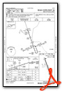
Instrument Approach Procedure (IAP) Charts
Nearby Airports with Instrument Procedures
| ID | Name | Heading / Distance | ||
|---|---|---|---|---|
 |
KGTG | Grantsburg Municipal Airport | 063° | 13.5 |
|
KCBG | Cambridge Municipal Airport | 237° | 15.6 |
|
KJMR | Mora Municipal Airport | 311° | 17.8 |
|
04W | Field of Dreams Airport | 006° | 19.7 |
|
KRZN | Burnett County Airport | 072° | 25.5 |
|
KOEO | L O Simenstad Municipal Airport | 154° | 25.8 |
|
KPNM | Princeton Municipal Airport | 253° | 28.8 |
|
KAHH | Amery Municipal Airport | 135° | 34.9 |
|
KANE | Anoka County/Blaine (Janes Field) Airport | 198° | 34.9 |
|
KRNH | New Richmond Regional Airport | 151° | 37.3 |
|
KMIC | Crystal Airport | 204° | 41.7 |
|
21D | Lake Elmo Airport | 174° | 42.2 |
Airport Images
Do you have a recent image of this airport? Upload it here!


