Login
Register


RSL
Russell Municipal Airport
Official FAA Data Effective 2026-02-19 0901Z
Chart Supplement

VFR Chart of KRSL
Sectional Charts at SkyVector.com
IFR Chart of KRSL
Enroute Charts at SkyVector.com
Location Information for KRSL
Coordinates: N38°52.28' / W98°48.70'Located 02 miles SE of Russell, Kansas on 173 acres of land. View all Airports in Kansas.
Surveyed Elevation is 1863 feet MSL.
Operations Data
|
|
Airport Communications
| ASOS: | 128.325 Tel. 785-483-5770 |
|---|---|
| CTAF: | 122.700 |
| UNICOM: | 122.700 |
| AWOS-3PT at HYS (21.7 W): | 125.525 785-625-3562 |
| AWOS-3PT at 9K7 (28.1 E): | 119.675 785-472-9746 |
| AWOS-3PT at GBD (32.0 S): | 119.275 620-792-5019 |
- APCH/DEP CTL SVC PRVDD BY KANSAS CITY ARTCC (ZKC) ON FREQS 124.4/322.4 (RUSSELL RCAG).
Nearby Navigation Aids
|
| ||||||||||||||||||||||||||||||||||||||||||||||||||||||||||||


Runway 17/35
| Dimensions: | 5000 x 75 feet / 1524 x 23 meters | |
|---|---|---|
| Surface: | Concrete in Excellent Condition | |
| Weight Limits: | 11 /R/C/X/U, S-30, D-30 | |
| Edge Lighting: | Medium Intensity | |
| Runway 17 | Runway 35 | |
| Coordinates: | N38°52.65' / W98°48.71' | N38°51.84' / W98°48.59' |
| Elevation: | 1859.7 | 1862.5 |
| Traffic Pattern: | Left | Left |
| Runway Heading: | 174° True | 354° True |
| Markings: | Non-Precision Instrument in good condition. | Non-Precision Instrument in good condition. |
| Glide Slope Indicator | P4L (3.00° Glide Path Angle) | P4L (3.00° Glide Path Angle) |
| REIL: | Yes | Yes |
| Obstacles: | 23 ft Railroad 1080 ft from runway, 332 ft left of center | |
Runway 03/21
| Dimensions: | 1602 x 300 feet / 488 x 91 meters | |
|---|---|---|
| Surface: | Turf in Fair Condition | |
| Runway 03 | Runway 21 | |
| Coordinates: | N38°52.29' / W98°48.96' | N38°52.50' / W98°48.74' |
| Elevation: | 1856.0 | 1859.0 |
| Traffic Pattern: | Left | Left |
| Runway Heading: | 40° True | 220° True |
| Obstacles: | 43 ft Trees 505 ft from runway, 89 ft left of center | 42 ft Antenna 1034 ft from runway, 146 ft left of center |
Services Available
| Fuel: | 100LL (blue) |
|---|---|
| Transient Storage: | Tiedowns |
| Airframe Repair: | MAJOR |
| Engine Repair: | MAJOR |
| Bottled Oxygen: | NOT AVAILABLE |
| Bulk Oxygen: | NOT AVAILABLE |
| Other Services: | CROP DUSTING SERVICES,PILOT INSTRUCTION |
Ownership Information
| Ownership: | Publicly owned | |
|---|---|---|
| Owner: | CITY OF RUSSELL | |
| CITY HALL | ||
| RUSSELL, KS 67665 | ||
| 785-483-6311 | ||
| Manager: | CHADD STEVENSON | |
| CITY HALL, 133 W 8TH ST | ||
| RUSSELL, KS 67665 | ||
| 785-483-6911 | ||
Other Remarks
- PUB PHONE ACCESS AT ARPT.
- FOR CD IF UNA TO CTC ON FSS FREQ, CTC KANSAS CITY ARTCC AT 913-254-8508.
- NO LINE OF SIGHT BETWEEN RWY ENDS.
- 03/21 MKD WITH HALF BARRELS ON POSTS PAINTED BLACK & YELLOW.
- 0LL FUEL 24 HR SELF-SERVE.
- ACTVT REIL RWY 17 & 35; PAPI RWY 17 & 35; MIRL RWY 17/35 -- CTAF.
Weather Minimums


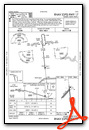
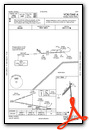
Instrument Approach Procedure (IAP) Charts

Nearby Airports with Instrument Procedures
| ID | Name | Heading / Distance | ||
|---|---|---|---|---|
 |
KHYS | Hays Regional Airport | 265° | 21.7 |
|
9K7 | Ellsworth Municipal Airport | 104° | 28.3 |
|
KGBD | Great Bend Municipal Airport | 184° | 31.7 |
|
KRCP | Rooks County Regional Airport | 321° | 36.6 |
|
KLQR | Larned-Pawnee County Airport | 198° | 41.8 |
|
KLYO | Lyons-Rice County Municipal Airport | 139° | 42.0 |
|
K61 | Moritz Memorial Airport | 041° | 48.1 |
|
0H1 | Trego Wakeeney Airport | 279° | 51.3 |
|
K82 | Smith Center Municipal Airport | 000° | 53.4 |
|
KSLN | Salina Regional Airport | 094° | 54.6 |
|
KHLC | Hill City Municipal Airport | 302° | 56.5 |
|
48K | Ness City Municipal Airport | 245° | 56.8 |
Airport Images
Do you have a recent image of this airport? Upload it here!


