Login
Register


LKU
Louisa County/Freeman Field Airport
Official FAA Data Effective 2025-11-27 0901Z
Chart Supplement

VFR Chart of KLKU
Sectional Charts at SkyVector.com
IFR Chart of KLKU
Enroute Charts at SkyVector.com
Location Information for KLKU
Coordinates: N38°0.59' / W77°58.21'Located 02 miles SE of Louisa, Virginia on 171 acres of land. View all Airports in Virginia.
Surveyed Elevation is 493 feet MSL.
Operations Data
|
|
Airport Communications
| AWOS-3: | 119.475 Tel. 540-967-1983 |
|---|---|
| POTOMAC APPROACH: | 120.525 132.85 323.125 |
| POTOMAC DEPARTURE: | 120.525 132.85 323.125 |
| CTAF: | 122.975 |
| UNICOM: | 122.975 |
| AWOS-3 at 7W4 (11.0 E): | 120.775 540-872-0303 |
| AWOS-3 at GVE (12.7 NW): | 120.225 540-832-2095 |
| AWOS-3 at OMH (14.8 N): | 118.075 540-672-0505 |
Nearby Navigation Aids
|
| ||||||||||||||||||||||||||||||||||||||||||||||||||||||||||||


Runway 09/27
| Dimensions: | 4300 x 100 feet / 1311 x 30 meters | |
|---|---|---|
| Surface: | Asphalt in Good Condition | |
| Weight Limits: | S-12 | |
| Edge Lighting: | Medium Intensity | |
| Runway 09 | Runway 27 | |
| Coordinates: | N38°0.54' / W77°58.65' | N38°0.64' / W77°57.76' |
| Elevation: | 469.4 | 493.5 |
| Traffic Pattern: | Right | |
| Runway Heading: | 82° True | 262° True |
| Markings: | Non-Precision Instrument in good condition. | Non-Precision Instrument in good condition. |
| Glide Slope Indicator | P2L (3.00° Glide Path Angle) | P2L (3.00° Glide Path Angle) |
| REIL: | Yes | Yes |
| Obstacles: | 50 ft Trees 1147 ft from runway, 344 ft right of center | |
Services Available
| Fuel: | 100LL (blue), Jet-A |
|---|---|
| Transient Storage: | Hangars,Tiedowns |
| Airframe Repair: | MAJOR |
| Engine Repair: | MAJOR |
| Bottled Oxygen: | NOT AVAILABLE |
| Bulk Oxygen: | NOT AVAILABLE |
| Other Services: | PILOT INSTRUCTION |
Ownership Information
| Ownership: | Publicly owned | |
|---|---|---|
| Owner: | IND DEV AUTH OF LOUISA CO. | |
| PO BOX 27 | ||
| LOUISA, VA 23093 | ||
| 540-967-0050 | ||
| Manager: | BRITTANY SHUPE | |
| 335 INDUSTRIAL DR, P.O. BOX 27 | ||
| LOUISA, VA 23093 | ||
| 540-967-0050 | BSHUPE@LOUISACOUNTY.GOV | |
Other Remarks
- BCN LOCATED ON WATER TWR; NORTH SIDE APCH RY 27.
- DEER & BIRDS ON & INVOF ARPT.
- 3 FT PVC GAS LINE MARKER LCTD APRX 26 FT FM RY 09 THLD, 54 FT LEFT OF CNTRLN.
- FOR CD CTC POTOMAC APCH AT 540-349-9697
- ACTVT REIL RWY 09/27; PAPI RWY 09 & 27; MIRL RWY 09/27 - CTAF.
Weather Minimums

Instrument Approach Procedure (IAP) Charts


Nearby Airports with Instrument Procedures
| ID | Name | Heading / Distance | ||
|---|---|---|---|---|
 |
7W4 | Lake Anna Airport | 103° | 11.0 |
|
KGVE | Gordonsville Municipal Airport | 313° | 12.8 |
|
KOMH | Orange County Airport | 345° | 14.7 |
|
KCHO | Charlottesville-Albemarle Airport | 288° | 24.1 |
|
KEZF | Shannon Airport | 057° | 29.1 |
|
KOFP | Hanover County Municipal Airport | 125° | 31.1 |
|
KCJR | Culpeper Regional Airport | 009° | 31.3 |
|
KRMN | Stafford Regional Airport | 045° | 33.7 |
|
KHWY | Warrenton/Fauquier Airport | 019° | 36.7 |
|
KFCI | Richmond Exec/Chesterfield County Airport | 149° | 41.9 |
|
KNYG | Quantico Mcaf (Turner Field) Airport | 046° | 43.2 |
|
KRIC | Richmond International Airport | 134° | 43.3 |
Airport Images
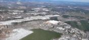
By: dfuell

By: Big Orange Bird


