Login
Register


LVL
Brunswick County Airport
Official FAA Data Effective 2026-02-19 0901Z
Chart Supplement

VFR Chart of KLVL
Sectional Charts at SkyVector.com
IFR Chart of KLVL
Enroute Charts at SkyVector.com
Location Information for KLVL
Coordinates: N36°46.48' / W77°47.63'Located 03 miles E of Lawrenceville, Virginia on 75 acres of land. View all Airports in Virginia.
Estimated Elevation is 328 feet MSL.
Operations Data
|
|
Airport Communications
| AWOS-3: | 119.625 Tel. 434-848-2017 |
|---|---|
| UNICOM: | 122.800 |
| CTAF: | 122.800 |
| AWOS-3 at AVC (13.5 SW): | 127.525 434-729-2229 |
| AWOS-3 at EMV (15.9 E): | 124.175 434-634-0656 |
| ASOS at BKT (19.4 NW): | 434-292-1400 |
- APCH/DEP SVC PRVDD BY WASHINGTON ARTCC (ZDC) ON FREQS 118.75/377.1 (GREEN BAY RCAG).
Nearby Navigation Aids
|
| ||||||||||||||||||||||||||||||||||||||||||||||||||||||||||||


Runway 18/36
| Dimensions: | 3020 x 50 feet / 920 x 15 meters | |
|---|---|---|
| Surface: | Asphalt in Fair Condition | |
| Weight Limits: | S-12 | |
| Runway 18 | Runway 36 | |
| Coordinates: | N36°46.72' / W77°47.67' | N36°46.23' / W77°47.59' |
| Elevation: | 328.7 | 311.4 |
| Traffic Pattern: | Left | Left |
| Runway Heading: | 172° True | 352° True |
| Markings: | Basic in fair condition. | Basic in fair condition. |
| Obstacles: | 48 ft Pole 984 ft from runway, 74 ft right of center | 10 ft Road 254 ft from runway |
Services Available
| Fuel: | NONE |
|---|---|
| Transient Storage: | Tiedowns |
| Airframe Repair: | NONE |
| Engine Repair: | NONE |
| Bottled Oxygen: | NONE |
| Bulk Oxygen: | NONE |
Ownership Information
| Ownership: | Publicly owned | |
|---|---|---|
| Owner: | COUNTY OF BRUNSWICK | |
| PO BOX 399 | ||
| LAWRENCEVILLE, VA 23868 | ||
| 434-848-3107 | ||
| Manager: | ANDREW SYKES | |
| 77 AIRPORT DR | ||
| LAWRENCEVILLE, VA 23868 | ||
| 434-848-2767 | ||
Other Remarks
- DEER ON & INVOF ARPT.
- ARPT CLSD SS-SR INDEFLY.
Weather Minimums

Instrument Approach Procedure (IAP) Charts

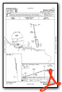
Nearby Airports with Instrument Procedures
| ID | Name | Heading / Distance | ||
|---|---|---|---|---|
 |
KAVC | Mecklenburg-Brunswick Regional Airport | 247° | 13.6 |
|
KEMV | Emporia-Greensville Regional Airport | 109° | 15.9 |
|
KBKT | Allan C Perkinson/Blackstone AAF Airport | 337° | 19.5 |
|
W31 | Lunenburg County Airport | 300° | 21.9 |
|
KIXA | Halifax/Northampton Regional Airport | 163° | 27.7 |
|
KPTB | Tri Cities Exec/Dinwiddie County Airport | 029° | 28.2 |
|
W81 | Crewe Municipal Airport | 329° | 28.4 |
|
KCXE | Chase City Municipal Airport | 271° | 34.1 |
|
W63 | Lake Country Regional Airport | 254° | 38.5 |
|
KFCI | Richmond Exec/Chesterfield County Airport | 018° | 40.0 |
|
KAKQ | Wakefield Municipal Airport | 071° | 40.2 |
|
KASJ | Tri-County At Henry Joyner Field Airport | 133° | 41.5 |
Airport Images
Do you have a recent image of this airport? Upload it here!


