Login
Register


LXY
Mexia-Limestone County Airport
Official FAA Data Effective 2026-01-22 0901Z
Chart Supplement

VFR Chart of KLXY
Sectional Charts at SkyVector.com
IFR Chart of KLXY
Enroute Charts at SkyVector.com
Location Information for KLXY
Coordinates: N31°38.47' / W96°30.87'Located 03 miles SW of Mexia, Texas on 141 acres of land. View all Airports in Texas.
Surveyed Elevation is 544 feet MSL.
Operations Data
|
|
Airport Communications
| AWOS-3: | 127.275 Tel. 254-472-9370 |
|---|---|
| WACO APPROACH: | 127.65 352.0 |
| WACO DEPARTURE: | 127.65 352.0 |
| UNICOM: | 122.800 |
| CTAF: | 122.800 |
| ASOS at CRS (23.9 N): | 120.675 903-872-9321 |
| AWOS-3PT at CNW (28.6 W): | 134.225 254-867-3880 |
| ATIS at ACT (36.6 W): | 123.85 |
- APCH/DEP CTL SVC PRVDD BY FORT WORTH ARTCC (ZFW) ON FREQS 133.3/269.5 (WACO RCAG) WHEN WACO APCH CTL (ACT) CLSD.
Nearby Navigation Aids
|
| ||||||||||||||||||||||||||||||||||||||||||||||||||||||||||||


Runway 18/36
| Dimensions: | 5000 x 75 feet / 1524 x 23 meters | |
|---|---|---|
| Surface: | Asphalt in Good Condition | |
| Weight Limits: | S-30 | |
| Edge Lighting: | Medium Intensity | |
| Runway 18 | Runway 36 | |
| Coordinates: | N31°38.88' / W96°30.79' | N31°38.06' / W96°30.95' |
| Elevation: | 543.7 | 532.7 |
| Traffic Pattern: | Left | |
| Runway Heading: | 189° True | 9° True |
| Markings: | None in poor condition. | None in poor condition. |
| Glide Slope Indicator | P2L (3.00° Glide Path Angle) PAPI OTS | P2L (3.00° Glide Path Angle) PAPI OTS |
| Obstacles: | 40 ft Trees 450 ft from runway, 260 ft left of center | |
Services Available
| Fuel: | 100LL (blue), Jet A-1+ |
|---|---|
| Transient Storage: | Tiedowns |
| Airframe Repair: | MAJOR |
| Engine Repair: | MAJOR |
| Bottled Oxygen: | NOT AVAILABLE |
| Bulk Oxygen: | HIGH/LOW |
| Other Services: | AIRCRAFT SALES |
Ownership Information
| Ownership: | Publicly owned | |
|---|---|---|
| Owner: | LIMESTONE CO | |
| LIMESTONE CO CT HOUSE, 200 W STATE ST | ||
| GROESBECK, TX 76642 | ||
| 254-729-3810 | ||
| Manager: | CHRIS SAVAGE | FBO/AMGR. |
| 4819 HIGHWAY 14 N | ||
| MEXIA, TX 76667 | ||
| 254-562-2857 | ||
Other Remarks
- FOR CD CTC FORT WORTH ARTCC AT 817-858-7584.
- FOR AFT HRS ATNDT, CALL AMGR DURG ATNDD HRS.
- 0LL SELF-SERVE FUEL AVBL 24 HRS.
- ACTVT MIRLS RWY 18/36 SS-SR - CTAF.
Weather Minimums

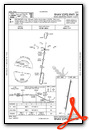
Instrument Approach Procedure (IAP) Charts
Nearby Airports with Instrument Procedures
| ID | Name | Heading / Distance | ||
|---|---|---|---|---|
 |
KCRS | C David Campbell Field-Corsicana Municipal Airport | 014° | 23.9 |
|
T15 | Marlin Airport | 223° | 25.0 |
|
KCNW | Tstc Waco Airport | 269° | 28.7 |
|
KACT | Waco Regional Airport | 267° | 36.7 |
|
KINJ | Hillsboro Municipal Airport | 311° | 39.9 |
|
F41 | Ennis Municipal Airport | 349° | 41.9 |
|
KPWG | Mc Gregor Exec Airport | 257° | 42.2 |
|
KPSN | Palestine Municipal Airport | 078° | 42.2 |
|
KLHB | Hearne Municipal Airport | 186° | 46.4 |
|
F44 | Athens Municipal Airport | 048° | 47.0 |
|
51R | Madisonville Municipal Airport | 146° | 52.3 |
|
KJWY | Mid-Way Regional Airport | 337° | 53.0 |
Airport Images
Do you have a recent image of this airport? Upload it here!


