Login
Register
MIO
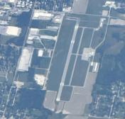
Miami Regional Airport
Official FAA Data Effective 2026-01-22 0901Z
VFR Chart of KMIO
Sectional Charts at SkyVector.com
IFR Chart of KMIO
Enroute Charts at SkyVector.com
Location Information for KMIO
Coordinates: N36°54.55' / W94°53.25'Located 02 miles NW of Miami, Oklahoma on 300 acres of land. View all Airports in Oklahoma.
Surveyed Elevation is 806 feet MSL.
Operations Data
|
|
Airport Communications
| AWOS-3PT: | 119.675 Tel. 918-544-6164 |
|---|---|
| UNICOM: | 122.800 |
| CTAF: | 122.800 |
| AWOS-3PT at GMJ (19.5 S): | 119.025 918-786-8350 |
| AWOS-3PT at 1K8 (22.8 S): | 118.150 918-782-2047 |
| ATIS at JLN (23.7 NE): | 120.85 |
- APCH/DEP CTL SVC PRVDD BY KANSAS CITY ARTCC (ZKC) ON FREQS 128.6/282.325 (EDNA RCAG).
Nearby Navigation Aids
|
| ||||||||||||||||||||||||||||||||||||||||||||||||||||||
Runway 17/35
| Dimensions: | 5020 x 100 feet / 1530 x 30 meters | |
|---|---|---|
| Surface: | Asphalt in Good Condition | |
| Weight Limits: | S-23 | |
| Edge Lighting: | Medium Intensity | |
| Runway 17 | Runway 35 | |
| Coordinates: | N36°54.97' / W94°53.25' | N36°54.14' / W94°53.25' |
| Elevation: | 806.3 | 799.6 |
| Traffic Pattern: | Right | Left |
| Runway Heading: | 180° True | 0 |
| Markings: | Non-Precision Instrument in good condition. | Non-Precision Instrument in good condition. |
| Glide Slope Indicator | P4L (3.00° Glide Path Angle) | P4L (3.00° Glide Path Angle) |
| Approach Lights: | ODALS Omnidirectional Approach Lighting System | |
| REIL: | Yes | |
| Obstacles: | 38 ft Trees 735 ft from runway, 115 ft left of center | |
Services Available
| Fuel: | 100LL (blue), Jet A+ |
|---|---|
| Transient Storage: | Hangars,Tiedowns |
| Airframe Repair: | NONE |
| Engine Repair: | NONE |
| Bottled Oxygen: | NONE |
| Bulk Oxygen: | NONE |
| Other Services: | CROP DUSTING SERVICES,PILOT INSTRUCTION |
Ownership Information
| Ownership: | Publicly owned | |
|---|---|---|
| Owner: | CITY OF MIAMI | |
| CITY HALL PO BOX 1288 | ||
| MIAMI, OK 74355 | ||
| 918-542-6685 | ||
| Manager: | JILL FITZGIBBON | |
| 2600 REX PLOTT DR | ||
| MIAMI, OK 74355 | ||
| 918-541-2349 | ALT PHONE # 918-961-0959. | |
Other Remarks
- FOR CD CTC KANSAS CITY ARTCC AT 913-254-8508.
- 0LL FUEL AVBL 24 HRS WITH CC.
- DUSK-DAWN. ACTVT ODALS RWY 17; REIL RWY 35; MIRL RWY 17/35 - CTAF.
Weather Minimums
Instrument Approach Procedure (IAP) Charts
Nearby Airports with Instrument Procedures
| ID | Name | Heading / Distance | ||
|---|---|---|---|---|
 |
KGMJ | Grove Regional Airport | 158° | 19.5 |
 |
H04 | Vinita Municipal Airport | 215° | 21.8 |
 |
1K8 | South Grand Lake Regional Airport | 195° | 22.6 |
 |
KJLN | Joplin Regional Airport | 051° | 23.7 |
 |
KEOS | Neosho Hugh Robinson Airport | 103° | 24.6 |
 |
KPTS | Atkinson Municipal Airport | 012° | 33.3 |
 |
KCFV | Coffeyville Municipal Airport | 288° | 34.7 |
 |
KPPF | Tri-City Airport | 310° | 39.0 |
 |
5M5 | Crystal Lake Airport | 147° | 40.1 |
 |
KHFJ | Monett Regional Airport | 090° | 42.0 |
 |
KLLU | Lamar Municipal Airport | 038° | 44.2 |
 |
KIDP | Independence Municipal Airport | 289° | 45.3 |


