Login
Register
P96
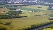
Jersey Shore Airport
Official FAA Data Effective 2026-01-22 0901Z
VFR Chart of P96
Sectional Charts at SkyVector.com
IFR Chart of P96
Enroute Charts at SkyVector.com
Location Information for P96
Coordinates: N41°12.39' / W77°13.55'Located 02 miles E of Jersey Shore, Pennsylvania on 15 acres of land. View all Airports in Pennsylvania.
Estimated Elevation is 554 feet MSL.
Operations Data
|
|
Airport Communications
| UNICOM: | 122.700 |
|---|---|
| CTAF: | 122.700 |
| ASOS at IPT (13.9 E): | 125.225 570-360-5258 |
| ASOS at SEG (28.3 SE): | 123.975 570-374-4099 |
| AWOS-3 at 79PN (31.5 SE): | 118.075 570-271-8192 |
- APCH/DEP SVC PRVDD BY NEW YORK ARTCC (ZNY) ON FREQS 134.8/338.3 (PHILIPSBURG RCAG).
Nearby Navigation Aids
|
| ||||||||||||||||||||||||||||||||||||||||||||||||
Runway 09/27
| Dimensions: | 3059 x 130 feet / 932 x 40 meters | |
|---|---|---|
| Surface: | Turf in Excellent Condition | |
| Runway 09 | Runway 27 | |
| Coordinates: | N41°12.35' / W77°13.88' | N41°12.42' / W77°13.22' |
| Elevation: | 551.0 | 537.0 |
| Traffic Pattern: | Left | Left |
| Displaced Threshold: | 300 Feet | |
| Obstacles: | 17 ft Road 149 ft from runway, 21 ft left of center APCH SLOPE 20:1 TO DTHR. |
10 ft Brush 38 ft from runway, 100 ft left of center |
Services Available
| Fuel: | NONE |
|---|---|
| Transient Storage: | Hangars,Tiedowns |
| Airframe Repair: | NONE |
| Engine Repair: | NONE |
| Bottled Oxygen: | NONE |
| Bulk Oxygen: | NONE |
Ownership Information
| Ownership: | Privately Owned | |
|---|---|---|
| Owner: | THOMAS DUNLAP | |
| 1181 PINE CREEK AVE | ||
| JERSEY SHORE, PA 17740 | ||
| 570-398-1391 | ||
| Manager: | JOYCE HENNIGAN | |
| 1181 PINE CREEK AVE | ||
| JERSEY SHORE, PA 17740 | ||
| 570-321-1408 | 570-279-1025. | |
Other Remarks
- DEER ON & INVOF ARPT.
- PARL TWY ADJ RWY 09/27 CLSD.
- FOR CD CTC NEW YORK ARTCC AT 631-468-1425.
Nearby Airports with Instrument Procedures
| ID | Name | Heading / Distance | ||
|---|---|---|---|---|
 |
KLHV | William T Piper Memorial Airport | 244° | 9.9 |
 |
KIPT | Williamsport Regional Airport | 081° | 13.9 |
 |
KSEG | Penn Valley Airport | 144° | 28.3 |
 |
8N8 | Danville Airport | 120° | 30.6 |
 |
N38 | Grand Canyon Regional Airport | 346° | 32.2 |
 |
N96 | Bellefonte Airport | 234° | 33.0 |
 |
KUNV | State College Regional Airport | 233° | 35.4 |
 |
KRVL | Mifflin County Airport | 210° | 36.6 |
 |
P34 | Mifflintown Airport | 192° | 37.3 |
 |
N79 | Northumberland County Airport | 125° | 37.8 |
 |
N13 | Bloomsburg Municipal Airport | 108° | 38.0 |
 |
KPSB | Mid-State Airport | 244° | 43.6 |


